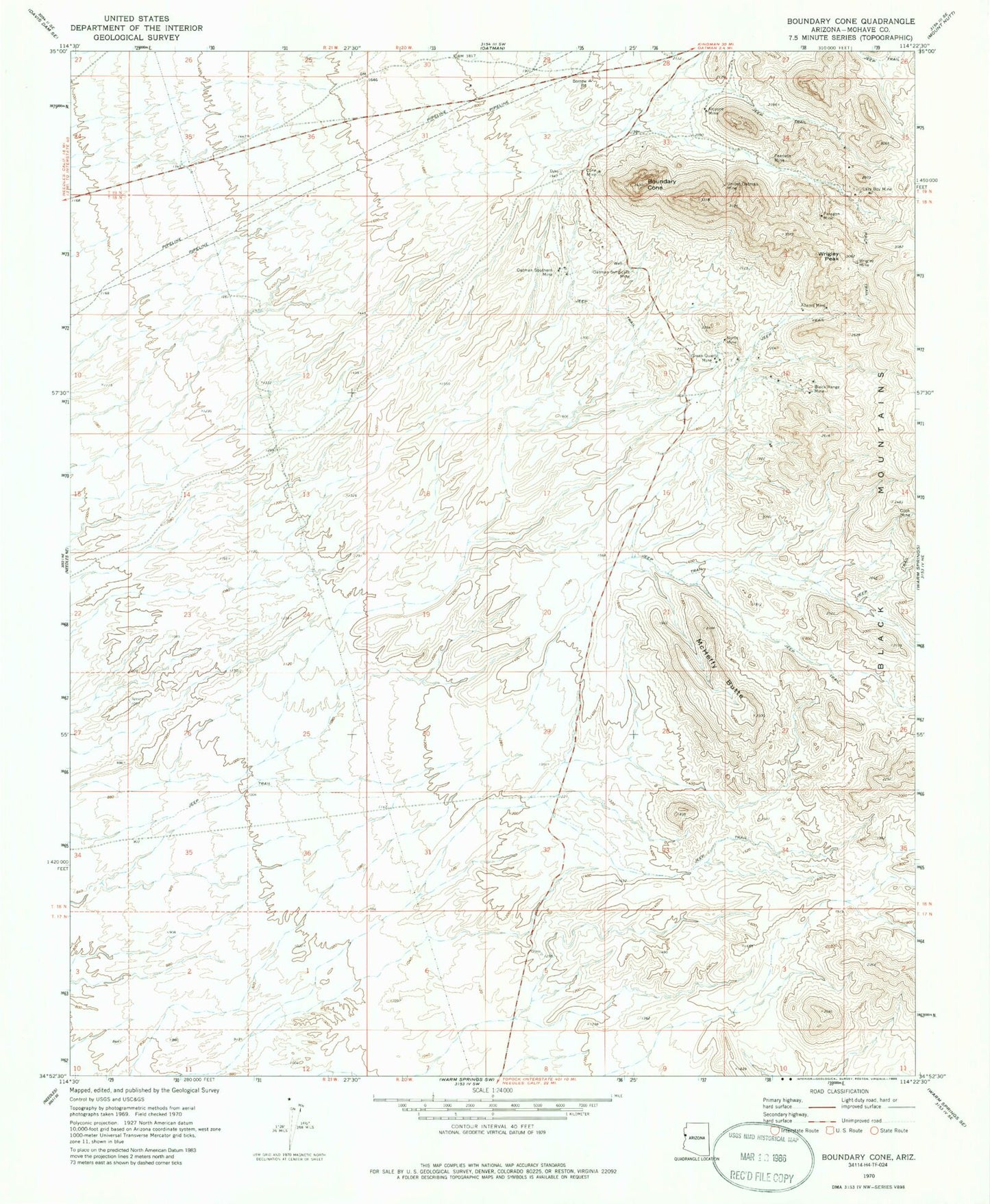
MyTopo
Classic USGS Boundary Cone Arizona 7.5'x7.5' Topo Map
Regular price
$16.95
Regular price
Sale price
$16.95
Unit price
per
Couldn't load pickup availability
Historical USGS topographic quad map of Boundary Cone in the state of Arizona. Map scale is 1:24000. Print size is approximately 24" x 27"
This quadrangle is in the following counties: Mohave.
The map contains contour lines, roads, rivers, towns, and lakes. Printed on high-quality waterproof paper with UV fade-resistant inks, and shipped rolled.
Contains the following named places: Adams Mine, Alcyone Mine, Black Range Mine, Boundary Cone, Cone Mine, Cook Mine, Green Quartz Mine, Lazy Boy Mine, McHeffy Butte, Nellie Mine, Oatman Southern Mine, Oatman Syndicate Mine, Paragon Mine, Peerless Mine, United Oatman Mine, Ute Mountains, Wrigley Mine, Wrigley Peak