MyTopo
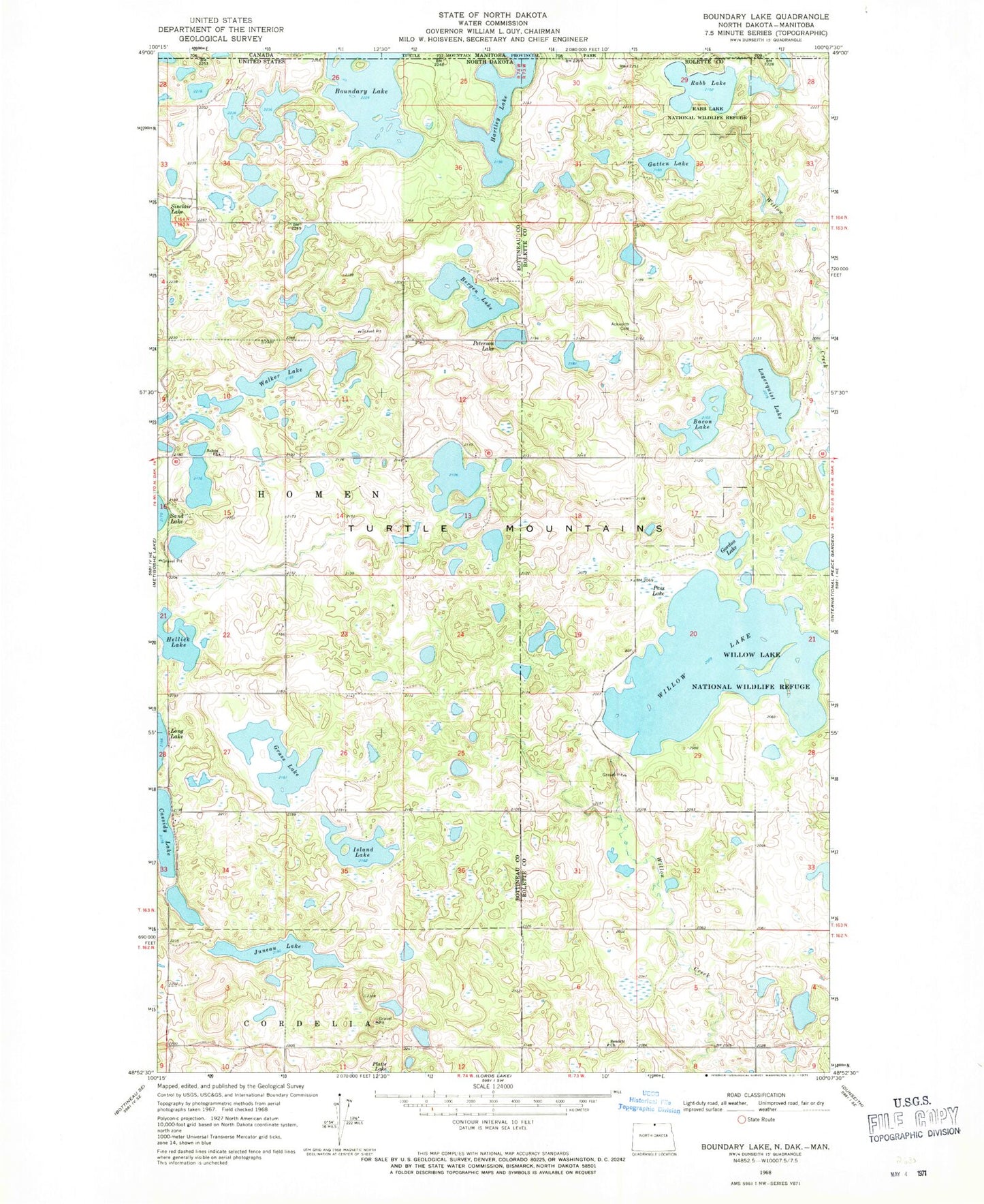
Classic USGS Boundary Lake North Dakota 7.5'x7.5' Topo Map
Couldn't load pickup availability
Historical USGS topographic quad map of Boundary Lake in the state of North Dakota. Map scale may vary for some years, but is generally around 1:24,000. Print size is approximately 24" x 27"
This quadrangle is in the following counties: Bottineau, Rolette.
The map contains contour lines, roads, rivers, towns, and lakes. Printed on high-quality waterproof paper with UV fade-resistant inks, and shipped rolled.
Contains the following named places: Ackworth Cemetery, Bacon Lake, Bergen Lake, Boundary Lake, Cassidy Lake, Elwood-Fauske Dam, Gatten Lake, Gordon Lake, Grass Lake, Hartley Lake, Hartley-Boundary Primitive Area, Hellick Lake, Island Lake, Juneau Lake, Lagerquist Lake, Pass Lake, Peterson Lake, Rabb Lake, Rabb Lake National Wildlife Refuge, Rendahl Cemetery, Rendahl Church, Salem Church, Salem Lutheran Cemetery, Township of Homen, Walker Lake, Willow Lake, Willow Lake National Wildlife Refuge