MyTopo
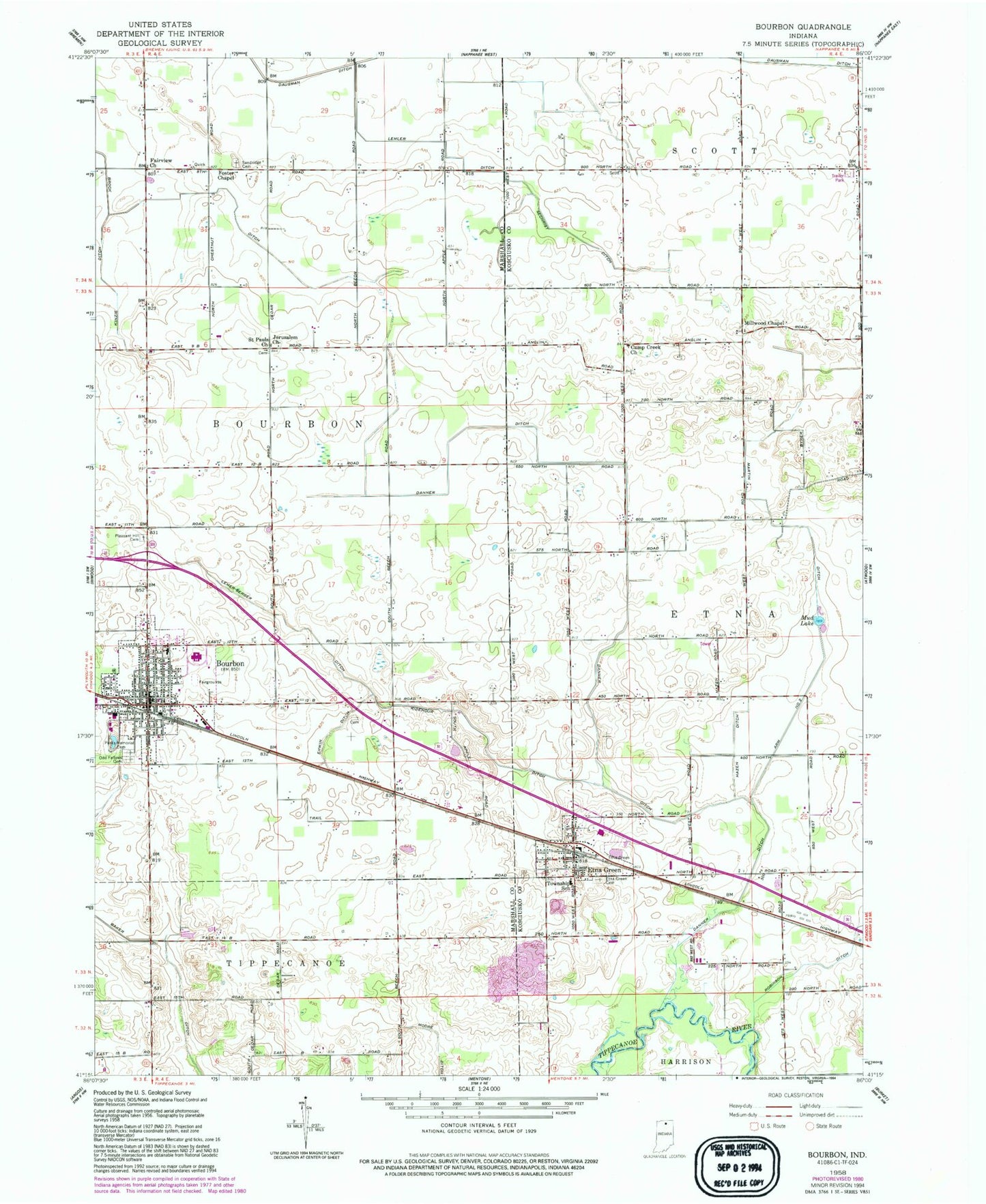
Classic USGS Bourbon Indiana 7.5'x7.5' Topo Map
Couldn't load pickup availability
Historical USGS topographic quad map of Bourbon in the state of Indiana. Map scale may vary for some years, but is generally around 1:24,000. Print size is approximately 24" x 27"
This quadrangle is in the following counties: Kosciusko, Marshall.
The map contains contour lines, roads, rivers, towns, and lakes. Printed on high-quality waterproof paper with UV fade-resistant inks, and shipped rolled.
Contains the following named places: Arm Number Two Ditch, Arrowhead Farm Airport, Baker Ditch, Bourbon, Bourbon Emergency Medical Service, Bourbon Fire Department, Bourbon Police Department, Bourbon Post Office, Bourbon Public Library, Brock Ditch, Camp Creek Church, Danner Ditch, Erwin Ditch, Etna Green, Etna Green East Cemetery, Etna Green Post Office, Etna Green West Cemetery, Etna Township Fire Department, Fairview Church, Foster Chapel, Hanes Farms, J and M Gravel Pit, Jerusalem Church, Kinzie Ditch, Knepp Farms, Lemer-Berger Ditch, Lemlar Farms, Lemler Ditch, Martin Ditch, Miller Farms, Millwood Chapel, Mud Lake, Parks Memorial Cemetery, Ridenour Ditch, Robinson Ditch, Rust's Landing, Saint Pauls Church, Sandridge Cemetery, Sechrist Ditch, Town of Bourbon, Town of Etna Green, Township of Etna, ZIP Codes: 46504, 46524