
MyTopo
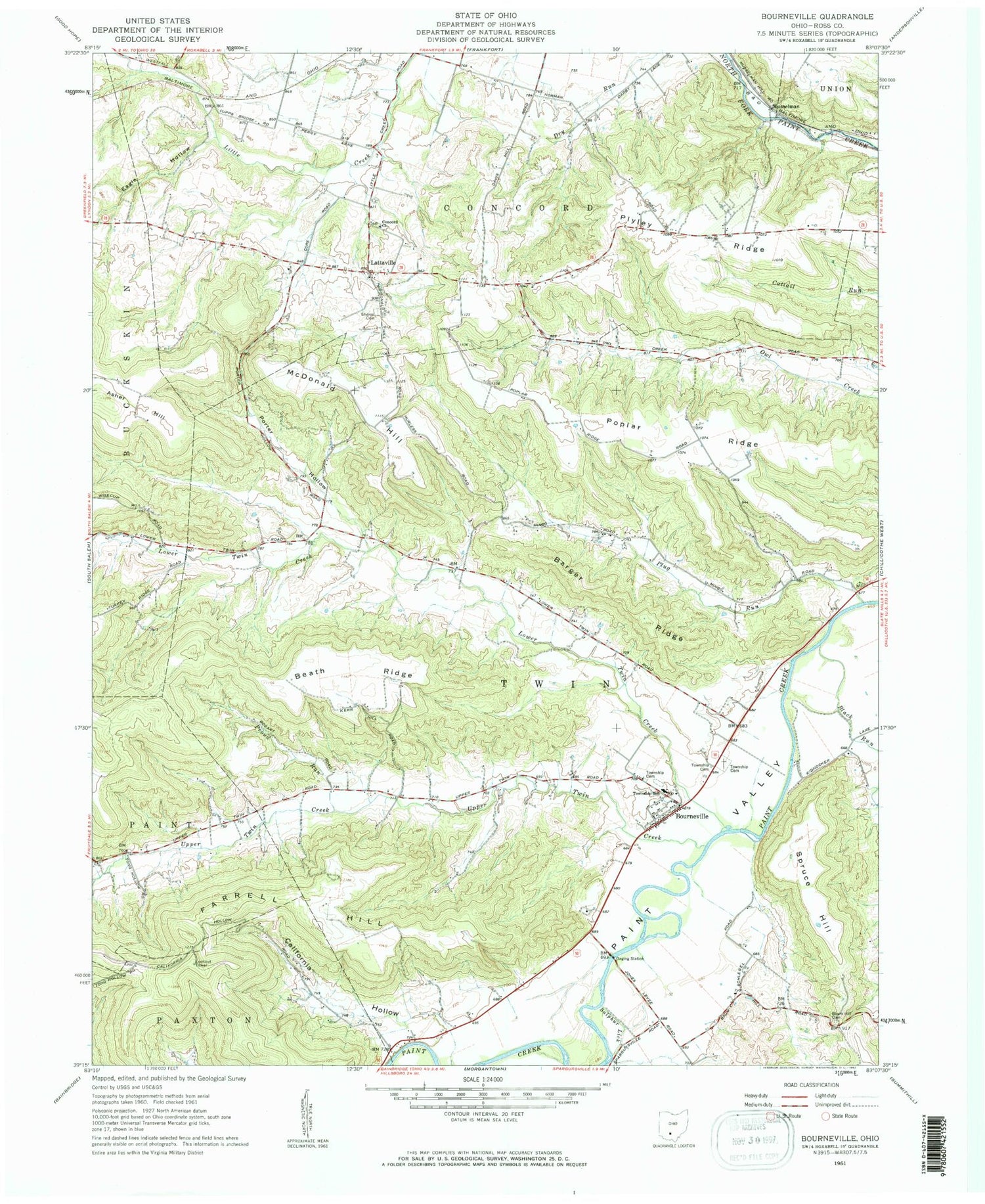
Classic USGS Bourneville Ohio 7.5'x7.5' Topo Map
Couldn't load pickup availability
Historical USGS topographic quad map of Bourneville in the state of Ohio. Typical map scale is 1:24,000, but may vary for certain years, if available. Print size: 24" x 27"
This quadrangle is in the following counties: Ross.
The map contains contour lines, roads, rivers, towns, and lakes. Printed on high-quality waterproof paper with UV fade-resistant inks, and shipped rolled.
Contains the following named places: Asher Hill, Barger Ridge, Baum Hill Cemetery, Beath Ridge, Black Run, California Hollow, Eagle Hollow, Farrell Hill, Lower Twin Creek, McDonald Hill, Plyley Ridge, Poplar Ridge, Porter Hollow, Proud Run, Sheron Cemetery, Spruce Hill, Sulphur Lick, Upper Twin Creek, Twin Elementary School, Roundtop School (historical), Hester School (historical), Pierce School (historical), Baum School (historical), Concord School (historical), Plug Run, Concord Church, Bourneville, Lattaville, Musselman, Sulphur Lick, Latta Run, Reeves Run, WVXC-FM (Chillicothe), Township of Twin, Hopewell Culture National Historical Park, Bourneville Methodist Cemetery, Concord Presbyterian Cemetery, Speakman Cemetery, Twin Township Cemetery, Upland Orchard, Bourneville Post Office, Musselman Post Office, Twin Township Volunteer Fire Department, Bourneville Census Designated Place


