MyTopo
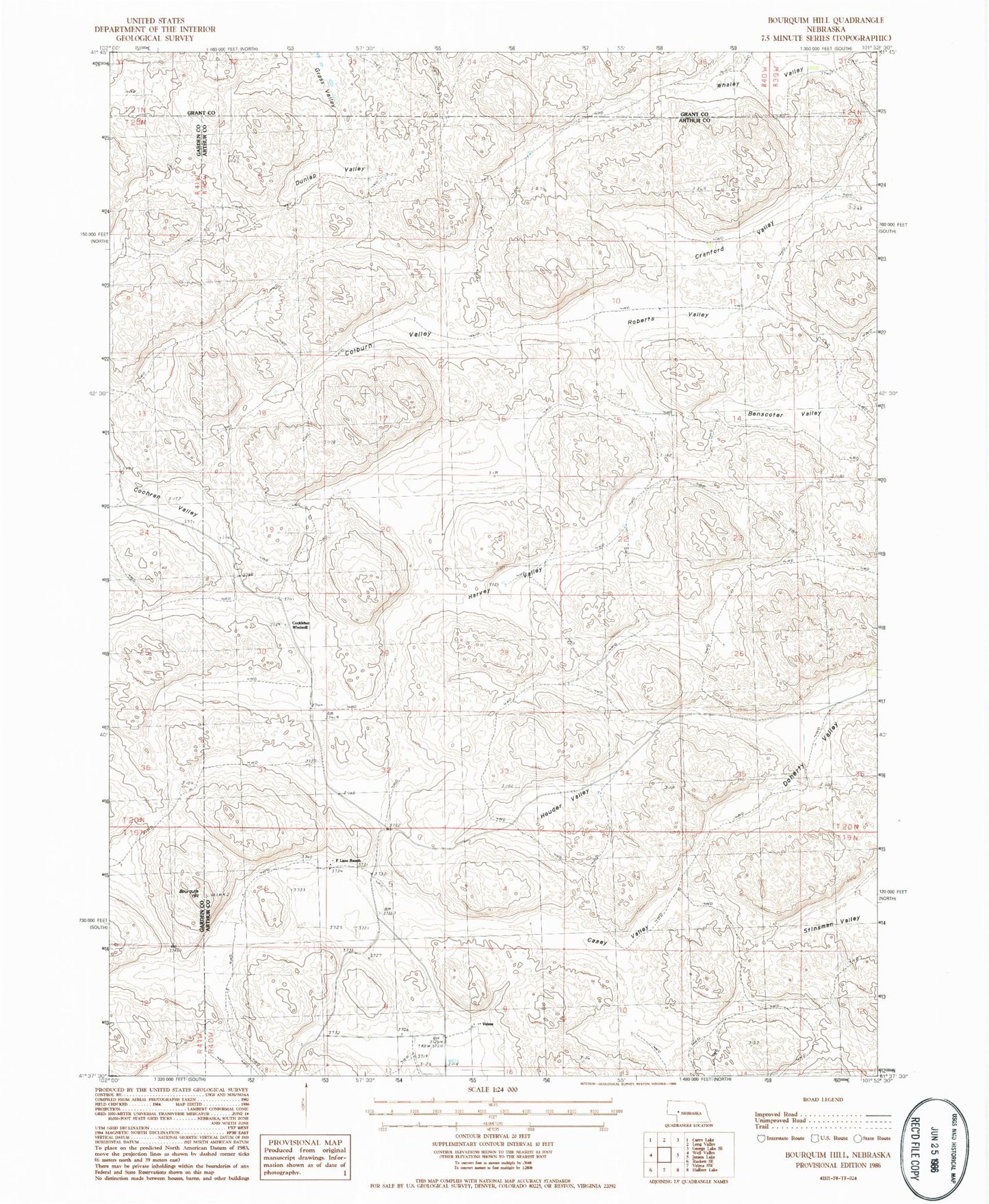
Classic USGS Bourquim Hill Nebraska 7.5'x7.5' Topo Map
Couldn't load pickup availability
Historical USGS topographic quad map of Bourquim Hill in the state of Nebraska. Map scale may vary for some years, but is generally around 1:24,000. Print size is approximately 24" x 27"
This quadrangle is in the following counties: Arthur, Garden, Grant.
The map contains contour lines, roads, rivers, towns, and lakes. Printed on high-quality waterproof paper with UV fade-resistant inks, and shipped rolled.
Contains the following named places: Benscoter Valley, Bourquim Hill, Casey Valley, Cochran Valley, Cocklebur Windmill, Colburn Valley, Cranford Valley, Doherty Valley, Dunlap Valley, F Lane Ranch, Harvey Valley, Houder Valley, Roberts Valley, School Number 27, Stinsman Valley, Velma, Velma Post Office, Whaley Valley