MyTopo
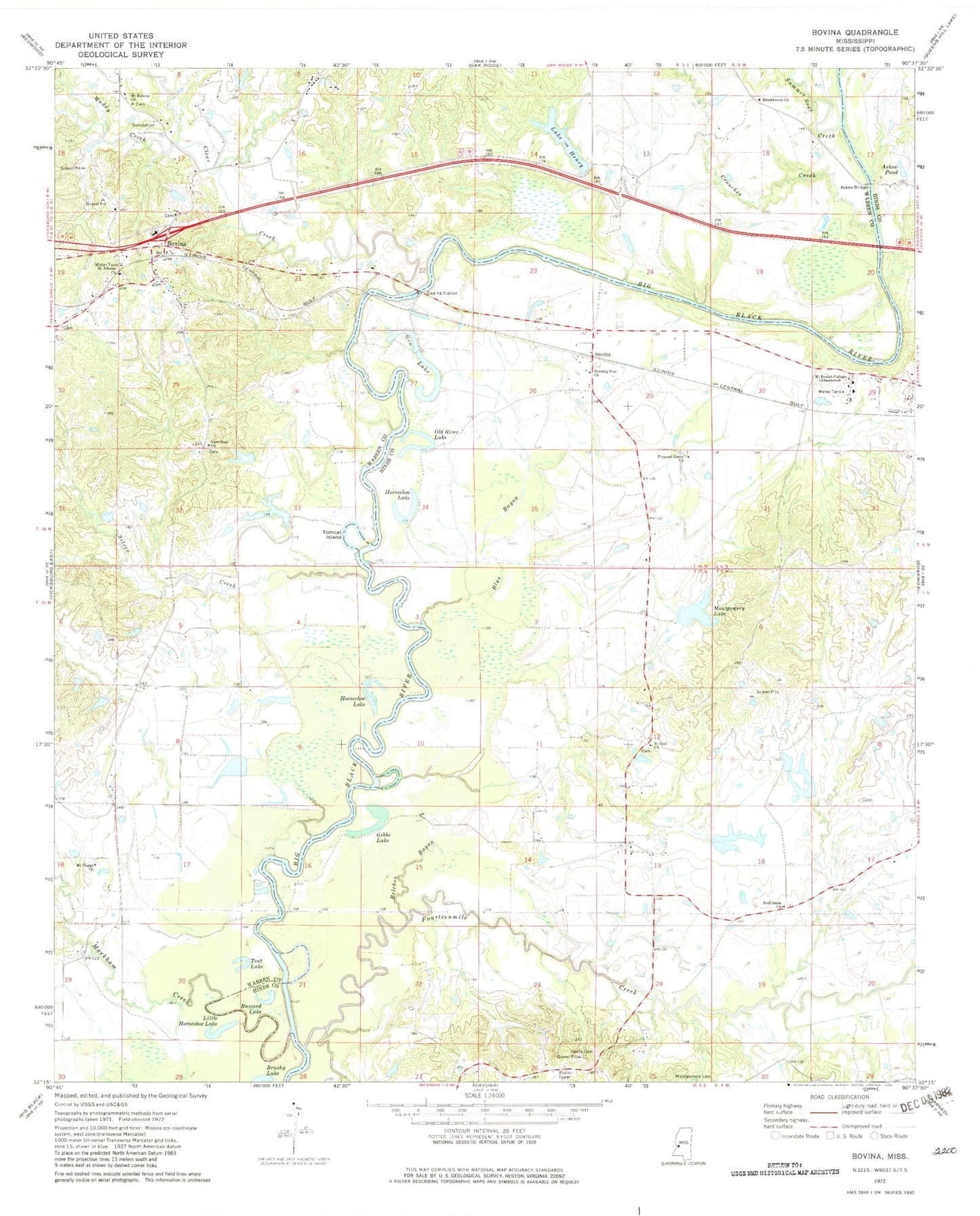
Classic USGS Bovina Mississippi 7.5'x7.5' Topo Map
Couldn't load pickup availability
Historical USGS topographic quad map of Bovina in the state of Mississippi. Map scale may vary for some years, but is generally around 1:24,000. Print size is approximately 24" x 27"
This quadrangle is in the following counties: Hinds, Warren.
The map contains contour lines, roads, rivers, towns, and lakes. Printed on high-quality waterproof paper with UV fade-resistant inks, and shipped rolled.
Contains the following named places: Amsterdam, Askew Bridge, Askew Pond, Bedford School, Belches Bayou, Bethlehem Church, Bethlehem School, Blue Bayou, Blue Lake, Bovina, Bovina Baptist Church, Bovina Census Designated Place, Bovina Elementary School, Bovina Methodist Church, Bovina Volunteer Fire Department, Bridgeport, Brookhaven Church, Brookhaven School, Brushy Lake, Buzzard Lake, Ceres Plantation, Chichester, Clear Creek, Crouches Creek, Culp Lake Dam, Farm Land Company Lake Dam, Fourteenmile Creek, Gibbs Lake, Gin Lake, Henry Cemetery, Hickory Tree School, Horseshoe Lake, Institute, July Lake, Lake Henry, Lake Henry Dam, Little Horseshoe Lake, Markham Creek, Montgomery Cemetery, Montgomery Lake, Montgomery Lake Dam, Moore Lake Dam, Morning Star Church, Mount Beulah College, Mount Hebron Church, Mount Pisgah Church, Muddy Creek, New Hope Church, Nortrust Farm Management Dam, Nortrust Farm Management Lake Dam, Old River Lake, Palestine Church, Paylons Creek, Pleasant Grove Church, Pleasant Row School, R O Duncan Lake Dam, Saint Albans Church, Saint Paul Church, Silver Creek, Smiths, Smiths Ferry, Summer Seat Creek, Tent Lake, Tomcat Island