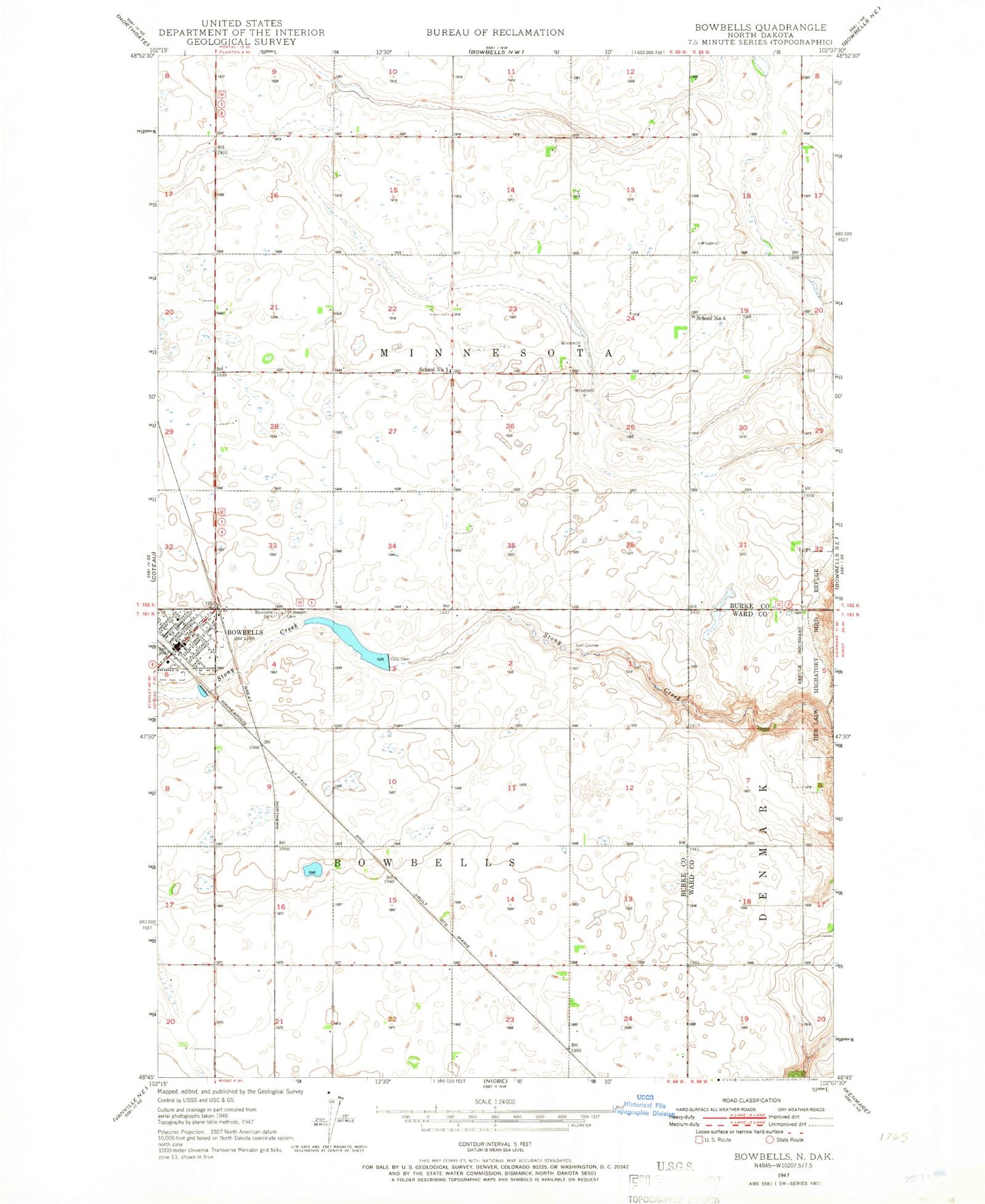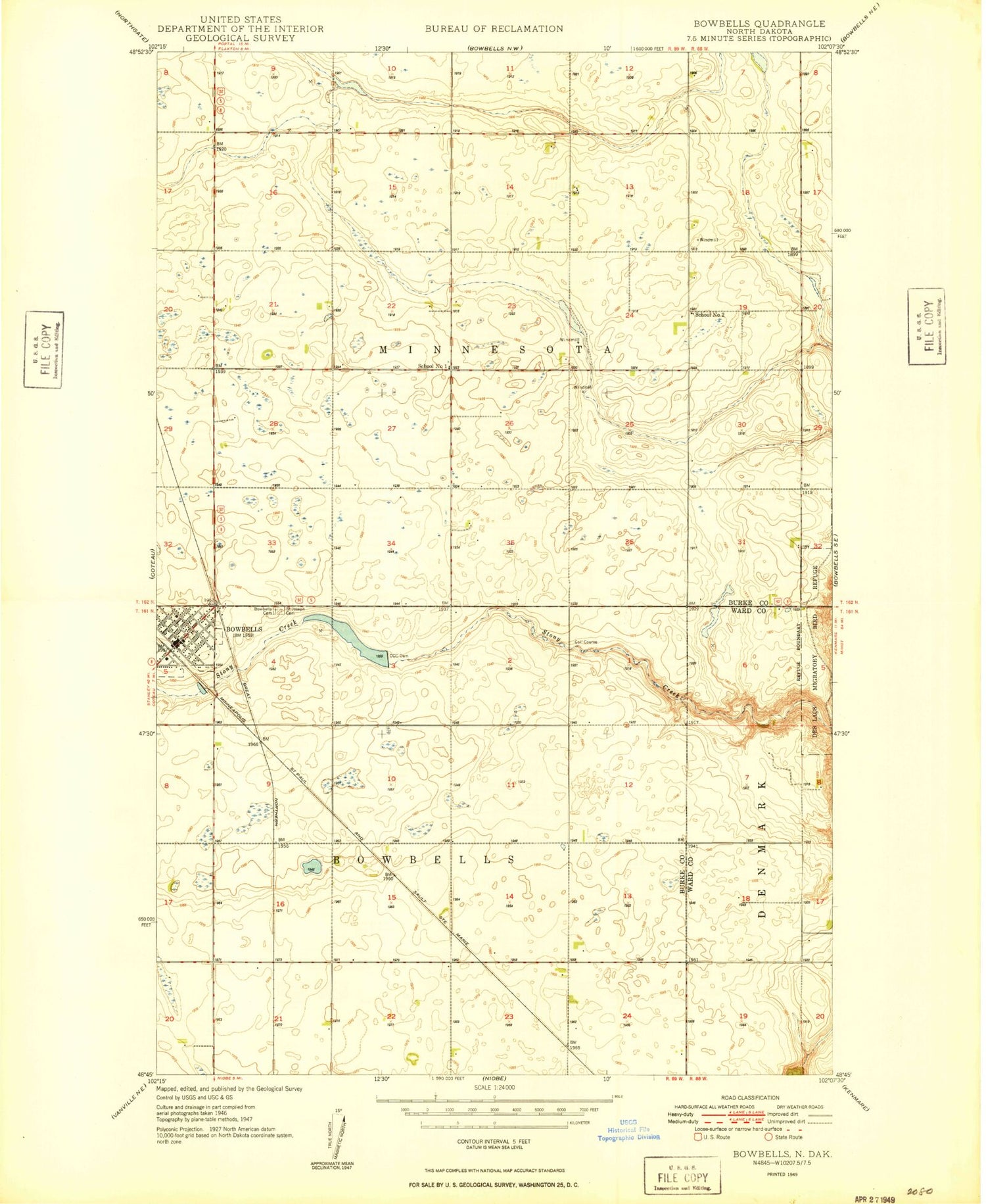
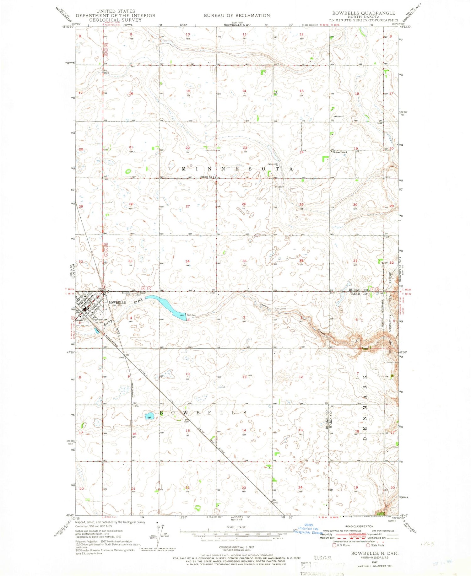
MyTopo
Classic USGS Bowbells North Dakota 7.5'x7.5' Topo Map
Couldn't load pickup availability
Historical USGS topographic quad map of Bowbells in the state of North Dakota. Map scale may vary for some years, but is generally around 1:24,000. Print size is approximately 24" x 27"
This quadrangle is in the following counties: Burke, Ward.
The map contains contour lines, roads, rivers, towns, and lakes. Printed on high-quality waterproof paper with UV fade-resistant inks, and shipped rolled.
Contains the following named places: Bowbells, Bowbells Ambulance Service, Bowbells Cemetery, Bowbells City Hall, Bowbells Fire Department, Bowbells Post Office, Bowbells Public School, Bowbells School and Public Library, Burke County Courthouse, Burke County Sheriff's Office, CCC Dam, City of Bowbells, Des Lacs Migratory Bird Refuge, Saint Joseph Cemetery, School Number 1, School Number 4, Township of Bowbells, Township of Minnesota