MyTopo
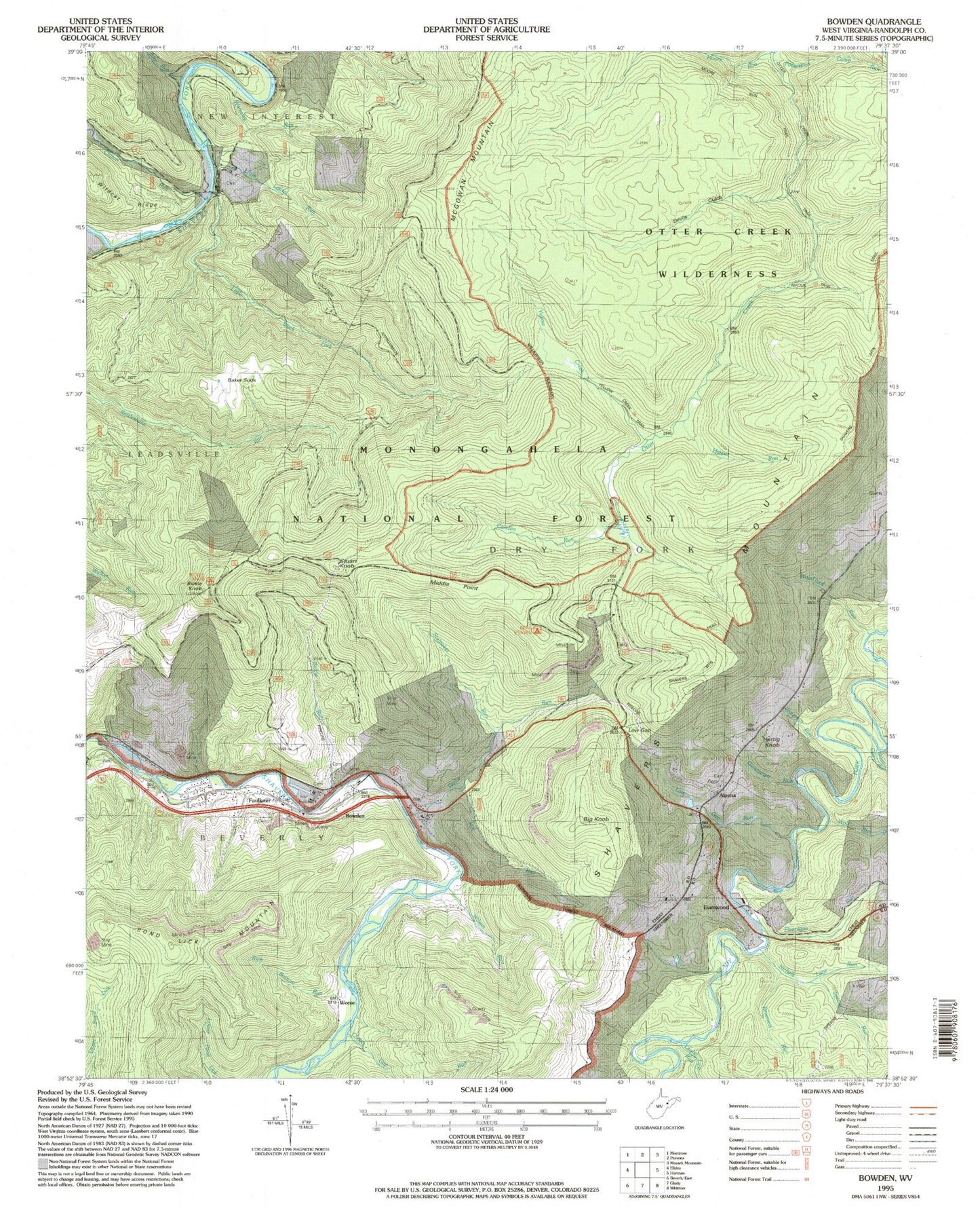
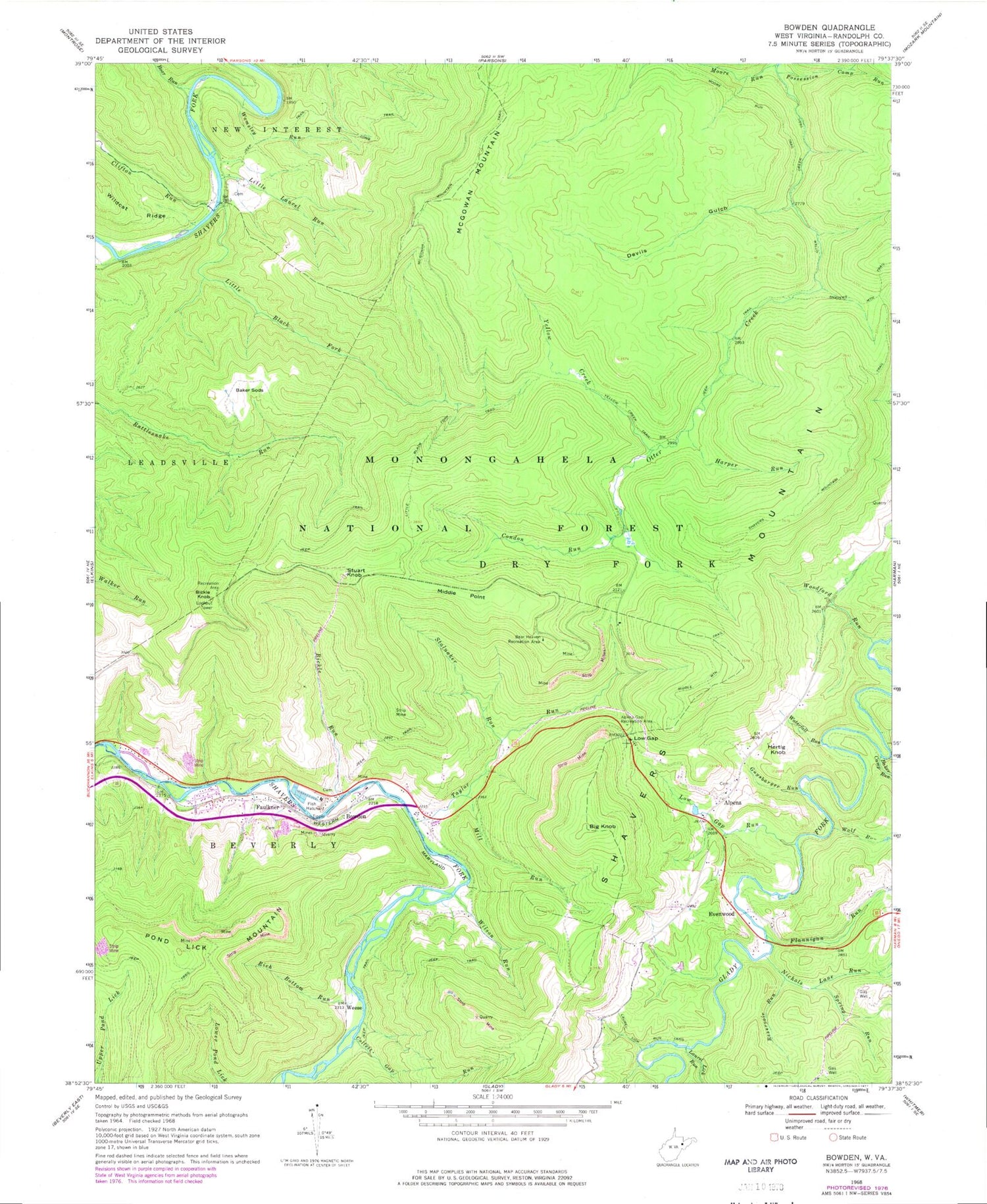
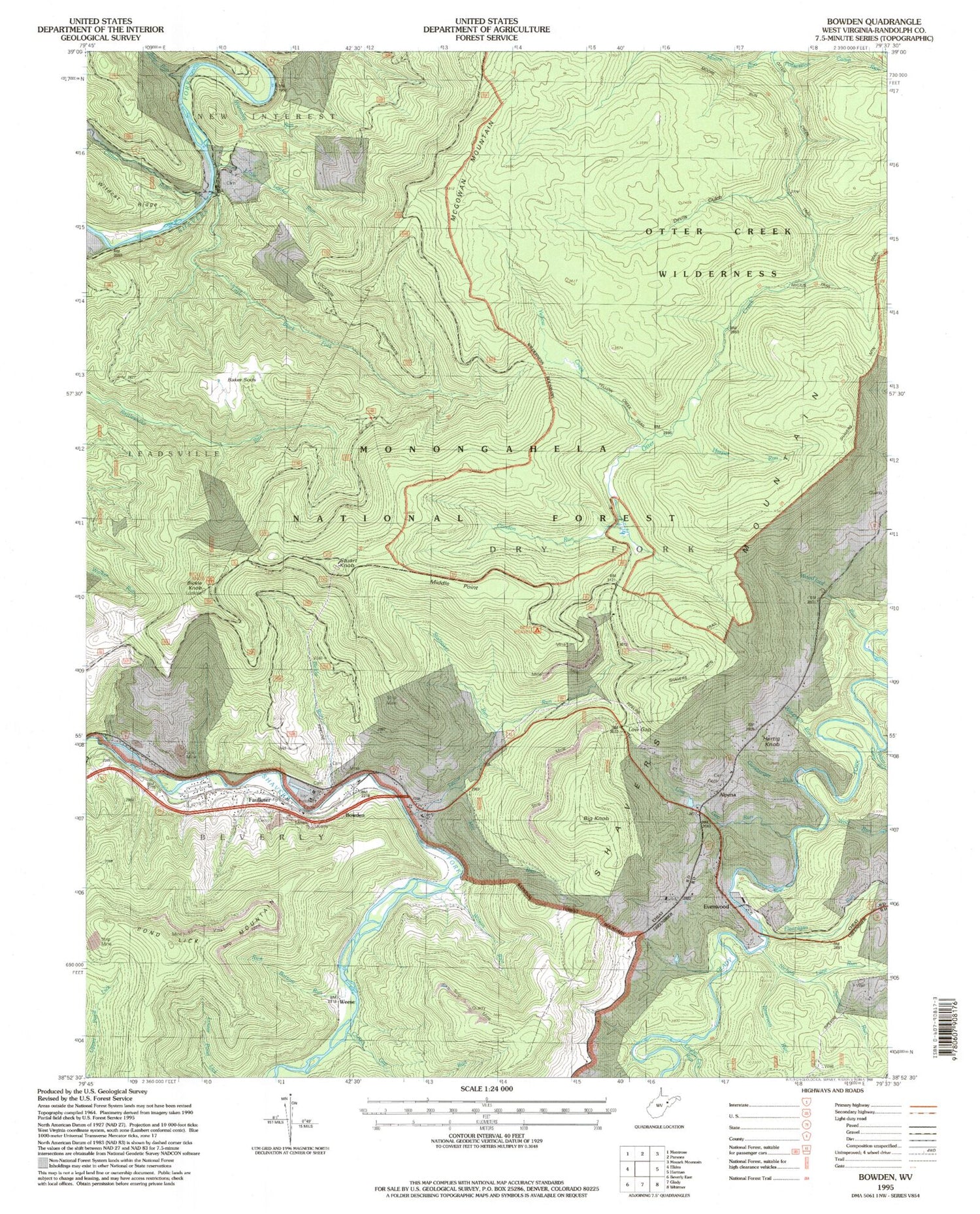
USGS Classic Bowden West Virginia 7.5'x7.5' Topo Map
Couldn't load pickup availability
Historical USGS topographic quad map of Bowden in the state of West Virginia. Scale: 1:24000. Print size: 24" x 27"
This quadrangle is in the following counties: Randolph.
The map contains contour lines, roads, rivers, towns, lakes, and grids including latitude / longitude and UTM / MGRS. Printed on high-quality waterproof paper with UV fade-resistant inks.
Contains the following named places: Alpena Gap Recreation Site, Baker Camp Run, Baker Sods, Bear Heaven Recreation Area, Bickle Run, Boar Run, Bowden, Clifton Run, Collett Gap Run, Condon Run, Devils Gulch, Flannigan Run, Guysbarger Run, Harper Run, Laurel Lick Run, Little Black Fork, Little Black Fork Trail, Little Laurel Run, Long Trail, Low Gap, Low Gap Run, McGowan Mountain, McGowan Mountain Trail, Middle Mountain Trail, Middle Point, Mill Run, Moore Run, Nichols Lane Run, Otter Creek Trail, Pond Lick Mountain, Possession Camp Run, Reservoir Run, Rich Bottom Run, Shavers Mountain Trail, Spring Run, Stalnaker Run, Taylor Run, Wamsley Run, Waterfall Run, Weese, Wilson Run, Wolf Run, Woodford Run, Yellow Creek, Yellow Creek Trail, Otter Creek Wilderness, Bickle Knob Picnic Area, Bowden National Fish Hatchery, Alpena, Bickle Knob, Big Knob, Evenwood, Faulkner, Hertig Knob, Stuart Knob, Mark E Burke Spring, Ernest Carr Spring, Lorraine Burke Spring, North Spring, South Spring, Bickle Knob Lookout Tower, Bowden Post Office, Chestnut Grove School (historical), Chestnut School (historical), Meadows, Otter Creek Wildlife Management Area, Bowden Census Designated Place, Faulkner Census Designated Place, Shavers Fork Bridge