
MyTopo
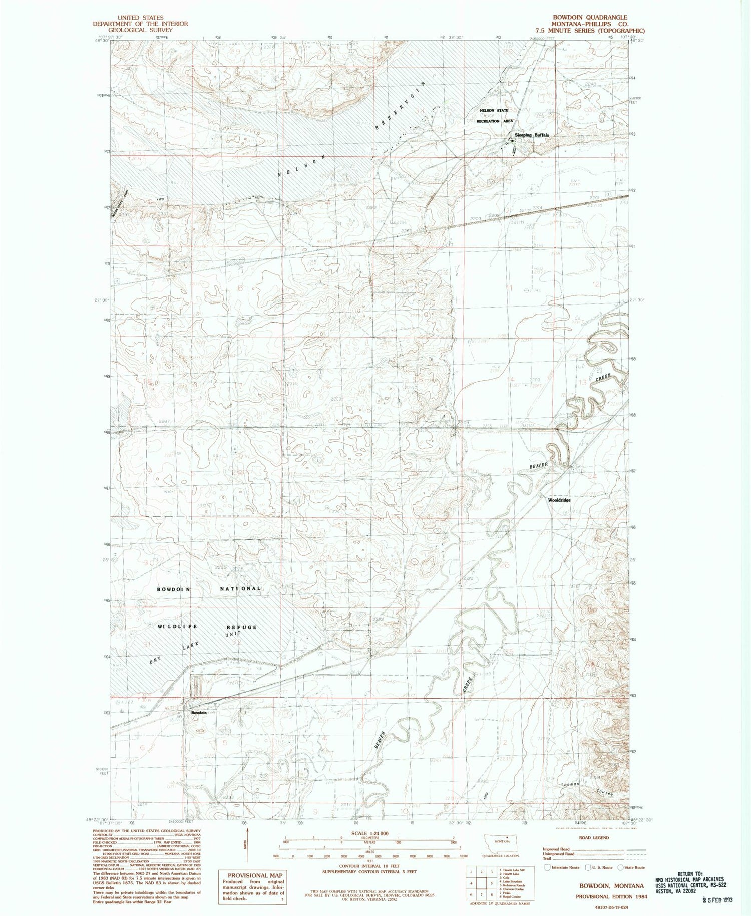
Classic USGS Bowdoin Montana 7.5'x7.5' Topo Map
Couldn't load pickup availability
Historical USGS topographic quad map of Bowdoin in the state of Montana. Map scale may vary for some years, but is generally around 1:24,000. Print size is approximately 24" x 27"
This quadrangle is in the following counties: Phillips.
The map contains contour lines, roads, rivers, towns, and lakes. Printed on high-quality waterproof paper with UV fade-resistant inks, and shipped rolled.
Contains the following named places: 31N32E21CCCC01 Well, 32N32E35CDB_01 Well, 32N32E35CDBD01 Well, 32N32E35DB__01 Well, 32N32E35DCCA01 Well, Bowdoin, Bowdoin Cemetery, Bowdoin Post Office, Bowdoin School, Brady's Ranch, Cree Crossing Historical Marker, Dry Lake Unit, Mud Lake, Nelson Reservoir, Nelson State Recreation Area, Sleeping Buffalo, Sleeping Buffalo Census Designated Place, Sleeping Buffalo Hot Springs, Sleeping Buffalo Resort Campground, Sleeping Buffalo Resort Golf Course, Sleeping Buffalo Rock Historical Marker, Thomas Coulee, Wooldridge, Wooldridge School


