MyTopo
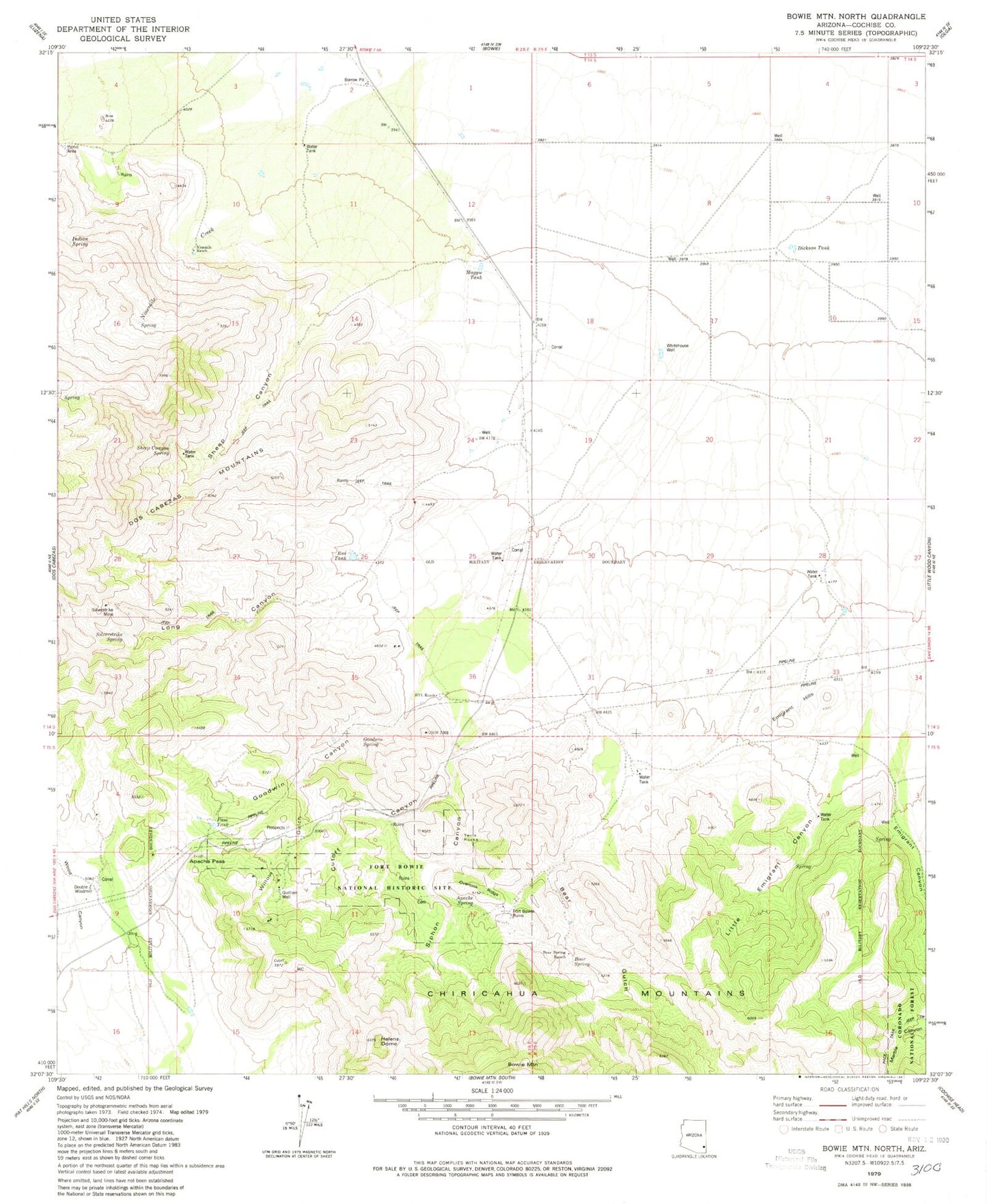
Classic USGS Bowie Mountain North Arizona 7.5'x7.5' Topo Map
Couldn't load pickup availability
Historical USGS topographic quad map of Bowie Mountain North in the state of Arizona. Typical map scale is 1:24,000, but may vary for certain years, if available. Print size: 24" x 27"
This quadrangle is in the following counties: Cochise.
The map contains contour lines, roads, rivers, towns, and lakes. Printed on high-quality waterproof paper with UV fade-resistant inks, and shipped rolled.
Contains the following named places: Apache Pass, Apache Spring, Bear Gulch, Bear Spring, Dickson Tank, Double Z Windmill, Emigrant Canyon, Emigrant Hills, Camp Bowie (historical), Goodwin Canyon, Goodwin Spring, HYL Ranch, Helens Dome, Knape Ranch, Little Emigrant Canyon, Long Canyon, Maggie Tank, Ninemile Creek, Ninemile Ranch, Overlook Ridge, Pass Tank, Quillian Well, Red Tank, Sheep Canyon, Sheep Canyon Spring, Silverstrike Mine, Silverstrike Spring, Siphon Canyon, Tevs Rocks, Whitehouse Well, Willow Gulch Canyon, Wood Canyon, Bear Spring Ranch, Cutoff Canyon, Shafer Ranch, Fort Bowie National Historic Site, Bowie Division