MyTopo
Classic USGS Bowie Mountain South Arizona 7.5'x7.5' Topo Map
Couldn't load pickup availability
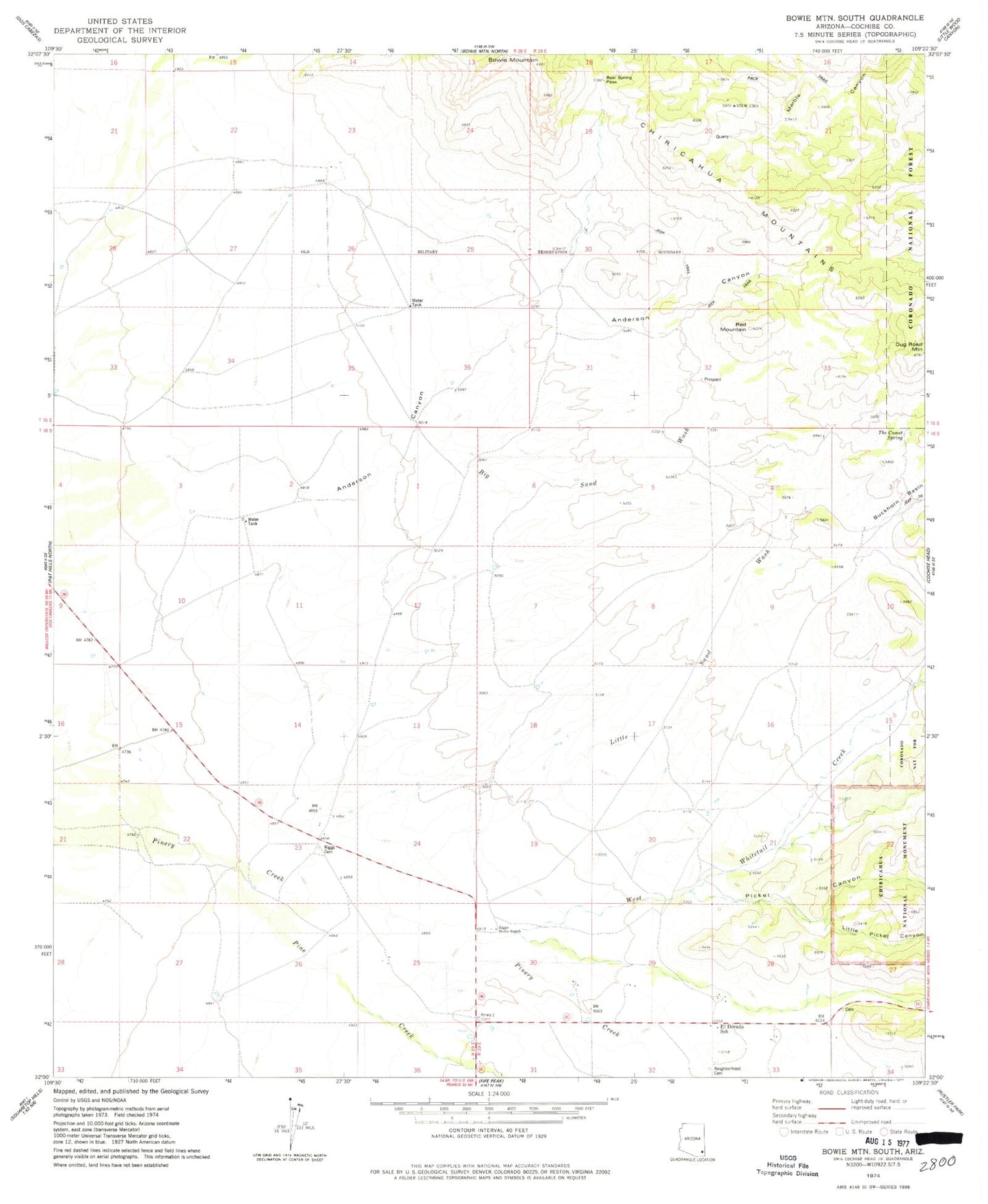
Historical USGS topographic quad map of Bowie Mountain South in the state of Arizona. Map scale may vary for some years, but is generally around 1:24,000. Print size is approximately 24" x 27"
This quadrangle is in the following counties: Cochise.
The map contains contour lines, roads, rivers, towns, and lakes. Printed on high-quality waterproof paper with UV fade-resistant inks, and shipped rolled.
Contains the following named places: Analong Ranch, Anderson Canyon, Bear Spring Pass, Big Sand Wash, Bowie Mountain, Dug Road Mountain, El Dorado School, Erickson Cemetery, Erickson Tank, Lamberson Ranch, Little Picket Canyon, Little Sand Wash, Marble Quarry, Neighborhood Cemetery, Picket Canyon, Pine Creek, Red Mountain, Red Wing Well, Riggs Cemetery, Riggs Home Ranch, Star Ranch, Stephenson Ranch, The Comet Spring, West Whitetail Creek, YY Ranch