MyTopo
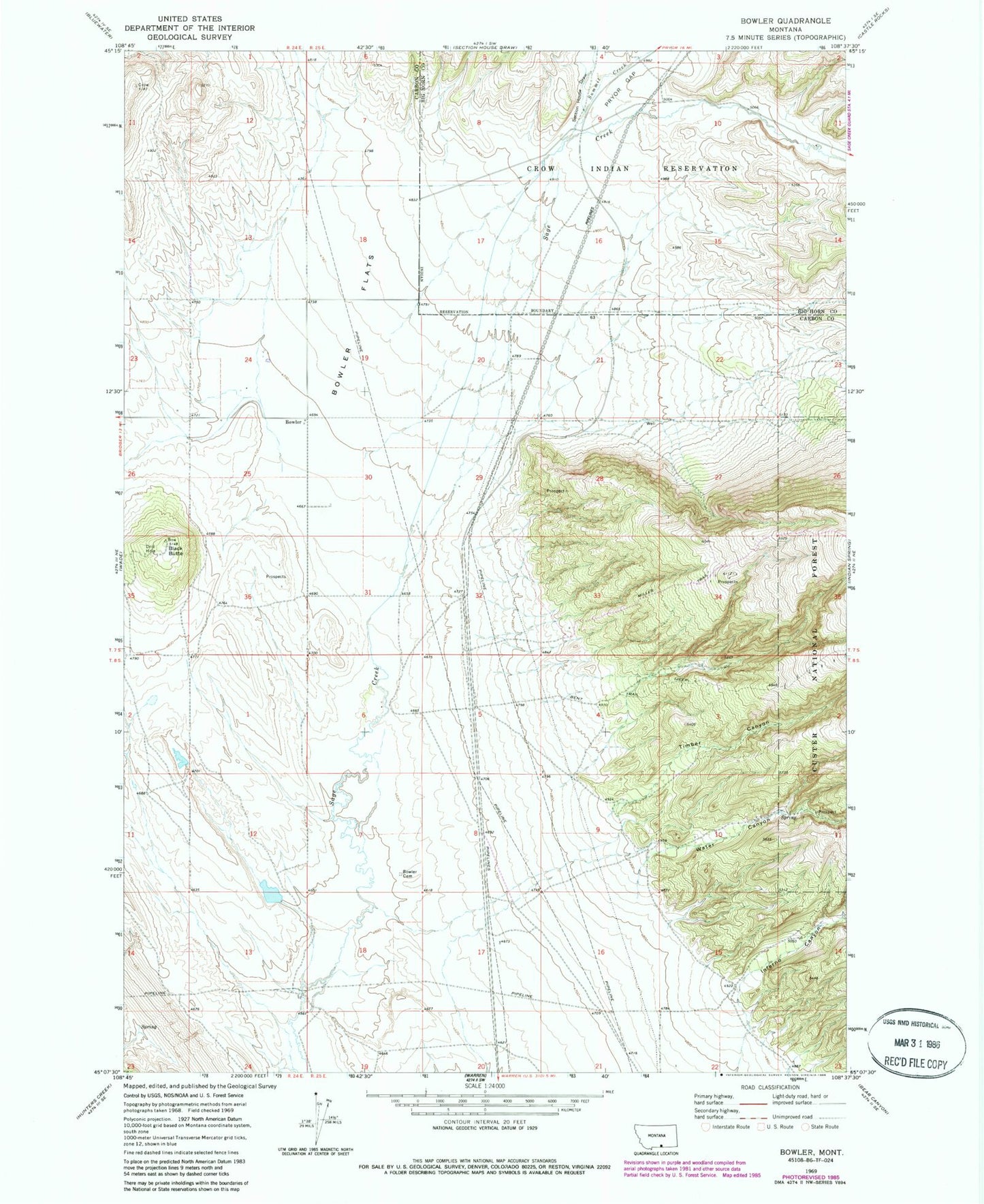
Classic USGS Bowler Montana 7.5'x7.5' Topo Map
Couldn't load pickup availability
Historical USGS topographic quad map of Bowler in the state of Montana. Map scale may vary for some years, but is generally around 1:24,000. Print size is approximately 24" x 27"
This quadrangle is in the following counties: Big Horn, Carbon.
The map contains contour lines, roads, rivers, towns, and lakes. Printed on high-quality waterproof paper with UV fade-resistant inks, and shipped rolled.
Contains the following named places: 07S24E25AAAA01 Well, 07S25E23CABB01 Well, 07S25E28AAA_01 Well, 08S25E04CCC_01 Well, 08S25E06DCDC01 Well, Black Butte, Bowler, Bowler Cemetery, Bowler Flats, Bowler Post Office, Bowler School, East Carbon Division, Marlew Number 2 Dam, Miller Trail, Section House Draw, Summit Creek, Timber Canyon, Water Canyon