
MyTopo
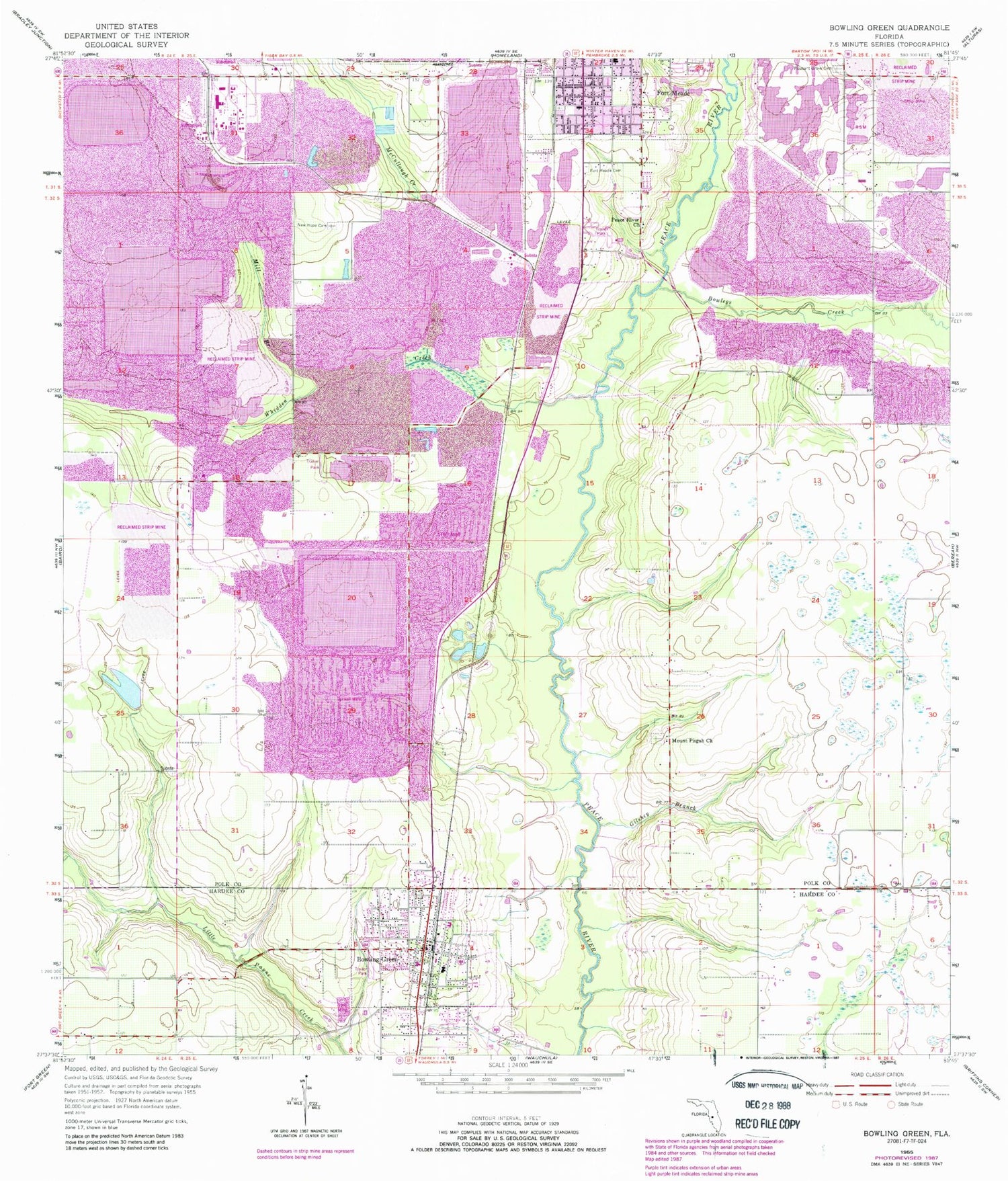
Classic USGS Bowling Green Florida 7.5'x7.5' Topo Map
Couldn't load pickup availability
Historical USGS topographic quad map of Bowling Green in the state of Florida. Map scale is 1:24000. Print size is approximately 24" x 27"
This quadrangle is in the following counties: Hardee, Polk.
The map contains contour lines, roads, rivers, towns, and lakes. Printed on high-quality waterproof paper with UV fade-resistant inks, and shipped rolled.
Contains the following named places: Bowlegs Creek, Bowling Green, Bowling Green Church of God, Bowling Green Elementary School, Bowling Green Police Department, Bowling Green Post Office, Christian Bible Fellowship Church, Christmas Tree Trailer Park, Church of the Living God, City of Bowling Green, Crooked Drain, Fort Meade Cemetery, Fort Meade Community Center, Fort Meade Middle School, Fort Meade Mobile Home Park, Gardner Mine Railroad Station, Gilshey Branch, Grace Mobile Home Park, Hammock Lake Mobile Estates, Hardee County Fire Rescue Department Station 3, Immanuel Baptist Church, Lewis Elementary School, McCullough Creek, McDuffie Mobile Home Park, Mill Branch, Mount Pisgah Church, New Hope Cemetery, Oakview Lakes Mobile Home Park, Paynes Creek Historic State Park, Peace River Church, Pleasant Grove Cemetery, Rockland Junction, Rockland Railroad Station, Sand Mountain, Swift Railroad Station, Twomile Lake, Valencia Mobile Home Park, Whidden Creek


