MyTopo
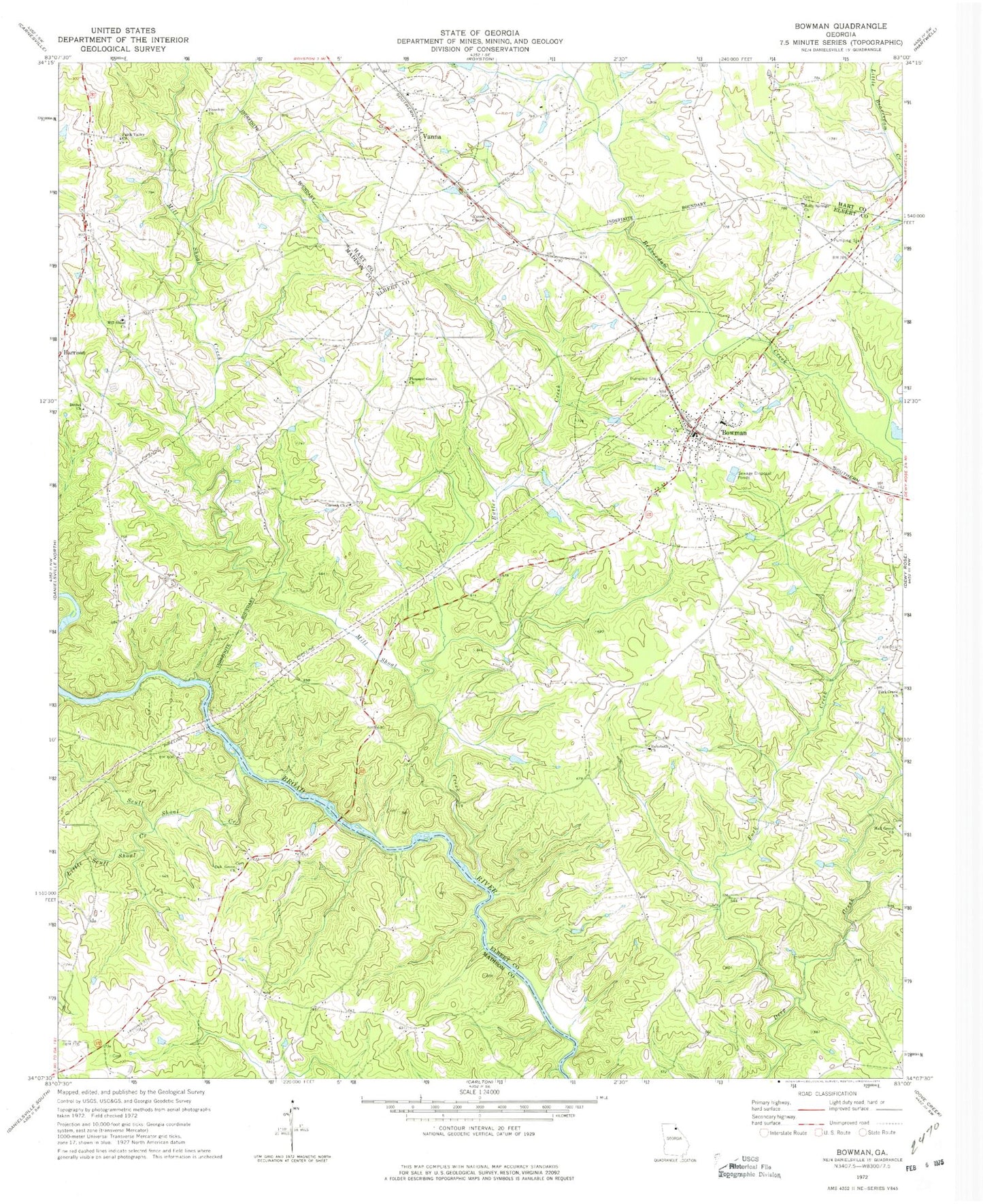
Classic USGS Bowman Georgia 7.5'x7.5' Topo Map
Couldn't load pickup availability
Historical USGS topographic quad map of Bowman in the state of Georgia. Map scale may vary for some years, but is generally around 1:24,000. Print size is approximately 24" x 27"
This quadrangle is in the following counties: Elbert, Hart, Madison.
The map contains contour lines, roads, rivers, towns, and lakes. Printed on high-quality waterproof paper with UV fade-resistant inks, and shipped rolled.
Contains the following named places: Berryman Mill, Berryman School, Bethel Church, Bowman, Bowman City Cemetery, Bowman Division, Bowman Elementary School, Bowman Post Office, Brice Drake Chicken Farm, Broad River Church, Butler Creek, Calvary Temple, Charles Moons Ferry, City of Bowman, Collins Cemetery, Collins District Volunteer Fire Department, Corinth Church, Elbert County Fire Department Bowman Station, Faith Valley Church, Fellowship Cemetery, Fellowship Methodist Church, Fork Creek, Fork Creek Cemetery, Fork Creek Church, Freedom Church, Hall Grove Cemetery, Hall Grove Church, Harris School, Harrison, Harrison School, Harrison Volunteer Fire Department, Hart County Fire Department Station 8 Vanna, Holly Springs Cemetery, Holly Springs Church, Jeptha, Little Scull Shoal Creek, Match, Mill Shoal Cemetery, Mill Shoal Church, Mill Shoal Creek, Mill Shoal School, Moore Ferry, New Bethel Cemetery, New Lattice Bridge, Oak Grove Baptist Church, Oak Grove School, Peytons Ferry, Pleasant Grove Cemetery, Pleasant Grove Church, Reeds, Rehoboth Cemetery, Rehoboth Church, Scull Shoal Creek, Seymours Store, Teasley Mill, Thornton Mill, Vanna, Vanna Chapel, Vineyard Creek, Wilson Ferry, Winns Mill, ZIP Code: 30624