MyTopo
Classic USGS Bowman South Carolina 7.5'x7.5' Topo Map
Couldn't load pickup availability
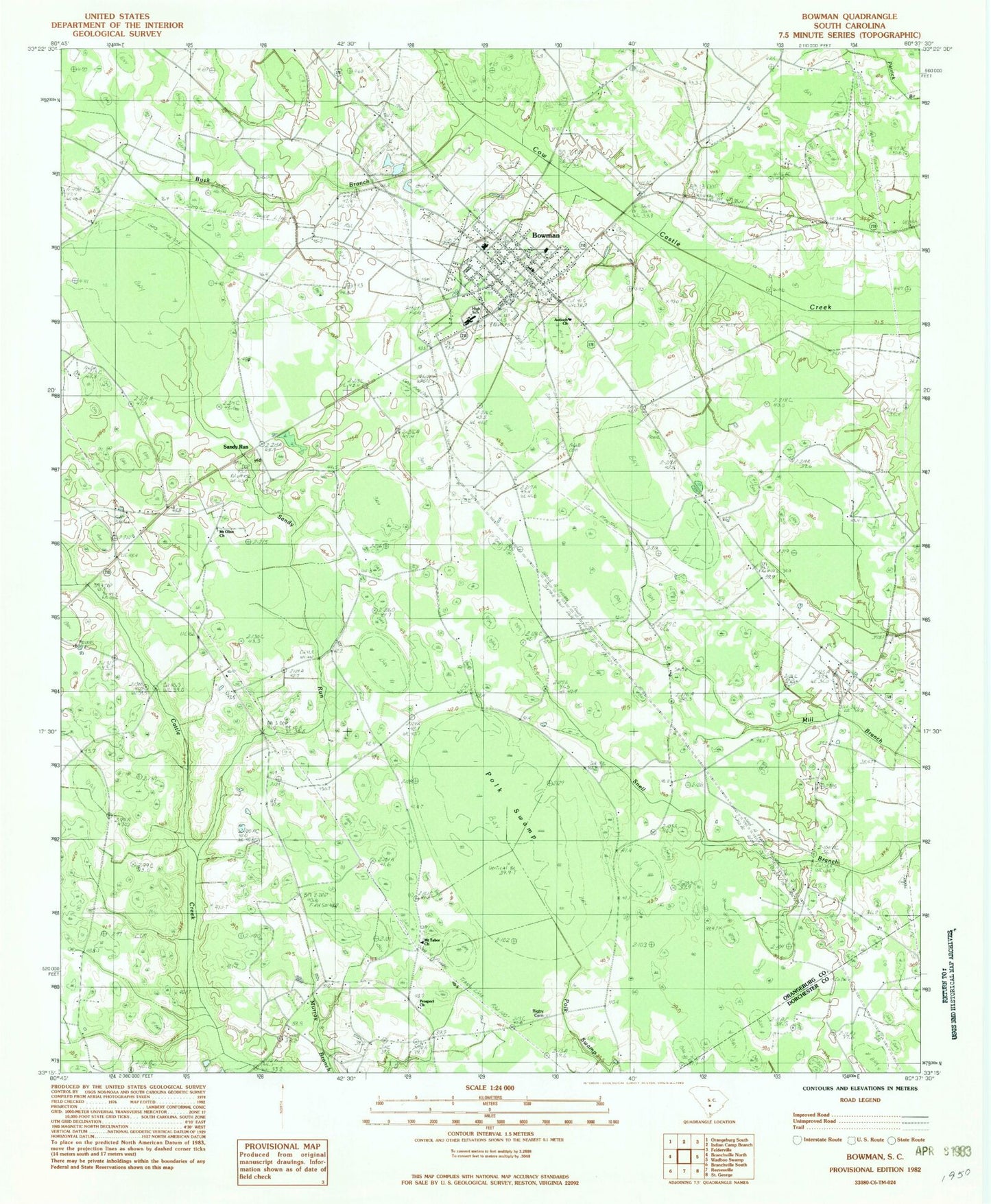
Historical USGS topographic quad map of Bowman in the state of South Carolina. Map scale may vary for some years, but is generally around 1:24,000. Print size is approximately 24" x 27"
This quadrangle is in the following counties: Dorchester, Orangeburg.
The map contains contour lines, roads, rivers, towns, and lakes. Printed on high-quality waterproof paper with UV fade-resistant inks, and shipped rolled.
Contains the following named places: Antioch Church, Bowman, Bowman Division, Bowman Elementary School, Bowman Fire Department, Bowman Fire Department Administration, Bowman High School, Bowman Police Department, Bowman Post Office, Bowman Southern Methodist Church, Buck Branch, Cattle Creek Fire Department, Cattle Creek Fire Department Station 2, Frederick School, Hickory Hill School, Johnson School, Lambrick, Mount Olive Church, Mount Olive School, Mount Tabor Baptist Church, Mount Tabor Cemetery, Murray Branch School, Murray School, Polk Swamp, Prospect Church, Rigby Cemetery, Sandy Run, Sandy Run School, Snell Branch School, Town of Bowman, West School, ZIP Code: 29018