MyTopo
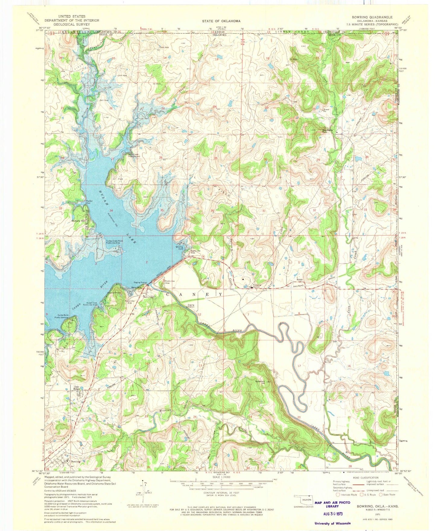
Classic USGS Bowring Oklahoma 7.5'x7.5' Topo Map
Couldn't load pickup availability
Historical USGS topographic quad map of Bowring in the state of Oklahoma. Map scale may vary for some years, but is generally around 1:24,000. Print size is approximately 24" x 27"
This quadrangle is in the following counties: Chautauqua, Osage, Washington.
The map contains contour lines, roads, rivers, towns, and lakes. Printed on high-quality waterproof paper with UV fade-resistant inks, and shipped rolled.
Contains the following named places: Bowring, Bowring Census Designated Place, Bowring Elementary School, Caney Bend Public Use Area, Coon Creek, Cotton-Coon-Mission Creek Site 4 Dam, Cotton-Coon-Mission Creek Site 4 Reservoir, Cotton-Coon-Mission Creek Site 5 Dam, Cotton-Coon-Mission Creek Site 5 Reservoir, Deadmans Rock, East Hickory Creek, Hay Hollow, Hickory Creek, Hickory Hill, Hickory Hill Fire Department, Hulah, Hulah Cove Public Use Area, Hulah Dam, Hulah Lake, Hulah Volunteer Fire Department, Labadie Family Cemetery, Lost Creek, Oak Ridge, Oknoname 113003 Dam, Oknoname 113003 Reservoir, Oknoname 113005 Dam, Oknoname 113005 Reservoir, Oknoname 113006 Dam, Oknoname 113006 Reservoir, Oknoname 113008 Dam, Oknoname 113008 Reservoir, Oknoname 113009 Dam, Oknoname 113009 Reservoir, Oknoname 113010 Dam, Oknoname 113010 Reservoir, Oknoname 113011 Dam, Oknoname 113011 Reservoir, Oknoname 113013 Dam, Oknoname 113013 Reservoir, Opossum Creek, Quarry Cove, Skull Creek, Skull Creek Public Access, Sundown Hill, Thunderbolt Creek, Tucker Cove, Turkey Creek Point Public Use Area, West Hickory Creek