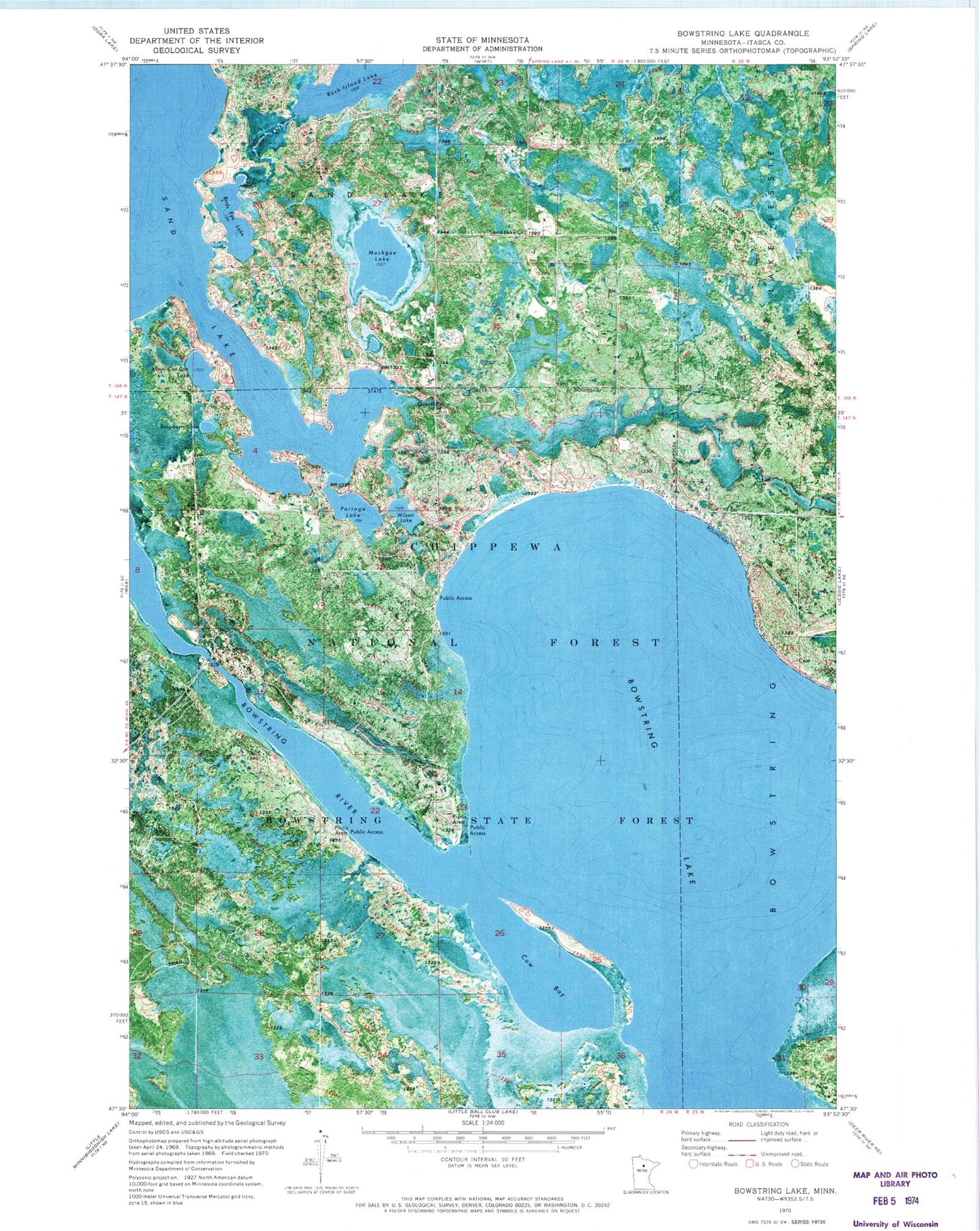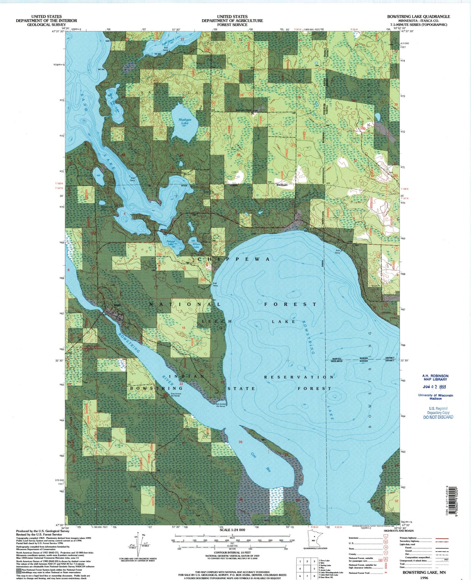

MyTopo
Classic USGS Bowstring Lake Minnesota 7.5'x7.5' Topo Map
Regular price
$16.95
Regular price
Sale price
$16.95
Unit price
per
Couldn't load pickup availability
Historical USGS topographic quad map of Bowstring Lake in the state of Minnesota. Map scale may vary for some years, but is generally around 1:24,000. Print size is approximately 24" x 27"
This quadrangle is in the following counties: Itasca.
The map contains contour lines, roads, rivers, towns, and lakes. Printed on high-quality waterproof paper with UV fade-resistant inks, and shipped rolled.
Contains the following named places: Birds Eye Lake, Bowstring Lake, Cow Bay, Donnelly Cemetery, Inger, Inger Cemetery, Inger Census Designated Place, Inger Post Office, Minni-Car-Car Lake, Mushgee Lake, Portage Lake, Raspberry Lake, Rush Island Lake, Sand Lake Church, Wilson Lake