
MyTopo
Classic USGS Boxiron Maryland 7.5'x7.5' Topo Map
Couldn't load pickup availability
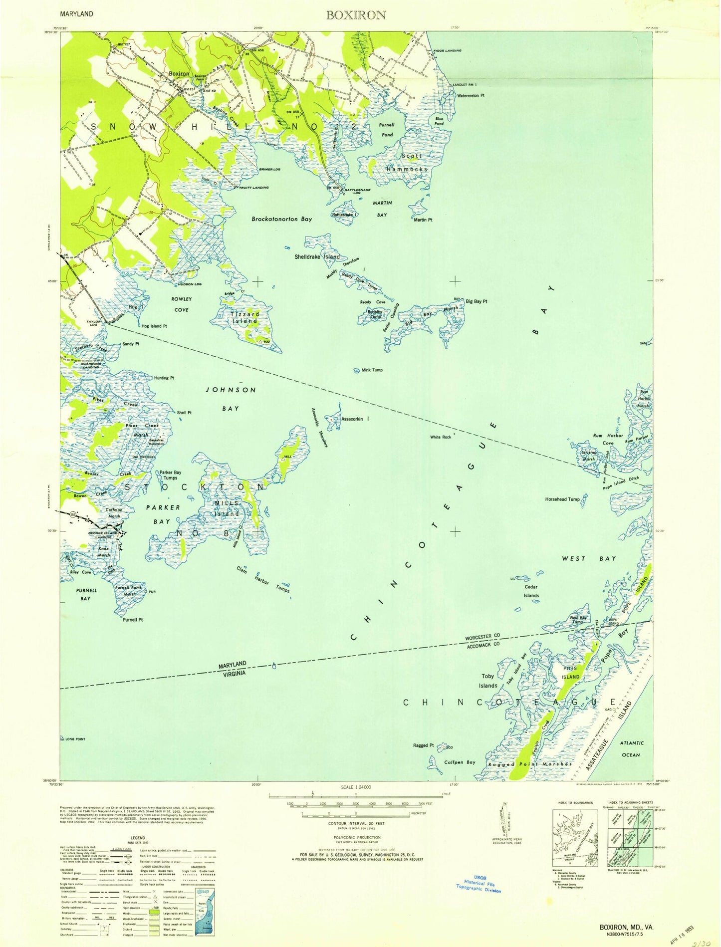
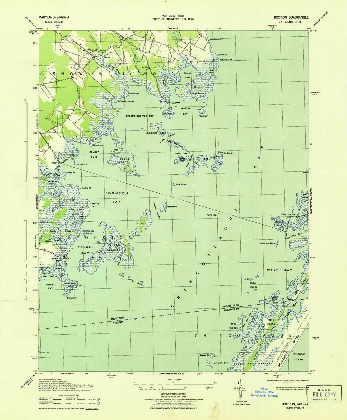
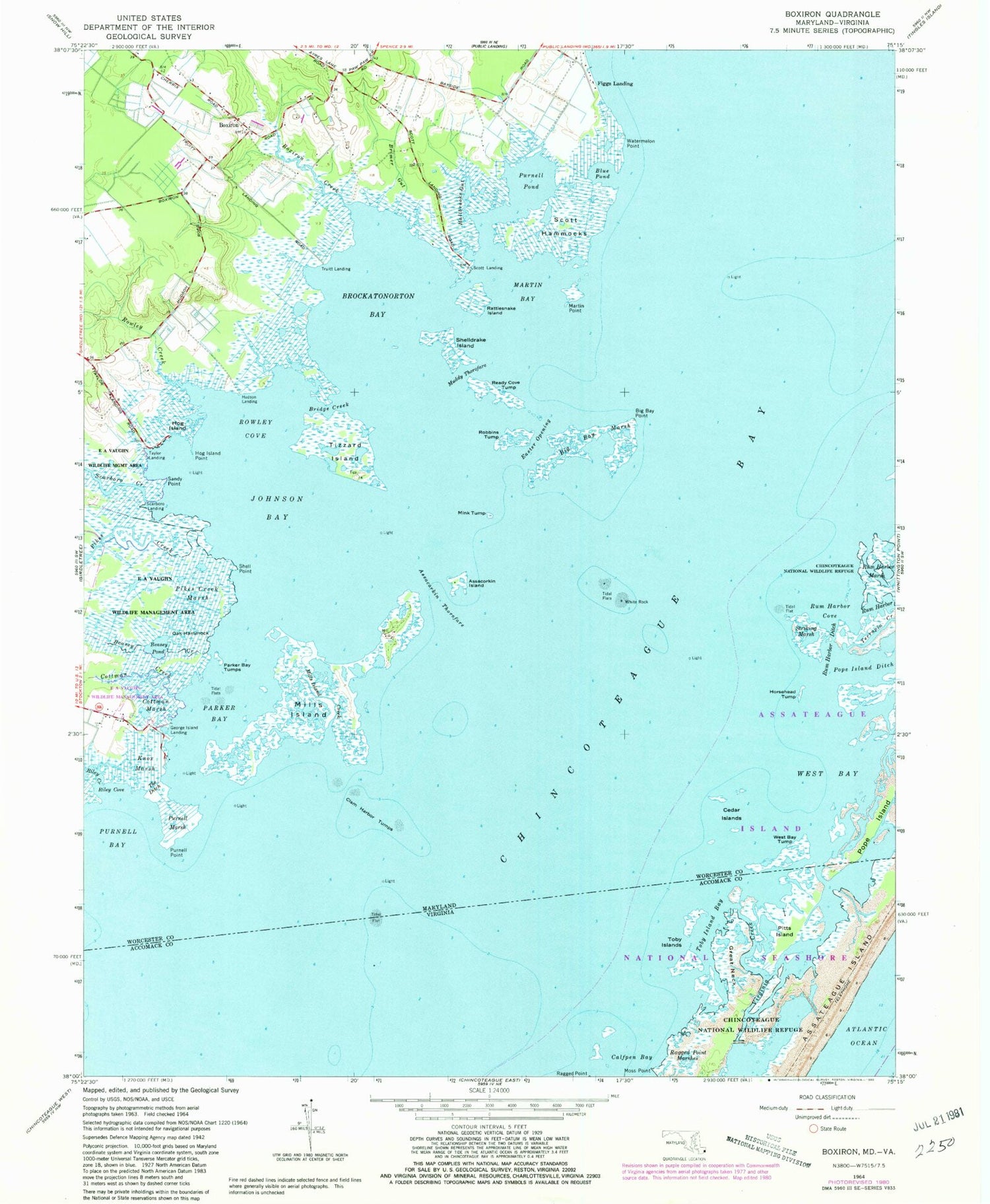
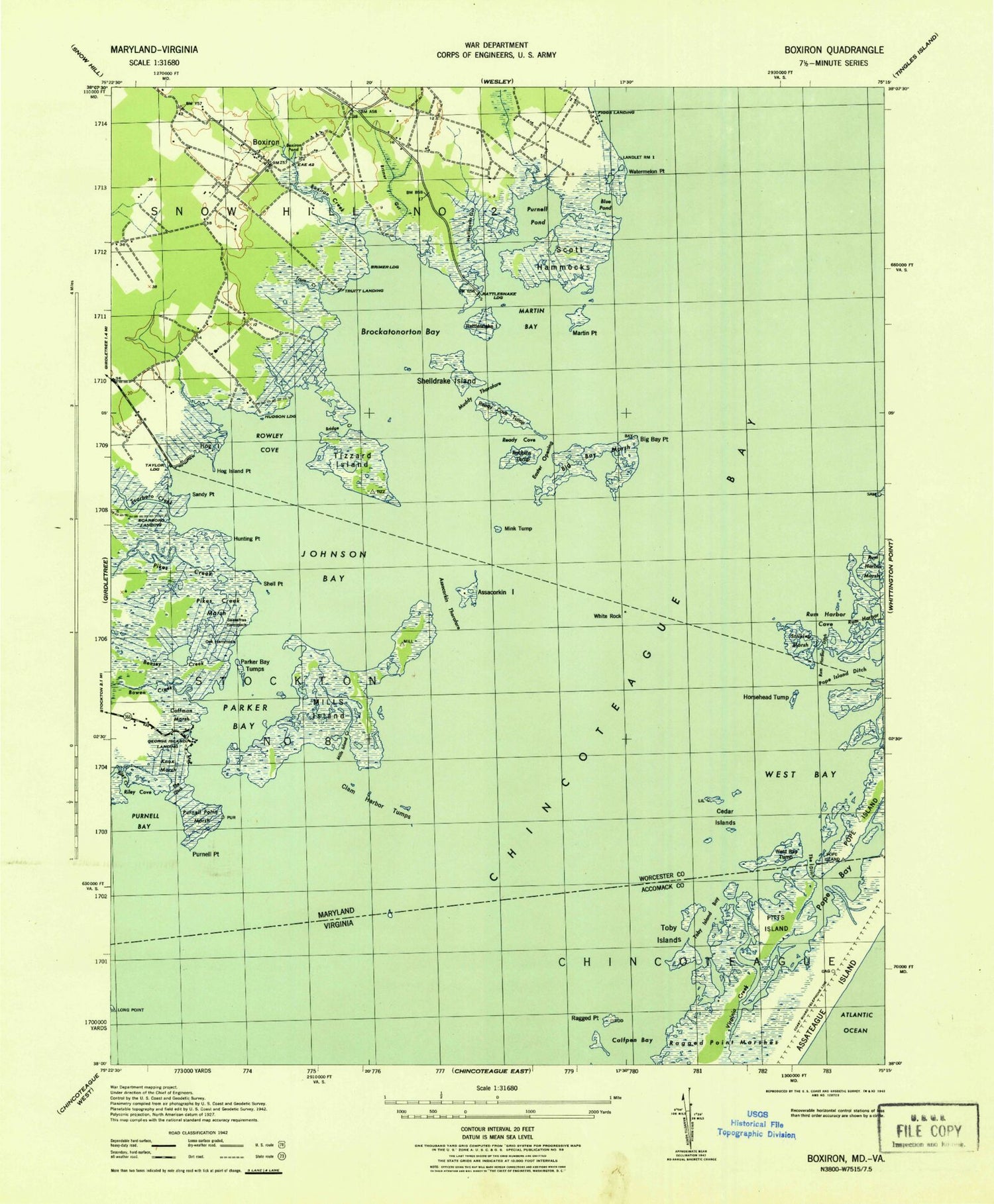
Historical USGS topographic quad map of Boxiron in the states of Maryland, Virginia. Map scale may vary for some years, but is generally around 1:24,000. Print size is approximately 24" x 27"
This quadrangle is in the following counties: Accomack, Worcester.
The map contains contour lines, roads, rivers, towns, and lakes. Printed on high-quality waterproof paper with UV fade-resistant inks, and shipped rolled.
Contains the following named places: Assacorkin Island, Assacorkin Thorofare, Ayres Lane Estates, Bayview, Beasey Creek, Beasey Pond, Big Bay Marsh, Big Bay Point, Blue Pond, Boxiron, Boxiron Creek, Boxiron Landing, Boxiron Pond, Bridge Creek, Brimer Landing, Brockatonorton Bay, Cedar Islands, Clam Harbor Tumps, Colburns Gut, Cottman Creek, Cottman Marsh, Duers Neck, Duers Neck Landing, Easter Opening, Figgs Landing, George Island Landing, Great Neck, Hallbrooks Gut, Hardys Hole, Hog Island, Hog Island Point, Horsehead Tump, Hudson Landing, Hunting Point, Johnson Bay, Knox Marsh, Martin Bay, Martin Point, Mills Island, Mills Island Creek, Mink Tump, Moss Point, Muddy Thorofare, Oak Hammock, Parker Bay, Parker Bay Tumps, Pikes Creek, Pikes Creek Marsh, Pitts Island, Pope Island, Pope Island Ditch, Purnell Bay, Purnell Hummock, Purnell Marsh, Purnell Point, Purnell Pond, Ragged Point, Rams Horn Tump, Ramshorn Island, Rattlesnake Island, Ready Cove Tump, Riley Cove, Riley Creek, Robbins Tump, Rowley Cove, Rowley Creek, Rum Harbor, Rum Harbor Cove, Rum Harbor Ditch, Rum Harbor Marsh, Saint Matthew United Methodist Church, Sandy Point, Sassafras Hammock, Scarboro Creek, Scarboro Landing, Selbys Gut, Shell Point, Shelldrake Island, Striking Marsh, Taylor Landing, Terrapin Creek, The Ditch, Tizzard Island, Toby Island Bay, Toby Islands, Virginia Creek, Watermelon Point, West Bay, West Bay Tump, Whales Gizzard Shoals, White Rock, ZIP Code: 21829