MyTopo
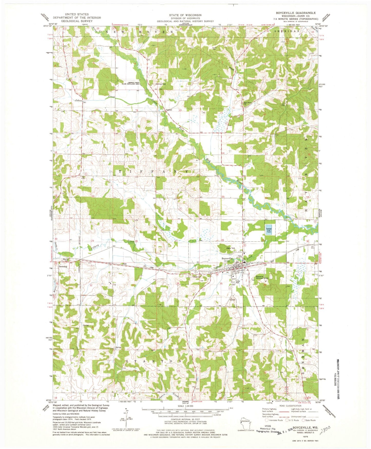
Classic USGS Boyceville Wisconsin 7.5'x7.5' Topo Map
Couldn't load pickup availability
Historical USGS topographic quad map of Boyceville in the state of Wisconsin. Map scale may vary for some years, but is generally around 1:24,000. Print size is approximately 24" x 27"
This quadrangle is in the following counties: Dunn.
The map contains contour lines, roads, rivers, towns, and lakes. Printed on high-quality waterproof paper with UV fade-resistant inks, and shipped rolled.
Contains the following named places: Beaver Creek, Bolen Creek, Boyceville, Boyceville Community Ambulance Service, Boyceville Middle / High School, Boyceville Municipal Airport, Boyceville Police Department, Boyceville Post Office, Boyceville Volunteer Fire Department, Chimney Rock, Chimney Rock School, Chimney Rock State Wetlands Area, Ebenezer Church, Goff School, Granger School, Holy Trinity Church, Johns Creek, Maple Ridge School, Midway School, Mound Cemetery, Oak Ridge School, Pleasant Dale School, Pleasant Hill School, Sandy Creek, Tiffany Cemetery, Tiffany Creek, Tiffany Creek Elementary School, Tiffany Townhall, Town of Tiffany, Village of Boyceville, Village of Downing