MyTopo
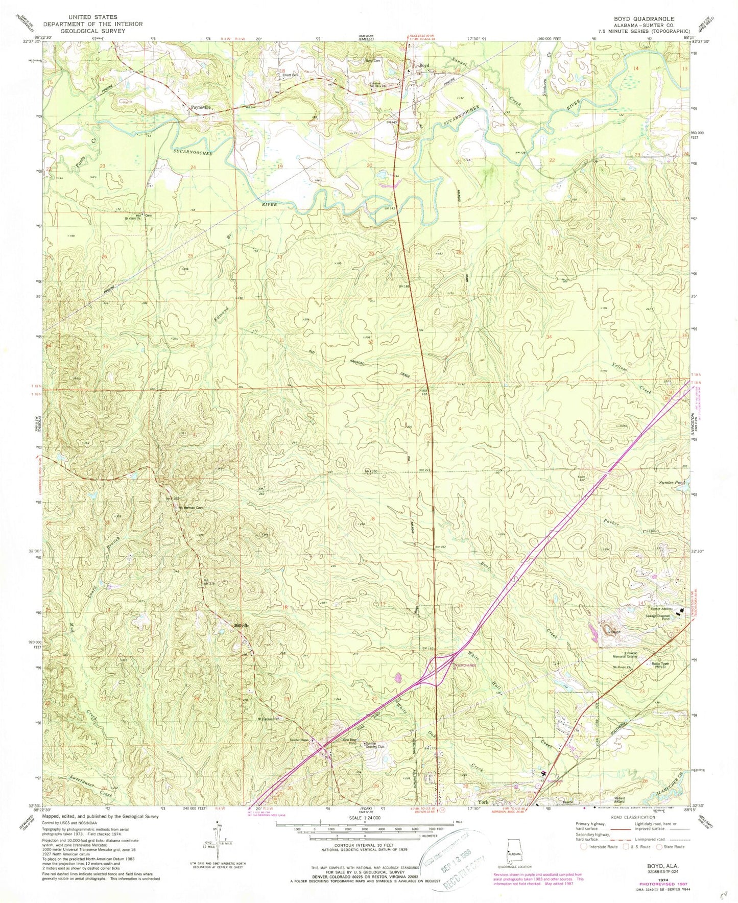
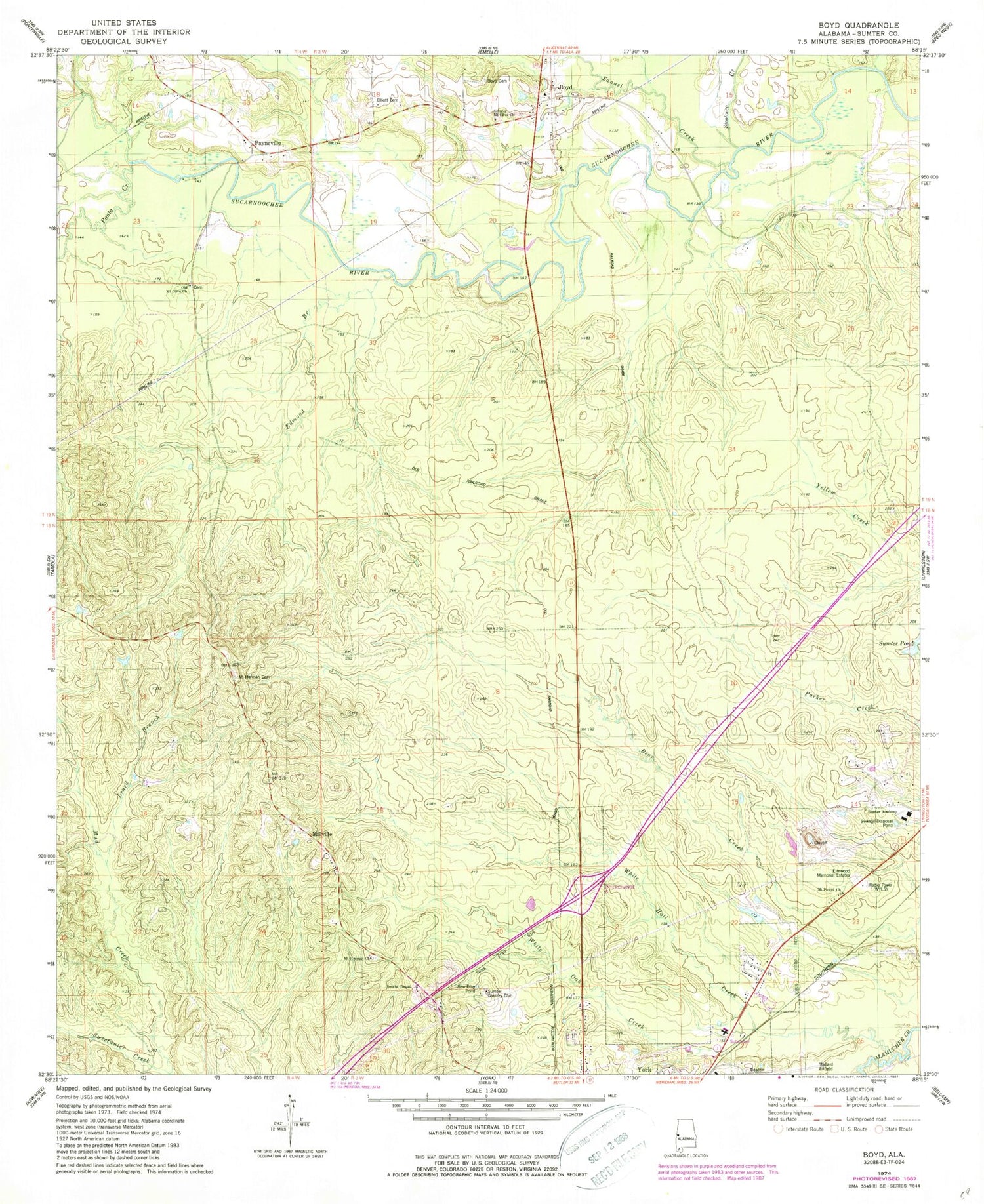
Classic USGS Boyd Alabama 7.5'x7.5' Topo Map
Couldn't load pickup availability
Historical USGS topographic quad map of Boyd in the state of Alabama. Map scale may vary for some years, but is generally around 1:24,000. Print size is approximately 24" x 27"
This quadrangle is in the following counties: Sumter.
The map contains contour lines, roads, rivers, towns, and lakes. Printed on high-quality waterproof paper with UV fade-resistant inks, and shipped rolled.
Contains the following named places: Atanchiluka Creek, Barebone Creek, Boyd, Boyd Cemetery, Boyd Volunteer Fire Department, Cobbs Crossing, Danner Cemetery, Edmond Branch, Elliott Cemetery, Elmwood Memorial Estates, Greater Mount Olive Primitive Baptist Church, Hadden Presbyterian Church, Leard Branch, Millville, Millville Cemetery, Mount Herman Cemetery, Mount Herman Church, Mount Herman School, Mount Olive Church, Mount Powell Baptist Church, Mount Powell School, Mud Creek, Old Mount Olive Cemetery, Old Mount Olive Primitive Baptist Church, Payneville, Payneville School, Ponta Creek, Sambo Creek, Sanusi Creek, Sicolocco Creek, Smiths Chapel, Sparkman, Sumter Academy, Sumter Country Club, Sumter Fire Tower, Teoc Creek, Tubby Creek, White Hall Creek, White Oak Creek, WSLY-FM (York), WYLS-AM (York)