MyTopo
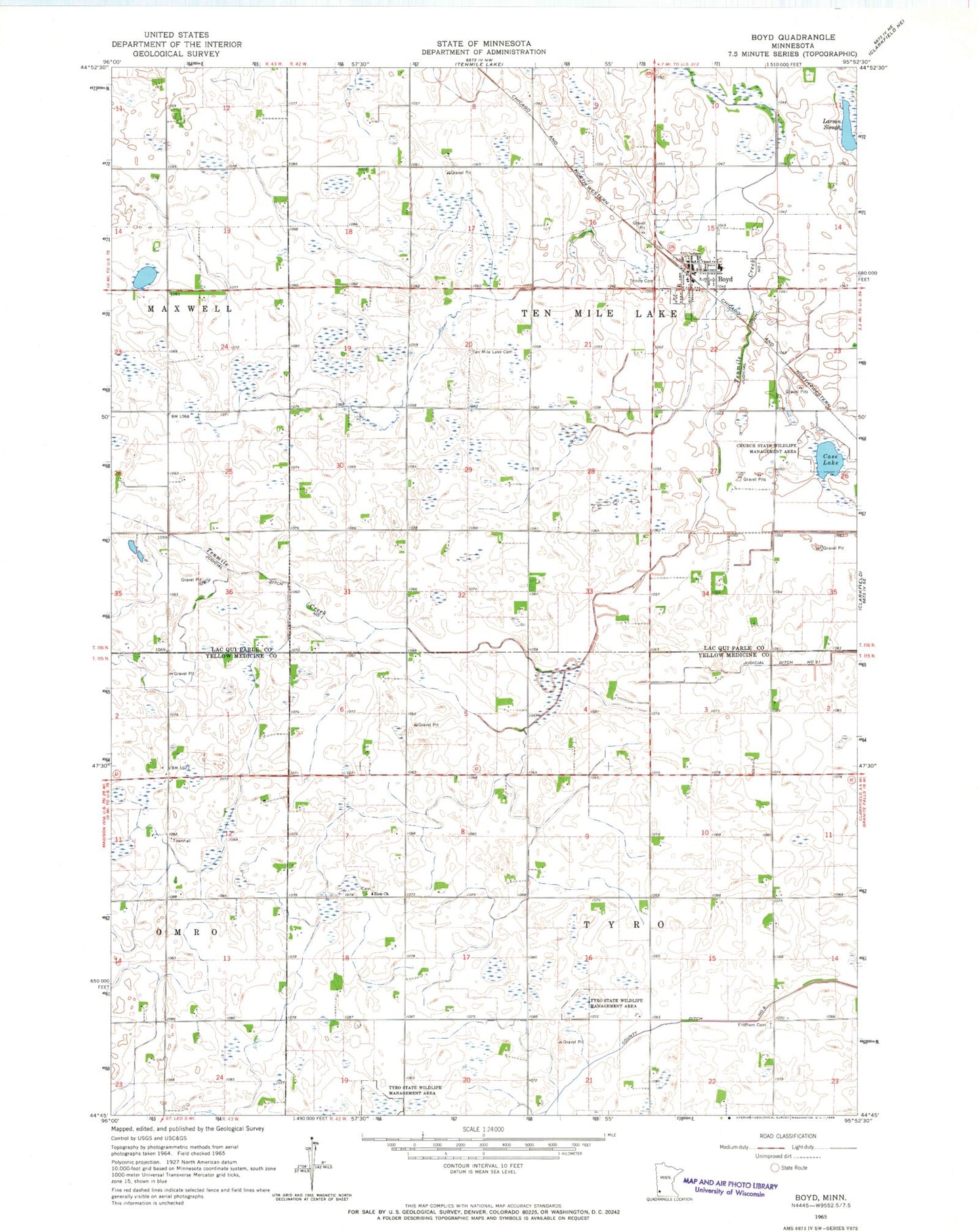
Classic USGS Boyd Minnesota 7.5'x7.5' Topo Map
Couldn't load pickup availability
Historical USGS topographic quad map of Boyd in the state of Minnesota. Map scale may vary for some years, but is generally around 1:24,000. Print size is approximately 24" x 27"
This quadrangle is in the following counties: Lac qui Parle, Yellow Medicine.
The map contains contour lines, roads, rivers, towns, and lakes. Printed on high-quality waterproof paper with UV fade-resistant inks, and shipped rolled.
Contains the following named places: Boyd, Boyd Post Office, Boyd Volunteer Fire Department, Case Lake, Church State Wildlife Management Area, City of Boyd, County Ditch Number Nine, Fridhem Cemetery, Jessen Farms, Judicial Ditch Number One, Larson Slough, Saint John Lutheran Church, Ten Mile Lake Cemetery, Township of Ten Mile Lake, Township of Tyro, Trinity Cemetery, Trinity Lutheran Church, Tyro State Wildlife Management Area, Zion Cemetery, ZIP Code: 56218