
MyTopo
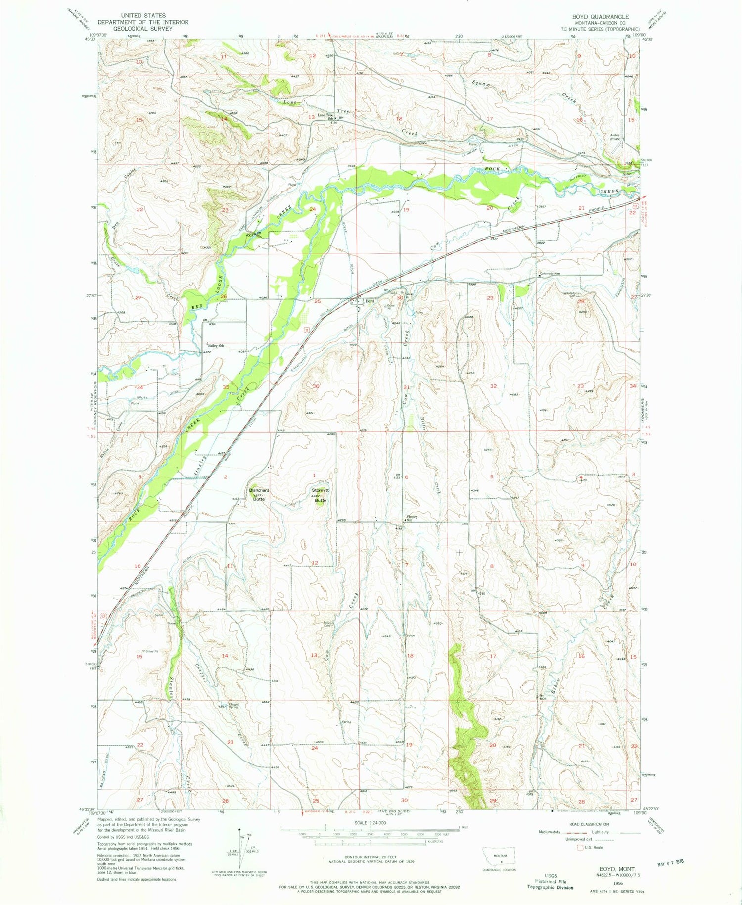
Classic USGS Boyd Montana 7.5'x7.5' Topo Map
Couldn't load pickup availability
Historical USGS topographic quad map of Boyd in the state of Montana. Map scale may vary for some years, but is generally around 1:24,000. Print size is approximately 24" x 27"
This quadrangle is in the following counties: Carbon.
The map contains contour lines, roads, rivers, towns, and lakes. Printed on high-quality waterproof paper with UV fade-resistant inks, and shipped rolled.
Contains the following named places: 04S22E17CBBA01 Well, 04S22E18ADCA01 Well, 04S22E28BBDD01 Well, 05S21E01CDAA01 Well, 05S21E14BBCA01 Well, 59013, Bailey School, Beltz Cemetery, Black Diamond Fishing Access Site, Blanchard Butte, Boyd, Boyd Census Designated Place, Boyd Methodist Episcopal Church, Boyd Post Office, Boyd School, Carbon, Carbonado Cemetery, Carbonado Ditch, Carbonado Mine, Carbonado Post Office, Carbonado School, Chappel Creek, Chappel Spring, Cow Creek, Dry Coulee, Grove Creek, Gruel Ditch, Heifer Creek, Highline Ditch, Hoyle Ditch, Leimback Ditch, Lone Tree Creek, Lone Tree School, Red Lodge Creek, Rooney Ditch, Sabo-Johnson-Curry Ditch, Selmes School, Stanley Creek, Stormitt Butte, Victory School, Wallila Coulee, Ward Ditch


