MyTopo
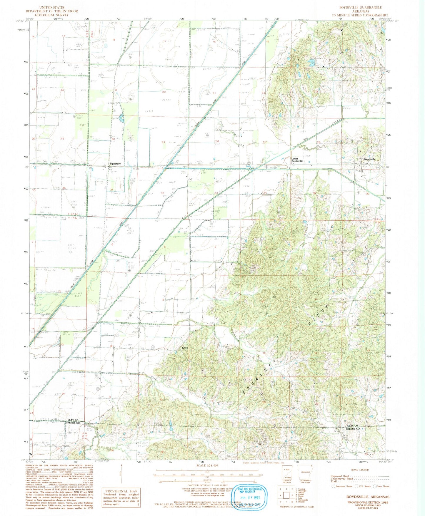
Classic USGS Boydsville Arkansas 7.5'x7.5' Topo Map
Couldn't load pickup availability
Historical USGS topographic quad map of Boydsville in the state of Arkansas. Map scale may vary for some years, but is generally around 1:24,000. Print size is approximately 24" x 27"
This quadrangle is in the following counties: Clay, Greene.
The map contains contour lines, roads, rivers, towns, and lakes. Printed on high-quality waterproof paper with UV fade-resistant inks, and shipped rolled.
Contains the following named places: Bethlehem Cemetery, Bethlehem Church, Boydsville, Boydsville Church, Clay County, Ditch Number 10, Ditch Number 20, Ditch Number 25, Ditch Number 26, Ditch Number 27, Ditch Number 28, Dort Creek, Frie Lake, Frie Lake Dam, Johnson Creek, Knob, Knob School, Lower Boydsville, North Big Creek, Purcel Cemetery, Purcel Church, Rock Springs Cemetery, Rock Springs Church, Salem Cemetery, Salem Church, Smith Chapel, Tipperary, Township of Johnson, Township of Knob, Turtle Knob School