MyTopo
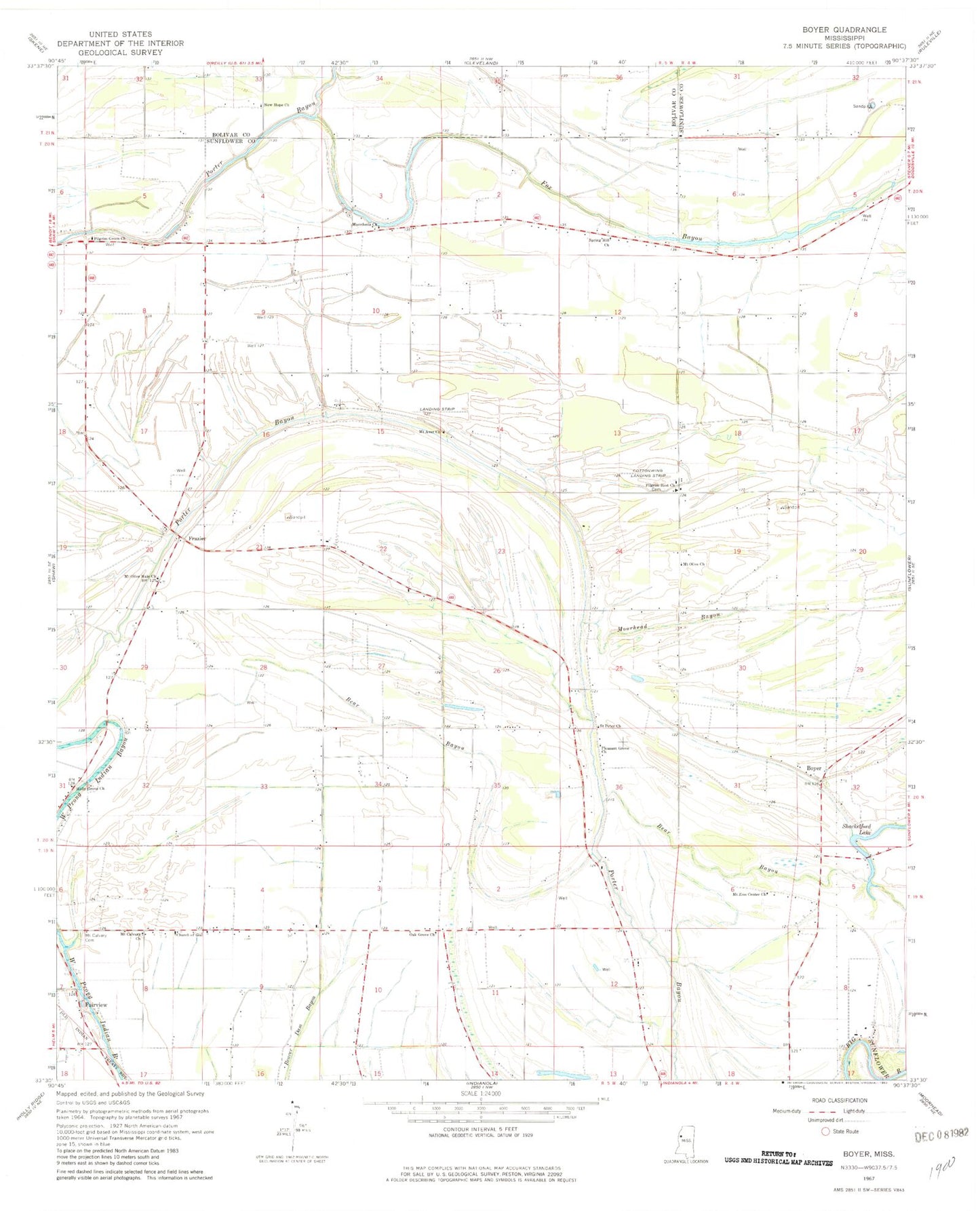
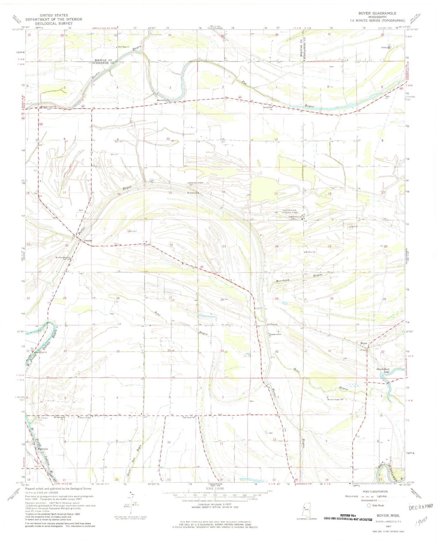
Classic USGS Boyer Mississippi 7.5'x7.5' Topo Map
Couldn't load pickup availability
Historical USGS topographic quad map of Boyer in the state of Mississippi. Map scale may vary for some years, but is generally around 1:24,000. Print size is approximately 24" x 27"
This quadrangle is in the following counties: Bolivar, Sunflower.
The map contains contour lines, roads, rivers, towns, and lakes. Printed on high-quality waterproof paper with UV fade-resistant inks, and shipped rolled.
Contains the following named places: A E Britt Pond Dam, Bishop Pond Dam, Boyer, Boyer Cemetery, Charles Ellis Pond Dam, Christian Church, Church of God, Cottonwing Airport, Fairview, Fairview Methodist Church, Fairview School, Faisonia, Fox Bayou, Frazier, Hale School, Holly Grove Church, Keller School, Lakeside Plantation, Macedonia Church, Macedonia School, Marie School, Moorhead Bayou, Mount Aver Church, Mount Calvary Cemetery, Mount Calvary Church, Mount Olive Church, Mount Olive Hale Church, Mount Olive School, Mount Zion Center Church, New Hope Church, Oak Grove Church, Oak Grove School, Pilgrim Green Church, Pilgrim Rest Church, Pleasant Grove Church, Saint Peter Church, Shackelford Lake, Spring Hill Church, Springhill School, Stephensville School, Stephenville, Tommy Ellis Lake Dam, Tommy Ellis Pond Dam, Waltonia, Waltonia School