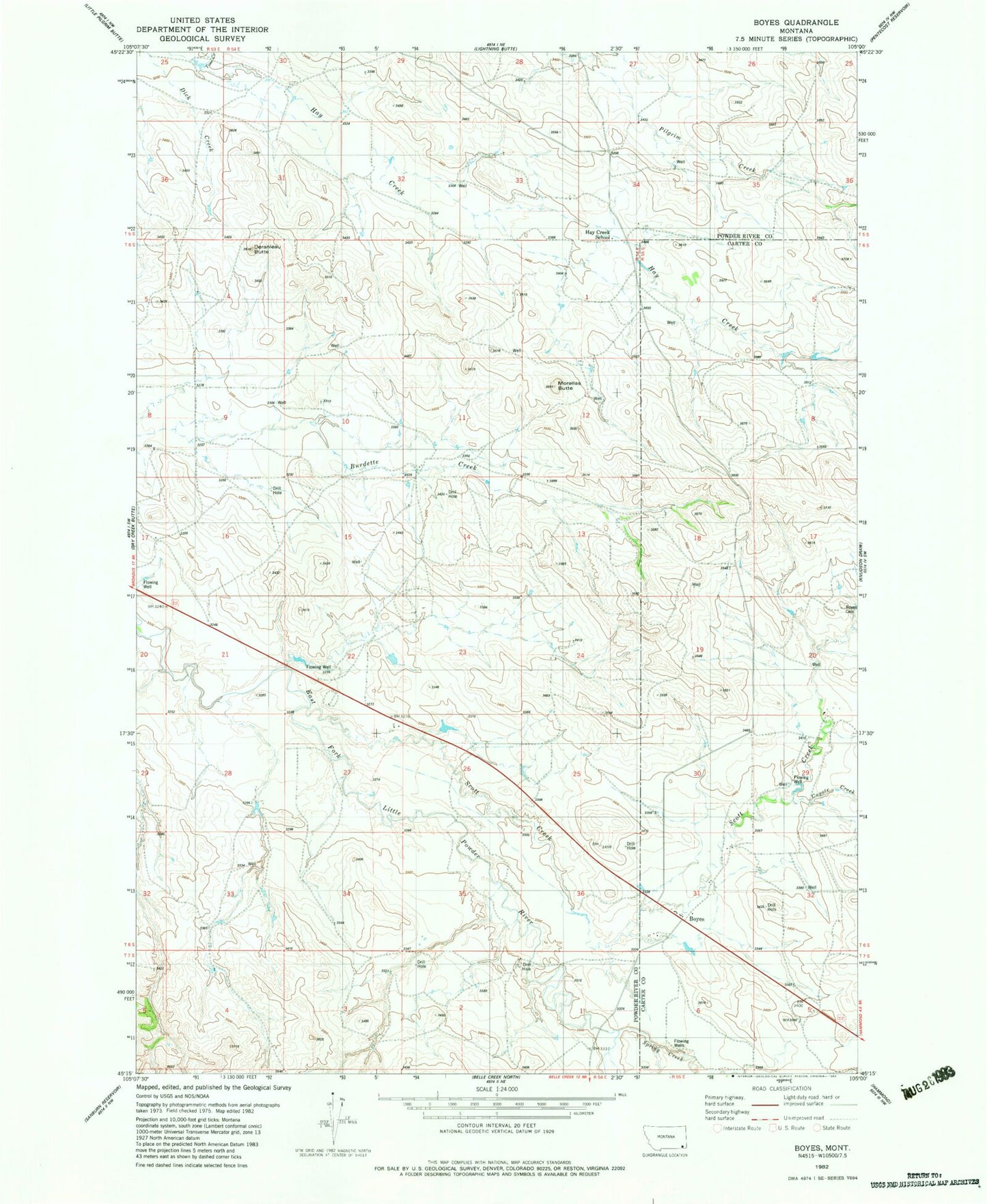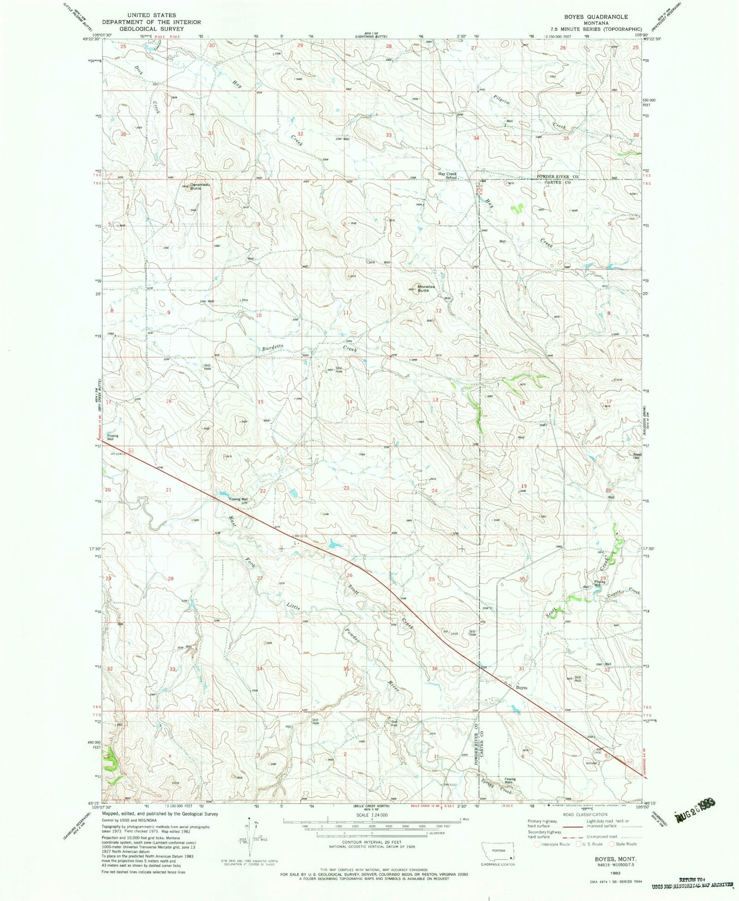
MyTopo
Classic USGS Boyes Montana 7.5'x7.5' Topo Map
Couldn't load pickup availability
Historical USGS topographic quad map of Boyes in the state of Montana. Map scale may vary for some years, but is generally around 1:24,000. Print size is approximately 24" x 27"
This quadrangle is in the following counties: Carter, Powder River.
The map contains contour lines, roads, rivers, towns, and lakes. Printed on high-quality waterproof paper with UV fade-resistant inks, and shipped rolled.
Contains the following named places: 05S53E25BDD_01 Well, 05S54E28DBB_01 Well, 05S54E34DDAD01 Well, 05S54E36CBB_01 Well, 06S54E01CCCB01 Well, 06S54E09ADAC01 Well, 06S54E12ACAC01 Well, 06S54E22CA__01 Well, 06S54E22CDC_01 Well, 06S54E28BDBB01 Well, 06S54E28DAA_01 Well, 06S55E05ADCA01 Well, 06S55E06CDA_01 Well, 06S55E07ABC_01 Well, 06S55E18BC__01 Well, 06S55E20CAAD01 Well, 06S55E31ACDC01 Well, 06S55E31BC__01 Well, 06S55E31CCAC01 Well, 06S55E31CCC_01 Well, 06S55E31CCDB01 Well, 07S54E03AADB01 Well, 07S55E05BB__01 Well, Boyes, Boyes Cemetery, Boyes Post Office, Boyes School, Coyote Creek, Deranleau Butte, Dick Creek, Hay Creek School, Morellas Butte, Scott Creek, Spring Creek, Tom Creek