
MyTopo
Classic USGS Boyleston Illinois 7.5'x7.5' Topo Map
Couldn't load pickup availability
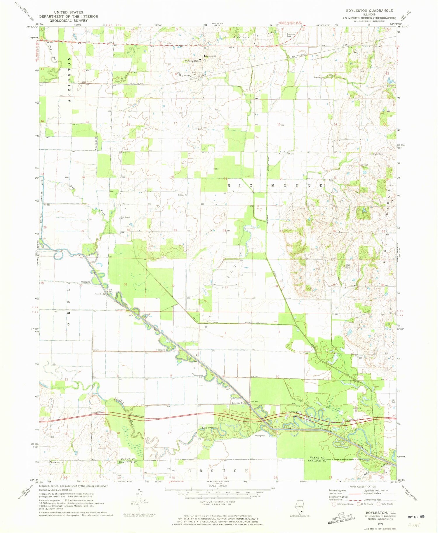
Historical USGS topographic quad map of Boyleston in the state of Illinois. Map scale may vary for some years, but is generally around 1:24,000. Print size is approximately 24" x 27"
This quadrangle is in the following counties: Hamilton, Wayne.
The map contains contour lines, roads, rivers, towns, and lakes. Printed on high-quality waterproof paper with UV fade-resistant inks, and shipped rolled.
Contains the following named places: Aden Oil Field, Big Mound Drainage Ditch, Boyleston, Boyleston School, Campbell, Clark Cemetery, Dry Fork, Dry Fork Drainage Ditch, Eagle Slough Drainage Ditch, Ellis Mound Church, Ellis Mound School, Forest Grove School, Full Gospel Church, Hall Cemetery, Hall School, Haw Creek, Independence School, Lakeside Bridge, Lakeside School, Lebanon School, Little Mound School, Livergood Creek, Lynn Grove School, Oakland School, Pig Ridge, Reed Bridge, Richland Church, Richland School, Shorb School, Skillet Fork Drainage Ditch, Skillet Fork Lagoon, Township of Big Mound, Walton Creek


