MyTopo
Classic USGS Boylston Center New York 7.5'x7.5' Topo Map
Couldn't load pickup availability
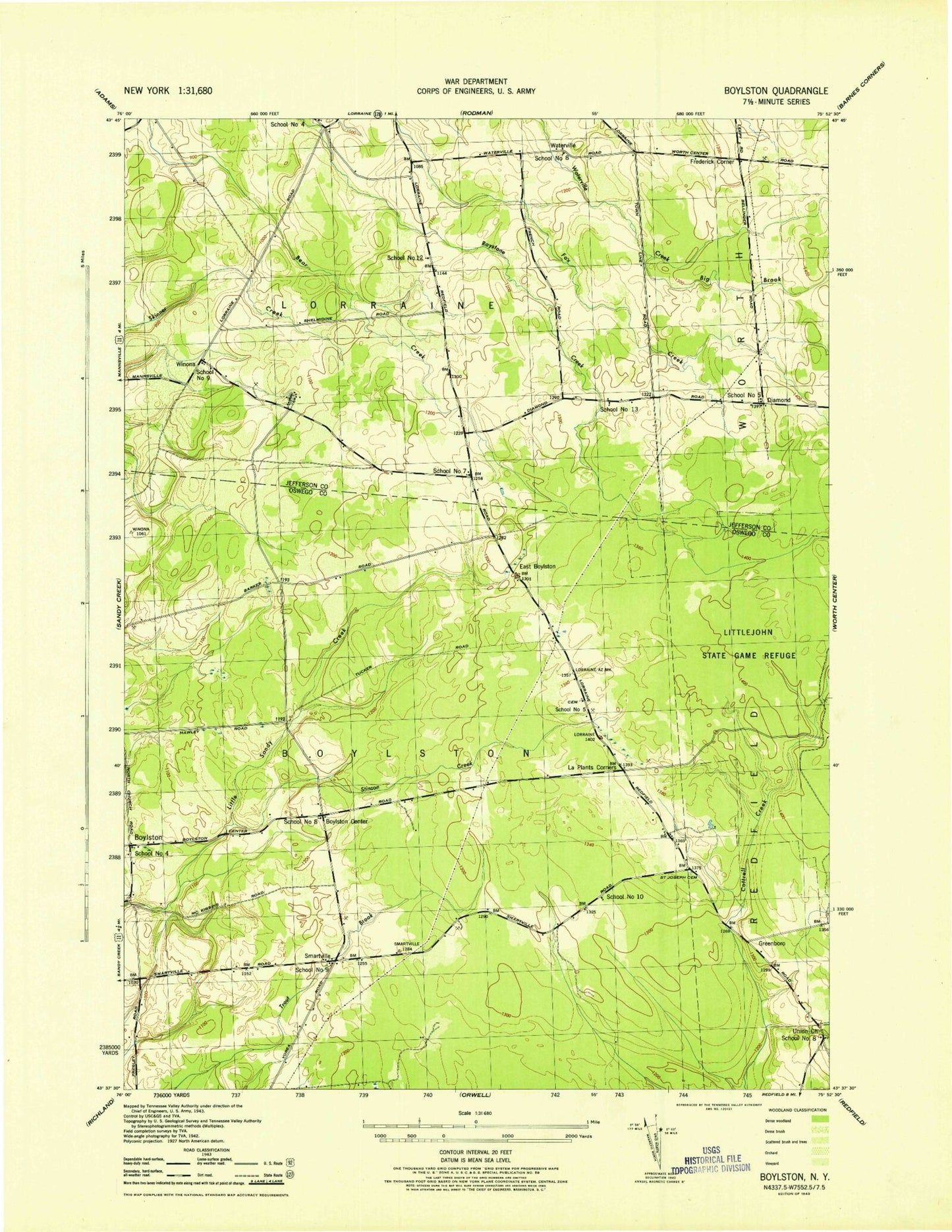
Historical USGS topographic quad map of Boylston Center in the state of New York. Typical map scale is 1:24,000, but may vary for certain years, if available. Print size: 24" x 27"
This quadrangle is in the following counties: Jefferson, Oswego.
The map contains contour lines, roads, rivers, towns, and lakes. Printed on high-quality waterproof paper with UV fade-resistant inks, and shipped rolled.
Contains the following named places: Diamond, Frederick Corners, Greenboro Cemetery, Hemlock District, Phelps Cemetery, Plantz Corners, Saint Josephs Cemetery, Stinson Creek, Union Church, Littlejohn State Game Management Area, Boylston Center, East Boylston, Greenboro, Smartville, Waterville, Winona, Town of Boylston, Town of Lorraine, School Number 4 (historical), School Number 5 (historical), School Number 7 (historical), School Number 8 (historical), Schjool Number 9 (historical), School Number 12 (historical), School Number 13 (historical), School Number 4 (historical), School Number 5 (historical), School Number 8 (historical), School Number 8 (historical), School Number 9 (historical), School Number 10 (historical)