
MyTopo
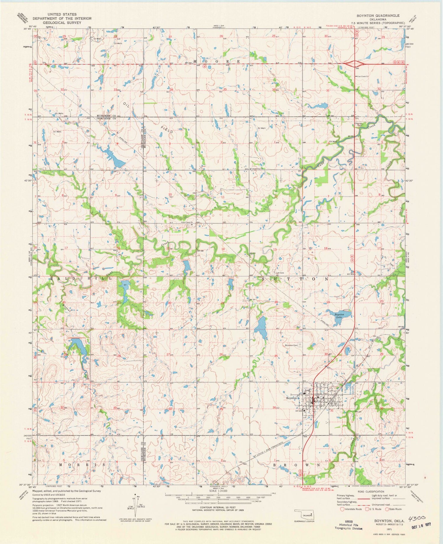
Classic USGS Boynton Oklahoma 7.5'x7.5' Topo Map
Couldn't load pickup availability
Historical USGS topographic quad map of Boynton in the state of Oklahoma. Map scale may vary for some years, but is generally around 1:24,000. Print size is approximately 24" x 27"
This quadrangle is in the following counties: Muskogee, Okmulgee.
The map contains contour lines, roads, rivers, towns, and lakes. Printed on high-quality waterproof paper with UV fade-resistant inks, and shipped rolled.
Contains the following named places: Boynton, Boynton - Moton Elementary School, Boynton - Moton High School, Boynton Cemetery, Boynton Division, Boynton Lake, Boynton Lake Dam, Boynton Post Office, Boynton Volunteer Fire Department, Cane Creek, Cane Creek Cemetery, Cane Creek Church, Cane Creek Site 18 Dam, Cane Creek Site 18 Reservoir, Cane Creek Site 19 Dam, Cane Creek Site 19 Reservoir, Cane Creek Site 2 Dam, Cane Creek Site 2 Reservoir, Cane Creek Site 20 Dam, Cane Creek Site 20 Reservoir, Cane Creek Site 21 Dam, Cane Creek Site 21 Reservoir, Cane Creek Site 22 Dam, Cane Creek Site 22 Reservoir, Cane Creek Site 26a Dam, Cane Creek Site 26a Reservoir, Cane Creek Site 5 Dam, Cane Creek Site 5 Reservoir, Charles Cemetery, Coal Creek Church, Lee Cemetery, Town of Boynton, Township of Sutton, Walnut Creek


