MyTopo
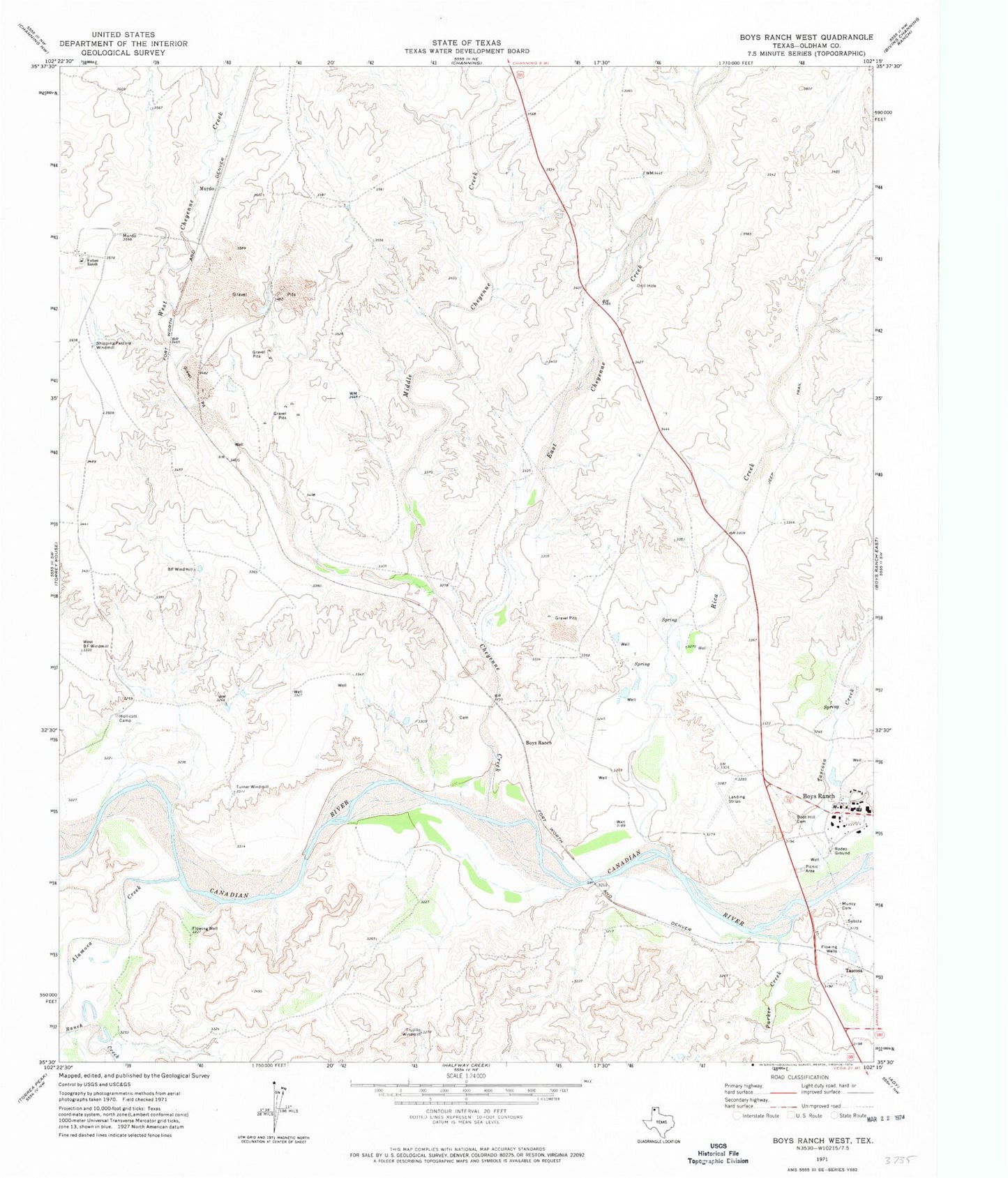
Classic USGS Boys Ranch West Texas 7.5'x7.5' Topo Map
Couldn't load pickup availability
Historical USGS topographic quad map of Boys Ranch West in the state of Texas. Map scale may vary for some years, but is generally around 1:24,000. Print size is approximately 24" x 27"
This quadrangle is in the following counties: Oldham.
The map contains contour lines, roads, rivers, towns, and lakes. Printed on high-quality waterproof paper with UV fade-resistant inks, and shipped rolled.
Contains the following named places: Alamosa Creek, B F Windmill, Boot Hill Cemetery, Boys Ranch, Boys Ranch Census Designated Place, Cal Farley's Boys Ranch Cemetery, Cal Farley's Boys Ranch Emergency Medical Services, Cal Farley's Boys Ranch Fire Department, Cheyenne Creek, East Cheyenne Creek, Fulton Ranch, Hollicott Camp, Middle Cheyenne Creek, Muncy Cemetery, Murdo, Old Tascosa, Parker Creek, Rica Creek, Shipping Pasture Windmill, Tascosa, Tascosa Creek, Trujillo Windmill, Turner Windmill, West B F Windmill, West Cheyenne Creek