MyTopo
Classic USGS Brad Texas 7.5'x7.5' Topo Map
Couldn't load pickup availability
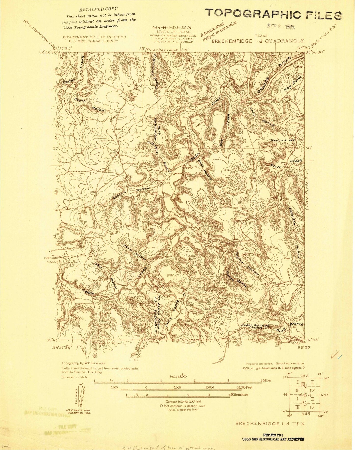
Historical USGS topographic quad map of Brad in the state of Texas. Map scale is 1:24000. Print size is approximately 24" x 27"
This quadrangle is in the following counties: Palo Pinto, Stephens.
The map contains contour lines, roads, rivers, towns, and lakes. Printed on high-quality waterproof paper with UV fade-resistant inks, and shipped rolled.
Contains the following named places: Bass Island, Bear Hollow, Bee Creek, Bone Bend, Brad, Brad Branch, Caddo Bay, Caddo Creek, Cedar Springs Church, Dillihunt Hollow, Elm Creek, Hamilton Hollow, Hayrick Mountain, Hughes Mountain, Iles Oil Field, Little Caddo Creek, Long Hollow, Petes Pride Lake, Petes Pride Lake Dam, Pitzer Lake, Pitzer Lake Dam, Possum Kingdom Lake, Possum Kingdom State Park, Possum Kingdom State Park Trail, Rocky Hollow, Round Mountain, Sam Bass Hollow, Scotch Hollow, Shot Hollow, Taylor Hollow, Texawa Canyon, Yellow Gap