
MyTopo
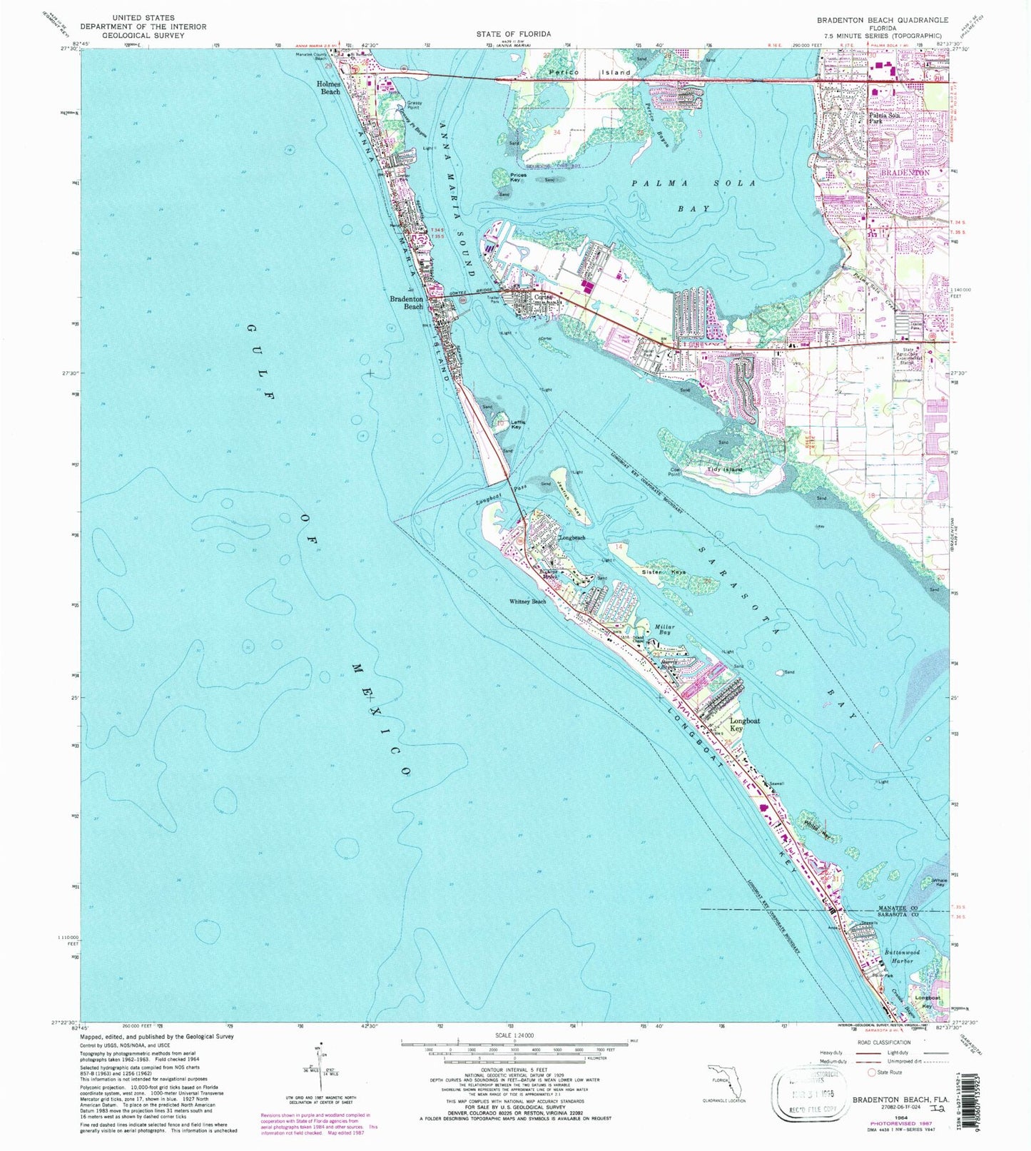
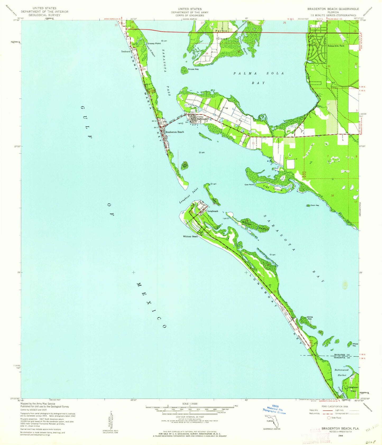
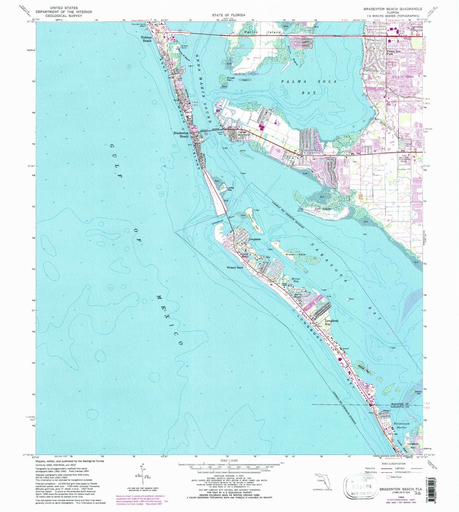
Classic USGS Bradenton Beach Florida 7.5'x7.5' Topo Map
Couldn't load pickup availability
Historical USGS topographic quad map of Bradenton Beach in the state of Florida. Typical map scale is 1:24,000, but may vary for certain years, if available. Print size: 24" x 27"
This quadrangle is in the following counties: Manatee, Sarasota.
The map contains contour lines, roads, rivers, towns, and lakes. Printed on high-quality waterproof paper with UV fade-resistant inks, and shipped rolled.
Contains the following named places: Bishops Bayou, Bradenton Beach, Buttonwood Harbor, Cortez, Cortez Bridge, Cow Point, Cranes Bayou, Grassy Point, Grassy Point Bayou, Harris Bayou, Holmes Beach, Ilexhurst, Island Chapel, Jewfish Key, Leffis Key, Longbeach, Longboat Key, Longboat Key, Longboat Pass, Manatee County Beach, Millar Bay, Palma Sola Creek, Palma Sola Park, Perico Island, Prices Key, Saint Bernards Church, Anna Maria Sound, Tidy Island, White Key, Palma Sola Bay, Sister Keys, Whale Key, Whitney Beach, Sands Plaza, Manatee Plaza, Lakeside Plaza, Coon Key, Andrews Christian Church, Anna Maria Bridge, Bradenton Division, Longboat Key Fire Rescue Station 1, West Manatee Fire and Rescue Station 1, Bradenton Beach Police Department, Longboat Key Police Department, Cortez Census Designated Place, City of Bradenton Beach, Town of Longboat Key, Longboat Key Fire and Rescue Department, Palma Sola Bay Baptist Church, Redeemer Lutheran Church, Saints Peter and Paul the Apostles Church, Cedar Hammock Fire Rescue Station 3, West Manatee Fire and Rescue Station 2, West Manatee Fire and Rescue Station 3, Palma Sola Post Office, Bradenton Beach Post Office, Cortez Post Office