MyTopo
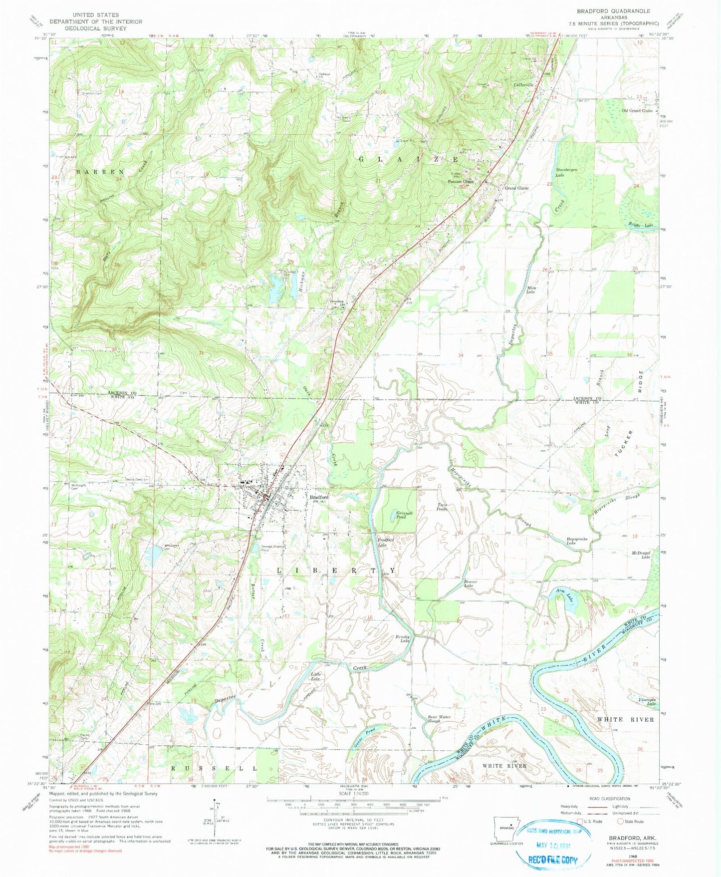
Classic USGS Bradford Arkansas 7.5'x7.5' Topo Map
Couldn't load pickup availability
Historical USGS topographic quad map of Bradford in the state of Arkansas. Map scale may vary for some years, but is generally around 1:24,000. Print size is approximately 24" x 27"
This quadrangle is in the following counties: Jackson, White, Woodruff.
The map contains contour lines, roads, rivers, towns, and lakes. Printed on high-quality waterproof paper with UV fade-resistant inks, and shipped rolled.
Contains the following named places: Arm Lake, B C Smith Lake Dam, Bear Water Slough, Beaver Lake, Blackbird Bend, Bradford, Bradford Elementary School, Bradford Fire Department Station 1, Bradford Fire Department Station 2, Bradford High School, Bradford Lake, Bradford Police Department, Bradford Post Office, Bright Lake, Brown Bend, Brushy Lake, Butter Creek, Carter Cemetery, City of Bradford, Coffeeville, Coffeyville Cemetery, Daniel Landing, Dudley Dread, Friendship Church, Goad Place, Goose Pond, Grand Glaise, Grinnell Pond, Heard Cemetery, Hickman Branch, Hickman Cemetery, Hopspinike Lake, Hopspinike Slough, Little Lake, Long Branch, Masons Reservoir, Masons Reservoir Dam, McKnight Cemetery, Mica Lake, Oakland Cemetery, Oakland Church, Oats Creek, Old Grand Glaise, Possum Grape, Raleigh Reach, Russell Place, Scantlin Cemetery, Smith Lake, Smith Lake One, Smith Lake One Dam, Smith Lake Two, Smith Lake Two Dam, Steenbergen Lake, Township of Glaize, Township of Liberty, Tucker Ridge, Twin Ponds, ZIP Code: 72020