
MyTopo
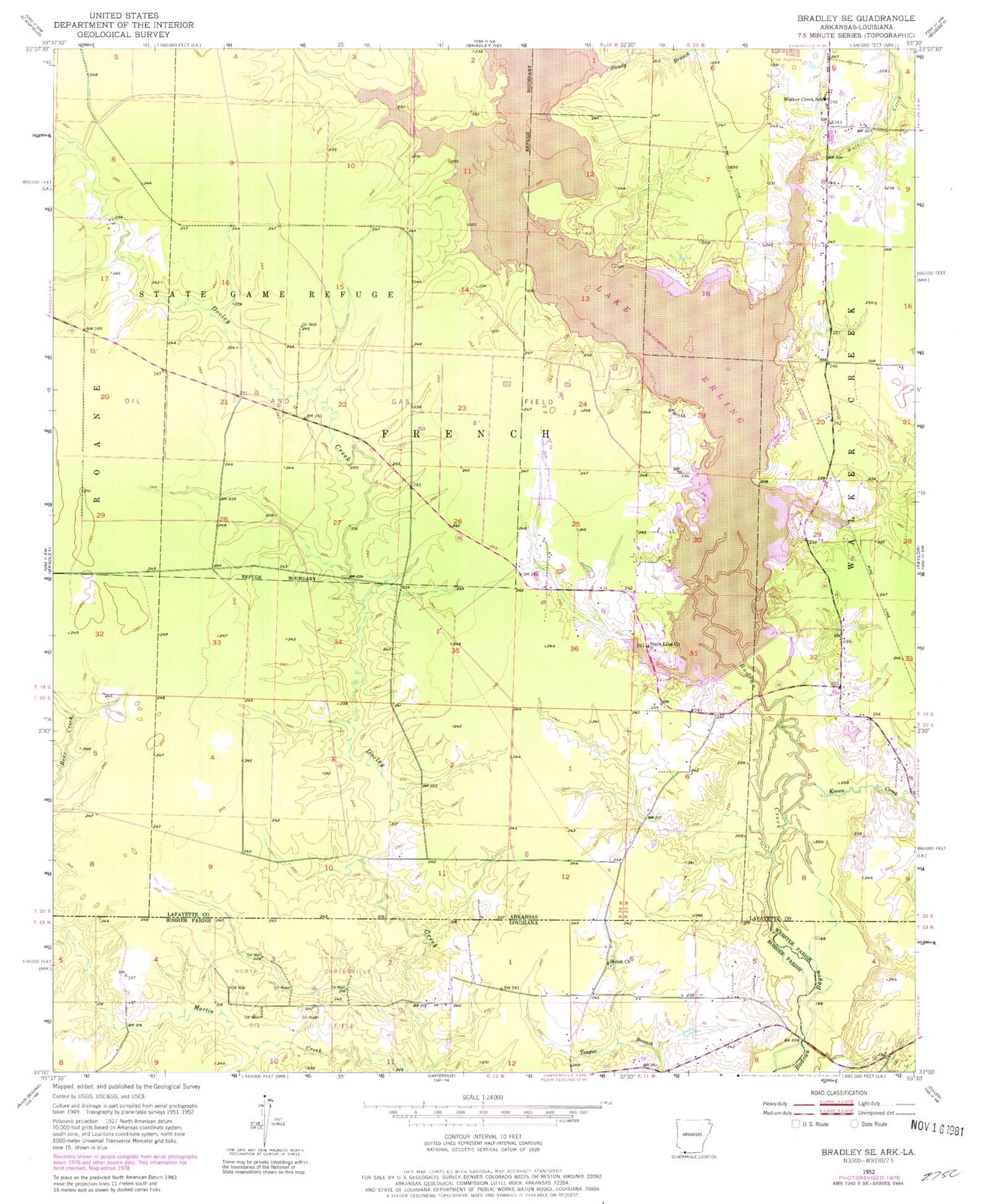
Classic USGS Bradley SE Arkansas 7.5'x7.5' Topo Map
Couldn't load pickup availability
Historical USGS topographic quad map of Bradley SE in the states of Arkansas, Louisiana. Typical map scale is 1:24,000, but may vary for certain years, if available. Print size: 24" x 27"
This quadrangle is in the following counties: Bossier, Lafayette, Webster.
The map contains contour lines, roads, rivers, towns, and lakes. Printed on high-quality waterproof paper with UV fade-resistant inks, and shipped rolled.
Contains the following named places: Bandy Branch, Keoun Creek, State Line Church, Walker Creek, Walker Creek School, Bradley Oil and Gas Field, Lafayette Wildlife Management Area, State Line, Walker Creek, Township of French, Lake Erling, Percy Cobb Dam, Lake Erling Volunteer Fire Department, Walker Creek Fire Department, North Carterville Oil Field, Shiloh Church


