MyTopo
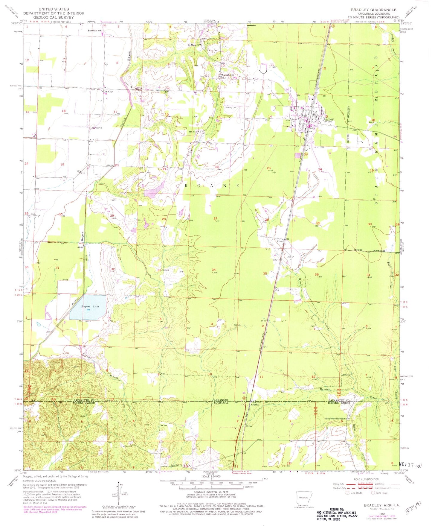
Classic USGS Bradley Arkansas 7.5'x7.5' Topo Map
Couldn't load pickup availability
Historical USGS topographic quad map of Bradley in the states of Arkansas, Louisiana. Map scale may vary for some years, but is generally around 1:24,000. Print size is approximately 24" x 27"
This quadrangle is in the following counties: Bossier, Lafayette.
The map contains contour lines, roads, rivers, towns, and lakes. Printed on high-quality waterproof paper with UV fade-resistant inks, and shipped rolled.
Contains the following named places: Arkana, Arkana Oil and Gas Field, Bear Creek, Boggs Creek, Bradley, Bradley Cemetery, Bradley Elementary School, Bradley Fire Station, Bradley High School, Bradley Police Department, Bradley Post Office, Bunkham School, Chalybeate Springs Church, City of Bradley, Cornish Branch, Enyart Lake, Gin City, Kizer, Mount Holly Church, Oak Hill Church, Saint Mary Cemetery, Saint Mary Church, Saint Paul Church, Township of Roane, Walnut Hill, Walnut Hill Cemetery, Wheeler Creek, ZIP Code: 71826