MyTopo
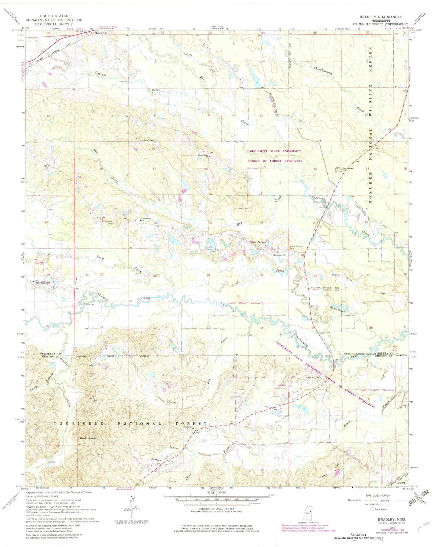
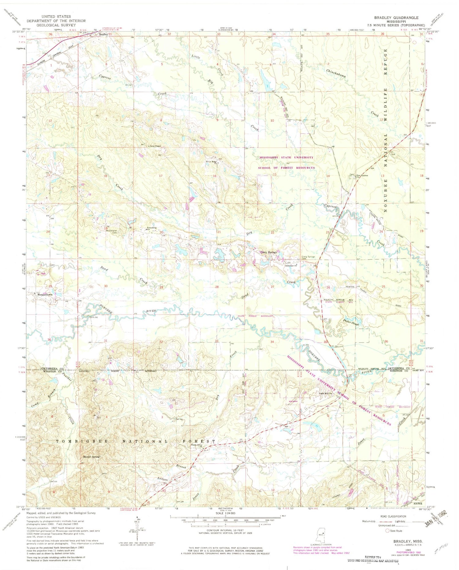
Classic USGS Bradley Mississippi 7.5'x7.5' Topo Map
Couldn't load pickup availability
Historical USGS topographic quad map of Bradley in the state of Mississippi. Map scale may vary for some years, but is generally around 1:24,000. Print size is approximately 24" x 27"
This quadrangle is in the following counties: Oktibbeha, Winston.
The map contains contour lines, roads, rivers, towns, and lakes. Printed on high-quality waterproof paper with UV fade-resistant inks, and shipped rolled.
Contains the following named places: Bells Mill, Big Creek, Bradley, Bradley Church of God, Camp Branch, Colcolough Cemetery, Coleman Lake Dam, Craig Springs, Craig Springs Cemetery, Dry Creek, Ennis Store, Friendship Baptist Church, Golden Horn Creek, Hamill Spring, Jackson Lake Dam, Jones Chapel Baptist Church, Lawson Branch, Little Creek, McClelland Cemetery, Mississippi State University School of Forest Resources, Morgan Chapel Baptist Church, Morgan Chapel Cemetery, Morgantown, Panther Creek, Parker Slough, Pugh Cemetery, Pughs Mill Church, Redeemer Church, Sand Creek, Shady Grove Church, Silver Ridge Church, Supervisor District 4, Sykes Lake Dam, Zion Cypress Methodist Church