MyTopo
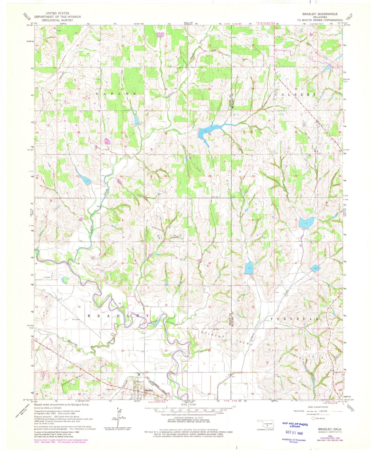
Classic USGS Bradley Oklahoma 7.5'x7.5' Topo Map
Couldn't load pickup availability
Historical USGS topographic quad map of Bradley in the state of Oklahoma. Map scale may vary for some years, but is generally around 1:24,000. Print size is approximately 24" x 27"
This quadrangle is in the following counties: Grady, McClain.
The map contains contour lines, roads, rivers, towns, and lakes. Printed on high-quality waterproof paper with UV fade-resistant inks, and shipped rolled.
Contains the following named places: Bear Hybarger Site 3a Dam, Bear Hybarger Site 3a Reservoir, Bradley, Bradley Post Office, Bradley Volunteer Fire Department, Colbert Creek Site 1 Dam, Colbert Creek Site 1 Reservoir, Colbert Creek Site 3 Dam, Colbert Creek Site 3 Reservoir, Criner Creek Site 101 Dam, Criner Creek Site 101 Reservoir, Laflin Cemetery, Laflin Creek, Northwest Bradley Oil Field, Oknoname 051029 Dam, Oknoname 051029 Reservoir, Roaring Creek, Roaring Creek Site 105 Dam, Roaring Creek Site 105 Reservoir, Town of Bradley, Township of Bradley, Township of Naples, Winter Creek Site 15 Dam, Winter Creek Site 15 Reservoir, Winter Creek Site 21 Dam, Winter Creek Site 21 Reservoir, ZIP Code: 73002