MyTopo
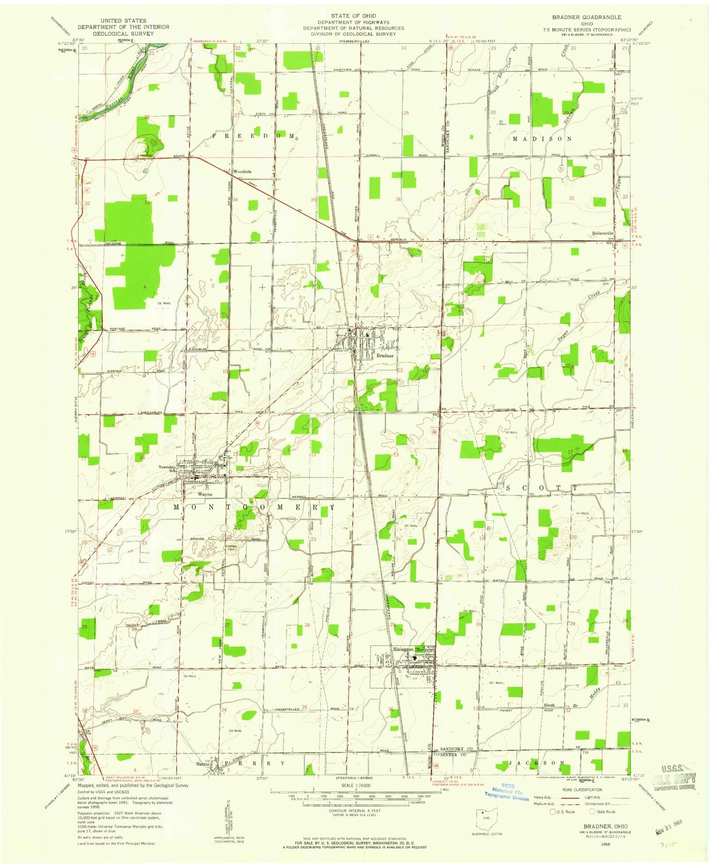
Classic USGS Bradner Ohio 7.5'x7.5' Topo Map
Couldn't load pickup availability
Historical USGS topographic quad map of Bradner in the state of Ohio. Map scale may vary for some years, but is generally around 1:24,000. Print size is approximately 24" x 27"
This quadrangle is in the following counties: Sandusky, Seneca, Wood.
The map contains contour lines, roads, rivers, towns, and lakes. Printed on high-quality waterproof paper with UV fade-resistant inks, and shipped rolled.
Contains the following named places: Bradner, Bradner Branch Wood County District Public Library, Bradner Cemetery, Bradner Fire Department, Bradner Police Department, Bradner Post Office, Bradner Preserve, Bradner Sewage Treatment Plant, Bradner Village Park, Bruningsville Station, Church Camp, City of Risingsun, Deininger Farms, Graham Cemetery, Haslinger Orchards, Hatton, Lakota Central Elementary School, Lakota West Elementary School, Magrum Farms, Montgomery Township House, Pember Farm Cemetery, Risingsun, Risingsun Community Park, Risingsun Police Department, Risingsun Post Office, Risingsun Volunteer Fire Department, Rollersville, Rollersville Post Office, Rupke Farms, Saint Jacobs Evangelical Lutheran Cemetery, Saint James Church, Saint Pauls United Methodist Church, Township of Montgomery, Twin Maples Trailer Court, Village of Bradner, Village of Risingsun, Village of Wayne, Wayne, Wayne Elementary School, Wayne Police Department, Wayne Post Office, Wayne Public Library, Wayne Volunteer Fire Department, Woodside, ZIP Codes: 43406, 43457