MyTopo
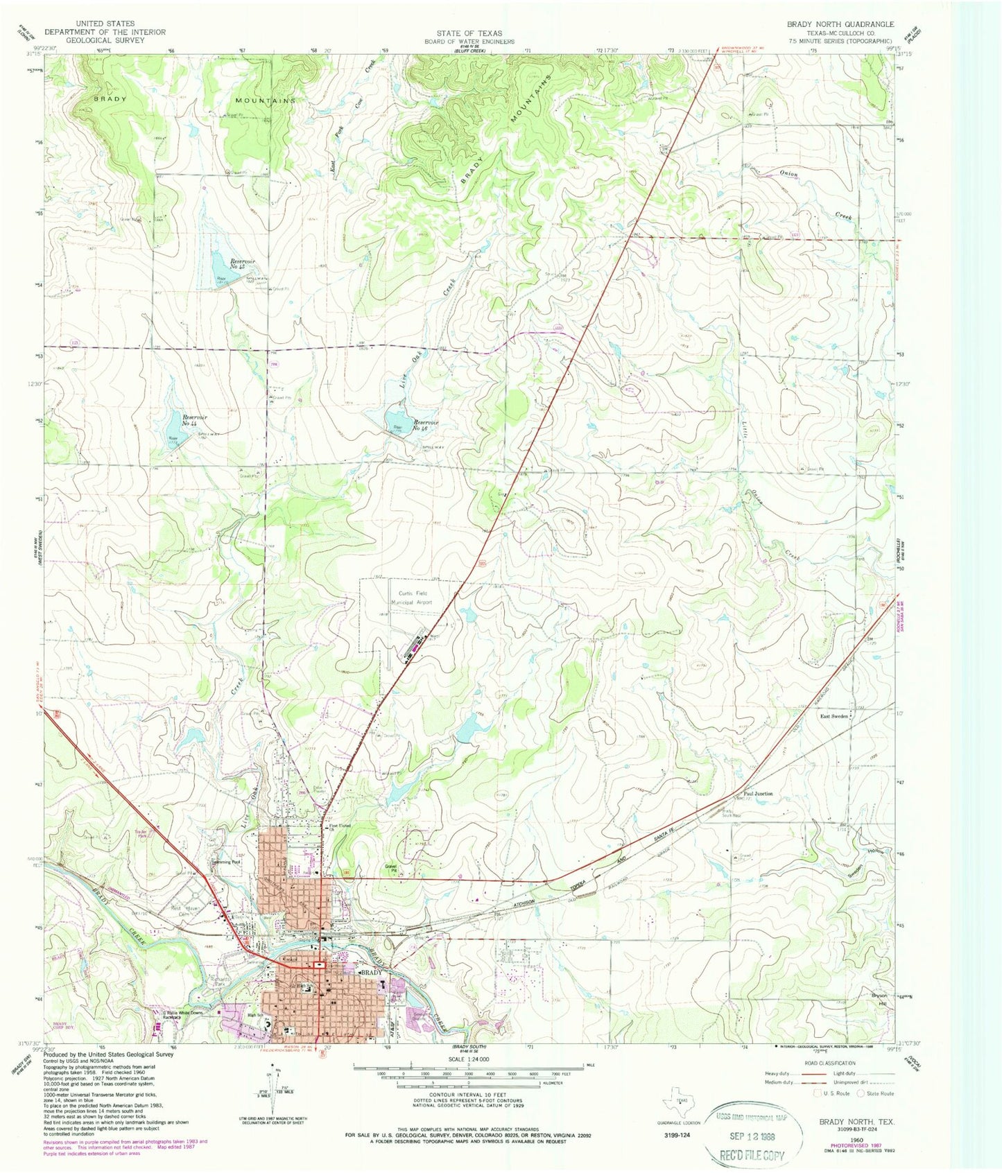
Classic USGS Brady North Texas 7.5'x7.5' Topo Map
Couldn't load pickup availability
Historical USGS topographic quad map of Brady North in the state of Texas. Map scale may vary for some years, but is generally around 1:24,000. Print size is approximately 24" x 27"
This quadrangle is in the following counties: McCulloch.
The map contains contour lines, roads, rivers, towns, and lakes. Printed on high-quality waterproof paper with UV fade-resistant inks, and shipped rolled.
Contains the following named places: Bible Baptist Church, Brady, Brady - McCulloch County Emergency Medical Service, Brady City Hall, Brady Fire Department, Brady High School, Brady Junior High School, Brady Police Department, Brady Post Office, Bulldog Stadium, Central Baptist Church, Curtis Field, East Sweden, East Sweden Cemetery, First United Church, First United Methodist Church of Brady, Gene Naumann Dam 1, Gene Naumann Dam 2, Gene Naumann Lake 1, Gene Naumann Lake 2, Heart of Texas Historical Museum, Jubilee Racetrack, KNEL-AM (Brady), Lake Brady Park, Leatherwood Memorial Chapel Church, Little Onion Creek, Live Oak Cemetery, Live Oak Creek, McCulloch County, McCulloch County Constable's Office Precinct 1, McCulloch County Law Enforcement Center, McCulloch County Sheriff's Office, North Ward Primary School, Old McCulloch County Jail, Parker Dam, Parker Lake, Paul Junction, Post Oak Creek, Reservoir Number Fortyfive, Reservoir Number Fortyfour, Reservoir Number Fortysix, Rest Haven Cemetery, Richards Park, Richards Park Dam, Richards Park Reservoir, Saint James Baptist Church, Saint Patricks Church, Saint Pauls Episcopal Church, Soil Conservation Service Site 44 Dam, Soil Conservation Service Site 45 Dam, Soil Conservation Service Site 46 Dam, Soldiers Water Hole Spring


