MyTopo
Classic USGS Bragg City Missouri 7.5'x7.5' Topo Map
Couldn't load pickup availability
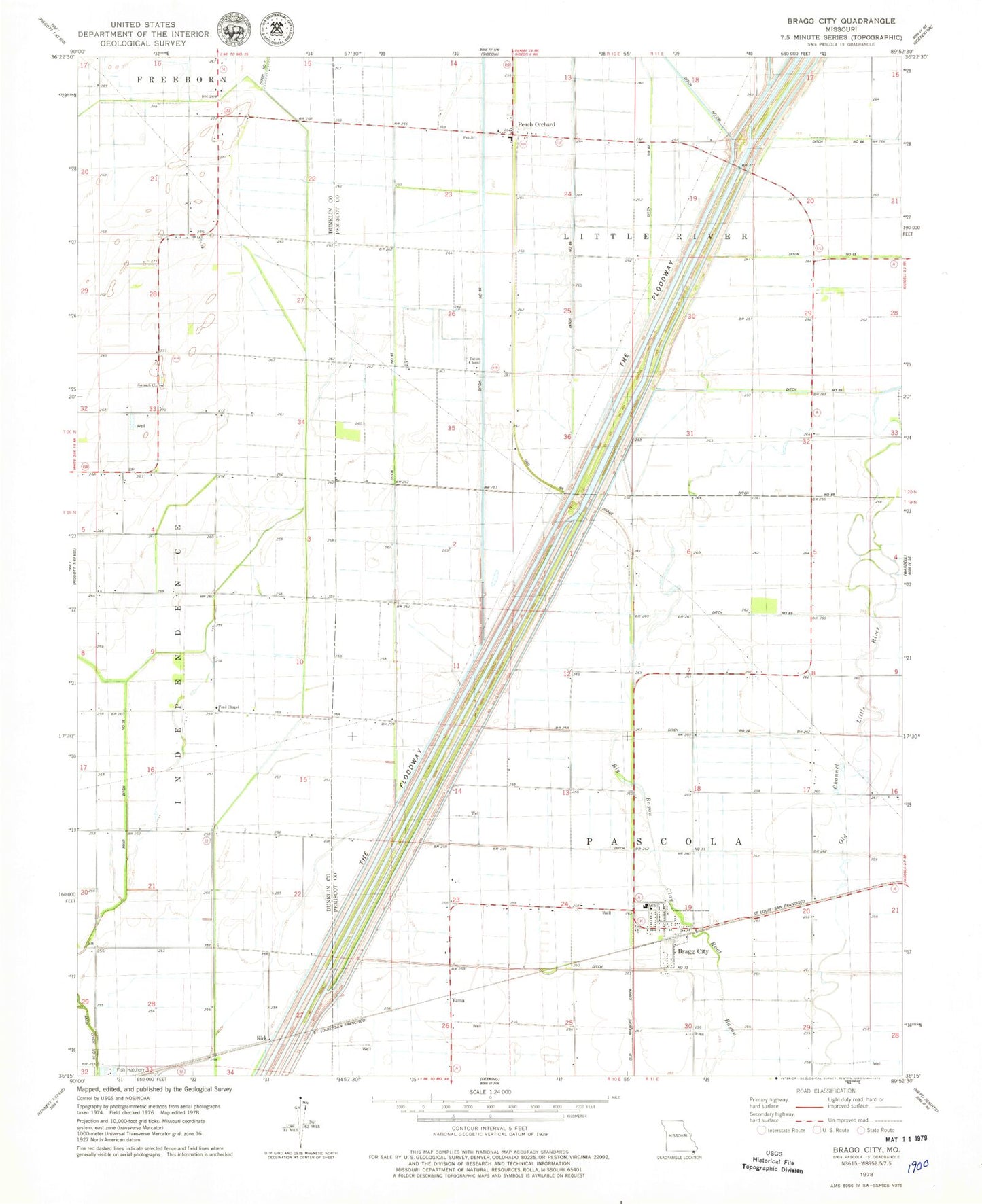
Historical USGS topographic quad map of Bragg City in the state of Missouri. Map scale may vary for some years, but is generally around 1:24,000. Print size is approximately 24" x 27"
This quadrangle is in the following counties: Dunklin, Pemiscot.
The map contains contour lines, roads, rivers, towns, and lakes. Printed on high-quality waterproof paper with UV fade-resistant inks, and shipped rolled.
Contains the following named places: Big Bayou, Bragg City, Bragg City Post Office, Bragg City Volunteer Fire Department, Ditch Number 251, Ditch Number 65, Ditch Number 71, Ditch Number 72, Ditch Number 82, Ditch Number 83, Ditch Number 84, Ditch Number 85, Ford Chapel, Gidson, Gregory School, Grey Horse Lake, Kirk, Main Ditch Number 36, Nelson School, Nilo School, North Island School, Ogden, Peach Orchard, Penhook School, Richland School, Simpson School, Sumach, Sumach Cemetery, Sumach Church, Sumach School, Sumack Branch School, Tatum Chapel, Tatum School, The Floodway, Town of Bragg City, Township of Pascola, Yama, Yama School, ZIP Code: 63827