MyTopo
Classic USGS Braggs Oklahoma 7.5'x7.5' Topo Map
Couldn't load pickup availability
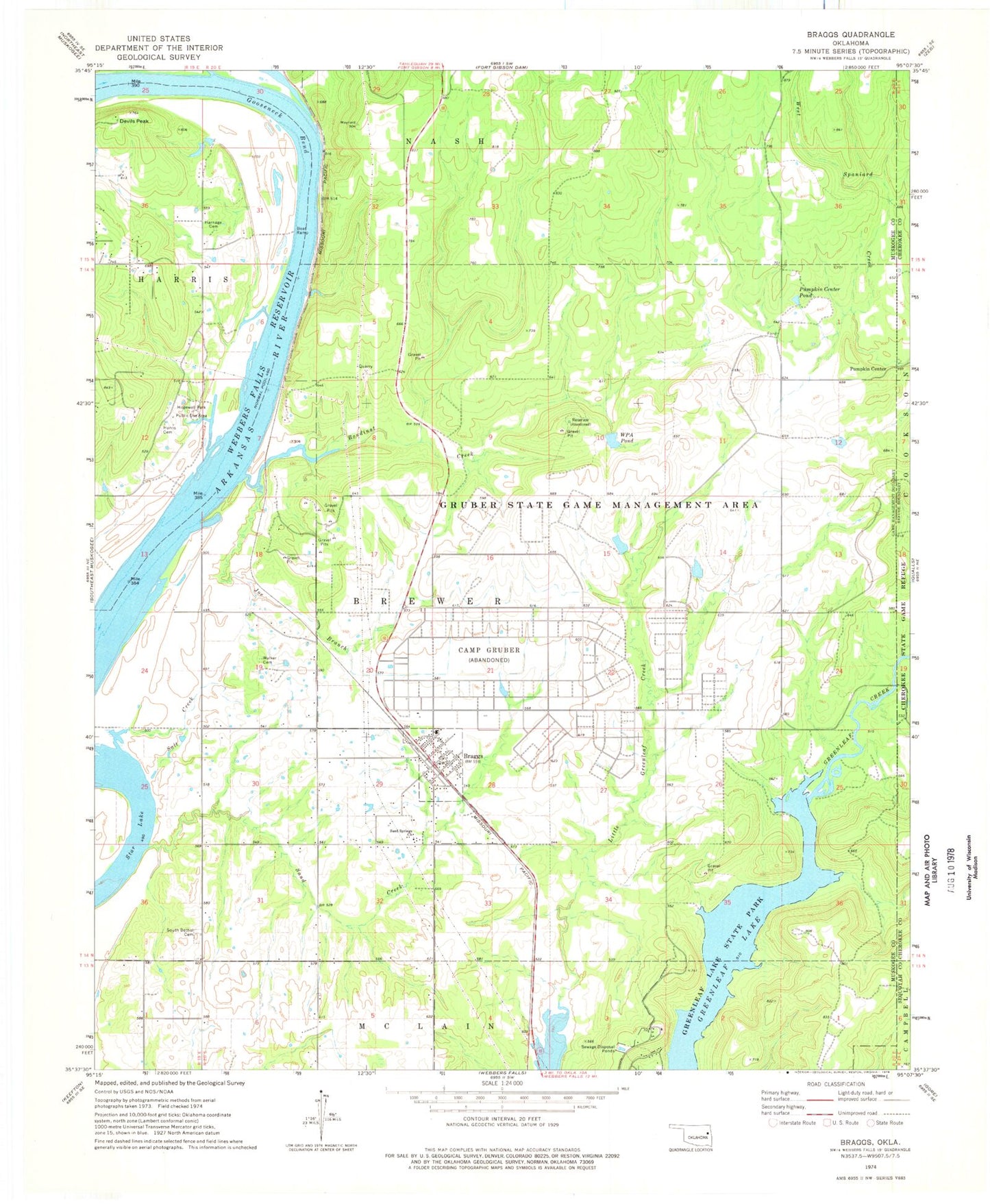
Historical USGS topographic quad map of Braggs in the state of Oklahoma. Typical map scale is 1:24,000, but may vary for certain years, if available. Print size: 24" x 27"
This quadrangle is in the following counties: Cherokee, Muskogee, Sequoyah.
The map contains contour lines, roads, rivers, towns, and lakes. Printed on high-quality waterproof paper with UV fade-resistant inks, and shipped rolled.
Contains the following named places: Bayou Manard, Bondinot Creek, Braggs, Camp Gruber, Devils Peak, Gooseneck Bend, Greenleaf Lake, Gruber State Game Management Area, Harnage Cemetery, Harris Cemetery, Hopewell Park Public Use Area, Joe Branch, Pumpkin Center Pond, Salt Creek, Sand Creek, Sand Springs Church, South Bethel Cemetery, Star Lake, Walker Cemetery, Pumpkin Center, Camp Gruber Heliport, Little Deep Fork Creek Site 57b Dam, Little Deep Fork Creek Site 57b Reservoir, Oknoname 101018 Dam, Oknoname 101018 Reservoir, Oknoname 101019 Dam, Oknoname 101019 Reservoir, Pumpkin Center Pond Dam, Oknoname 101020 Dam, Oknoname 101020 Reservoir, WPA Pond Dam, WPA Pond, Oknoname 101021 Dam, Oknoname 101021 Reservoir, Braggs High School, Braggs Public School, Braggs Post Office, Township of Brewer, River Bottom Census Designated Place, Sand Hill Census Designated Place, Town of Braggs, Camp Gruber, River Bottom, Sand Hill, Braggs Volunteer Fire Department, Braggs Police Department