MyTopo
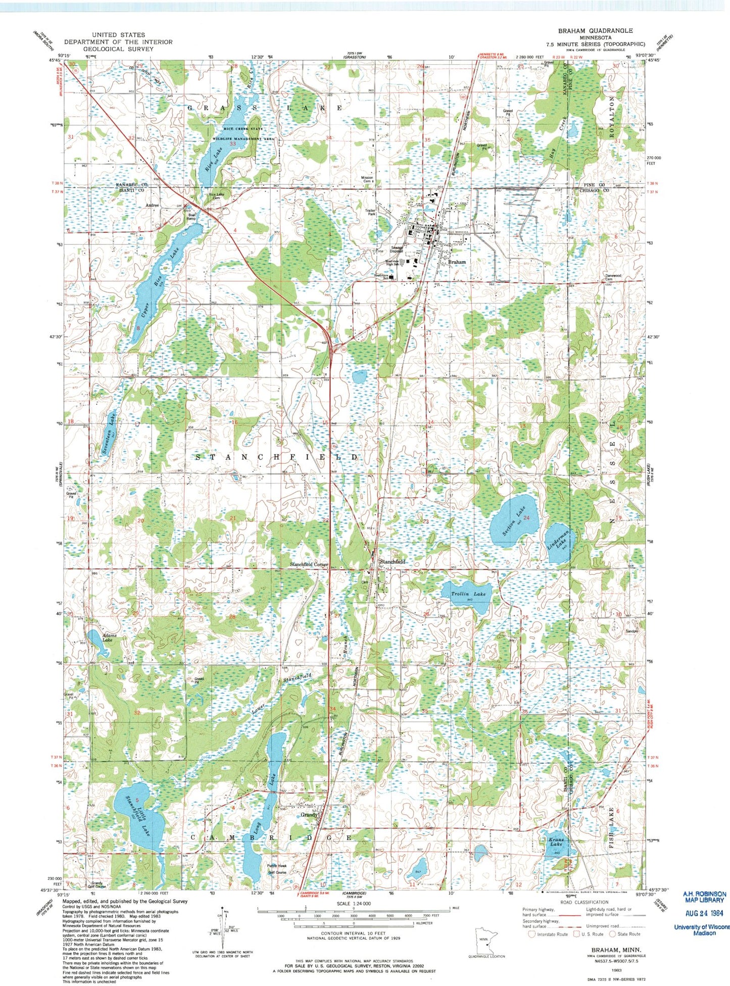
Classic USGS Braham Minnesota 7.5'x7.5' Topo Map
Couldn't load pickup availability
Historical USGS topographic quad map of Braham in the state of Minnesota. Map scale may vary for some years, but is generally around 1:24,000. Print size is approximately 24" x 27"
This quadrangle is in the following counties: Chisago, Isanti, Kanabec, Pine.
The map contains contour lines, roads, rivers, towns, and lakes. Printed on high-quality waterproof paper with UV fade-resistant inks, and shipped rolled.
Contains the following named places: Adams Lake, Adventist Cemetery, Andree, Andree Post Office, Braham, Braham City Hall, Braham Evangelical Covenant Church, Braham Evangelical Lutheran Church, Braham Mobile Home Park, Braham Police Department, Braham Post Office, Braham Volunteer Fire Department, City of Braham, Danewood Cemetery, Elm Park Cemetery, Freedom Park, Grandy, Grandy Church, Grandy Golf Course, Grandy Pines Golf Course, Grandy Post Office, Grandy School, Hidden Park, Krans Lake, Linderman Lake, Little Stanchfield Lake, Long Lake, Lower Stanchfield Branch, Mission Cemetery, Purple Hawk Golf Course, Rice Creek State Wildlife Management Area, Rice Lake, Rice Lake Cemetery, Saint Peter and Paul Catholic Church, Saint Stephen's Lutheran Church, Section Lake, Seventeen Lake, Southview School, Stanchfield, Stanchfield Baptist Cemetery, Stanchfield Baptist Church, Stanchfield Census Designated Place, Stanchfield Corner, Stanchfield Post Office, Township of Stanchfield, Trollin Lake, Upper Rice Lake, Westview High School, ZIP Codes: 55006, 55029, 55080