
MyTopo
Classic USGS Branchborough Florida 7.5'x7.5' Topo Map
Couldn't load pickup availability
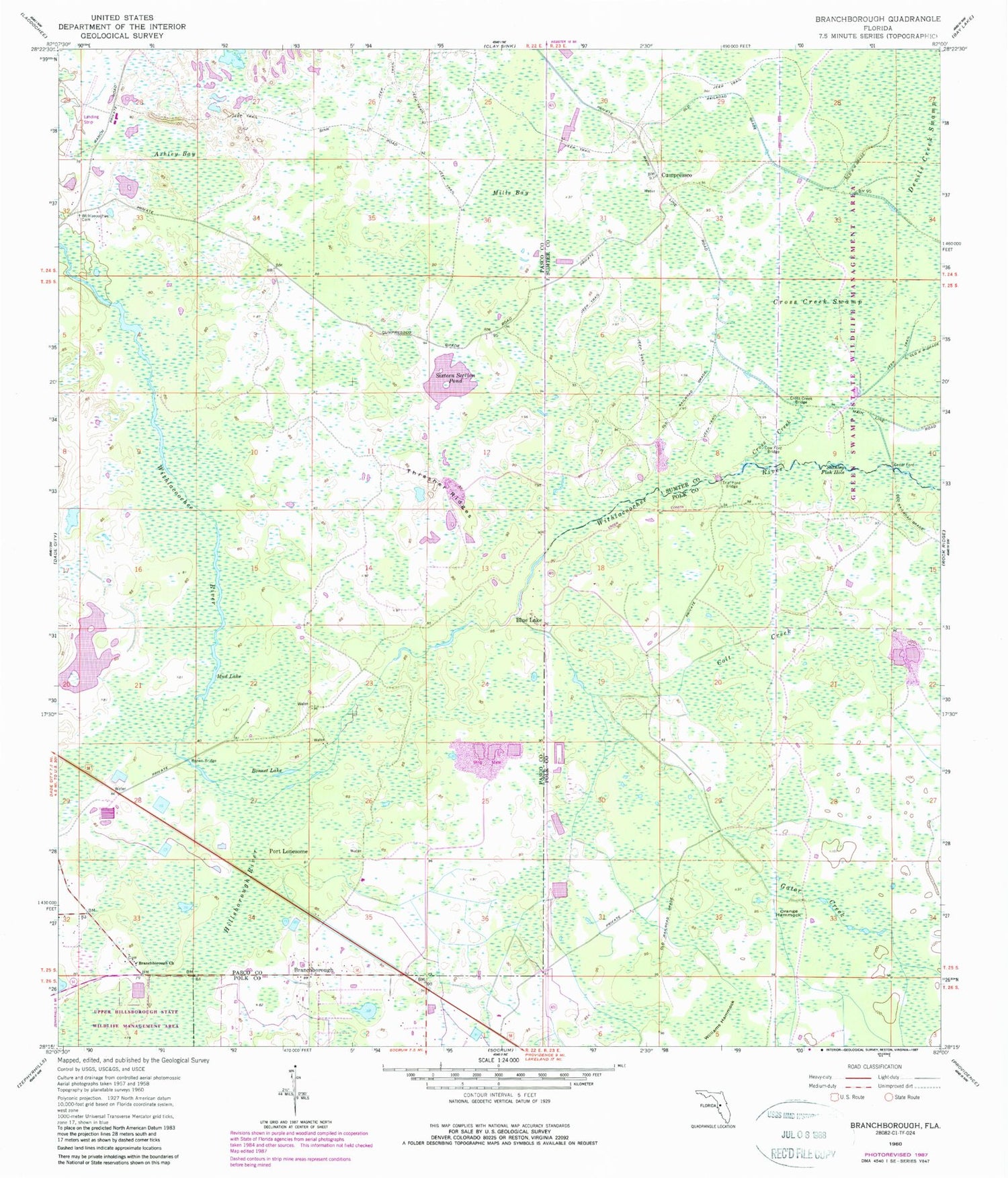
Historical USGS topographic quad map of Branchborough in the state of Florida. Typical map scale is 1:24,000, but may vary for certain years, if available. Print size: 24" x 27"
This quadrangle is in the following counties: Pasco, Polk, Sumter.
The map contains contour lines, roads, rivers, towns, and lakes. Printed on high-quality waterproof paper with UV fade-resistant inks, and shipped rolled.
Contains the following named places: Ashley Bay, Bonnet Lake, Branchborough Church, Brown Bridge, Colt Creek, Cow Ford Bridge, Cross Creek, Cross Creek Bridge, Cross Creek Swamp, Devils Creek Swamp, Gator Creek, Hillsborough River, Mills Bay, Mud Lake, Orange Hammock, Sixteen Section Pond, Stanley Fish Hole, Thrasher Ridges, Trial Ford Bridge, Williams Hammock, Withlacoochee Cemetery, Branchborough, Cumpressco, Blue Lake, Port Lonesome, Wildwood Shopping Center, Withlacoochee Cemetery


