MyTopo
Classic USGS Branchville North South Carolina 7.5'x7.5' Topo Map
Couldn't load pickup availability
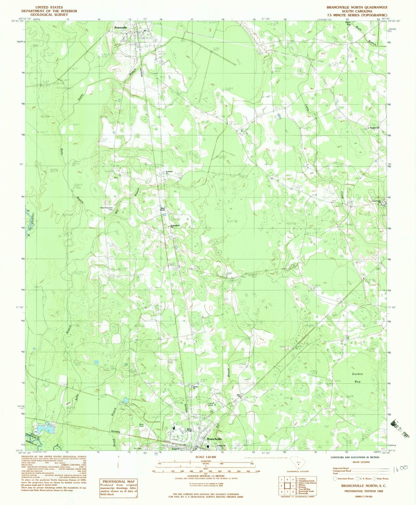
Historical USGS topographic quad map of Branchville North in the state of South Carolina. Map scale may vary for some years, but is generally around 1:24,000. Print size is approximately 24" x 27"
This quadrangle is in the following counties: Bamberg, Orangeburg.
The map contains contour lines, roads, rivers, towns, and lakes. Printed on high-quality waterproof paper with UV fade-resistant inks, and shipped rolled.
Contains the following named places: Bethel Church, Branchville, Branchville Baptist Church, Branchville Christian Church, Branchville Division, Branchville Elementary School, Branchville Post Office, Branchville United Methodist Church, Byrd Cemetery, Camp Edisto, Canaan Baptist Church Cemetery, Canaan Church, Cattle Creek Campground, Cattle Creek Cemetery, Cattle Creek Church, Cattle Creek Fire Department, Collier School, Duke School, Durbin Bay, East Branchville School, Mays Chapel, Mill Branch, Mill Branch School, Ott Cemetery, Peter Bowman Cemetery, Prospect Church, Prospect School, Robinsons Bay, Rowesville, Rowesville Fire Department, Rowesville Post Office, Rowesville School, Saint James Church, Saint James School, Saint Lukes Church, Saint Lukes School, Saint Stephens Church, Sardis Cemetery, Sardis Church, Sardis School, Sixty Six, Staley Branch, Summers Cemetery, Town of Branchville, Town of Rowesville, Wilson Chapel, ZIP Code: 29133