MyTopo
Classic USGS Branchville South South Carolina 7.5'x7.5' Topo Map
Couldn't load pickup availability
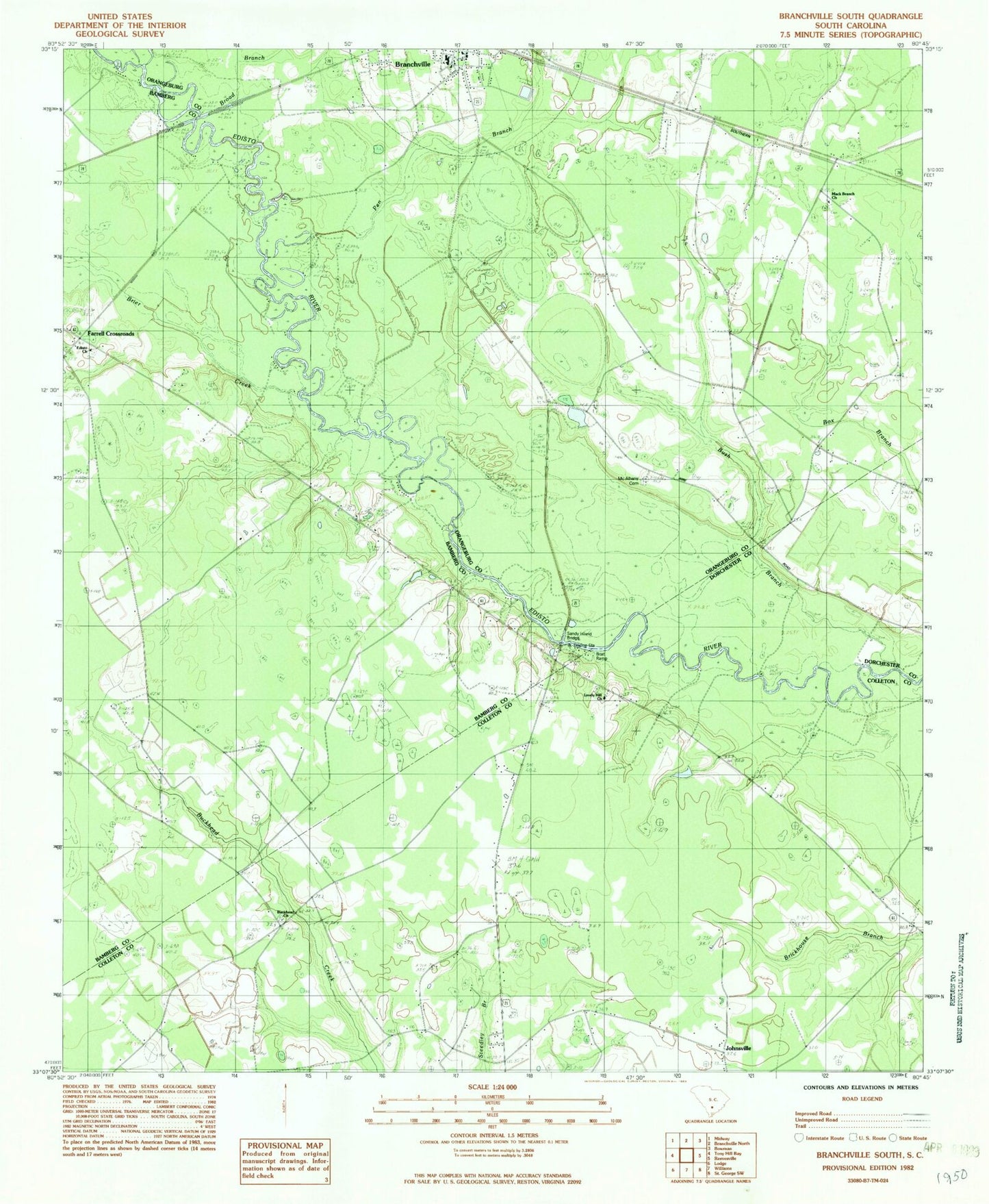
Historical USGS topographic quad map of Branchville South in the state of South Carolina. Typical map scale is 1:24,000, but may vary for certain years, if available. Print size: 24" x 27"
This quadrangle is in the following counties: Bamberg, Colleton, Dorchester, Orangeburg.
The map contains contour lines, roads, rivers, towns, and lakes. Printed on high-quality waterproof paper with UV fade-resistant inks, and shipped rolled.
Contains the following named places: Betty Branch, Fitts Bridge, Hopewell School, McIihenny School, Pen Branch, Piney Grove School, Sandy Run Church, Sandy Run School, Edisto Baptist Church, Whetstone Crossroads, Dukes Pond Dam D-3779, Buckhead Cemetery, Buckhead Church, Johnsville, Lovely Hill Church, May Cemetery, May - Stokes - Raysor Cemetery, Simmons Johnsville School (historical), Spell - Risher Cemetery, Bush Branch, Branchville High School, Fifty Eight (historical), Mack Branch Baptist Church, Mack Branch School (historical), McAlbany Church, McAlhany Cemetery, Brier Creek, Buckhead School (historical), Sandy Island Bridge, Farrell Crossroads, Branchville Police Department, Branchville Rescue Squad, Branchville Fire Department, Edisto Fire Department Station 9, Branchville Fire Department McAlhany Station, Lockett Elementary School, McBranch Baptist Church