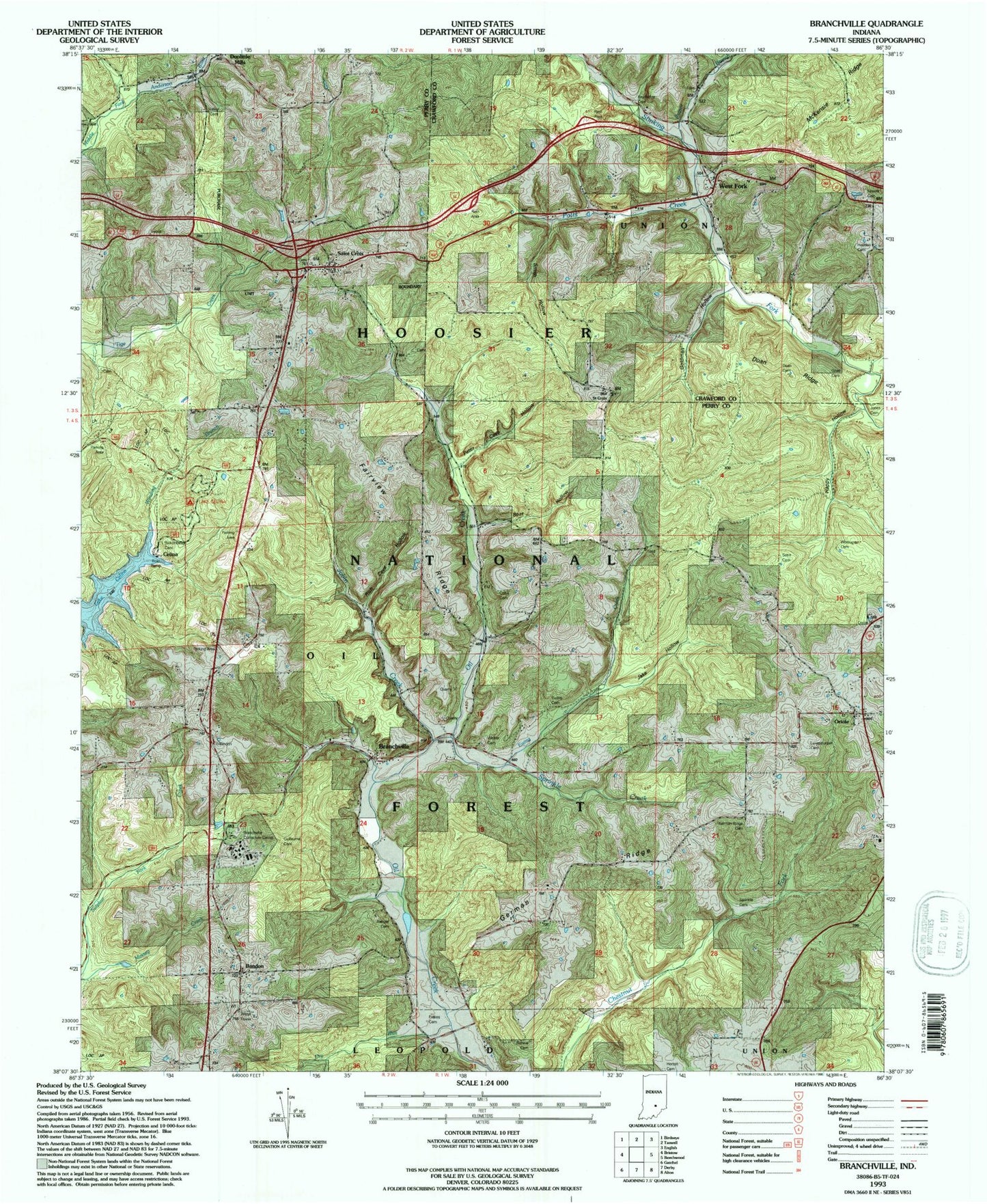
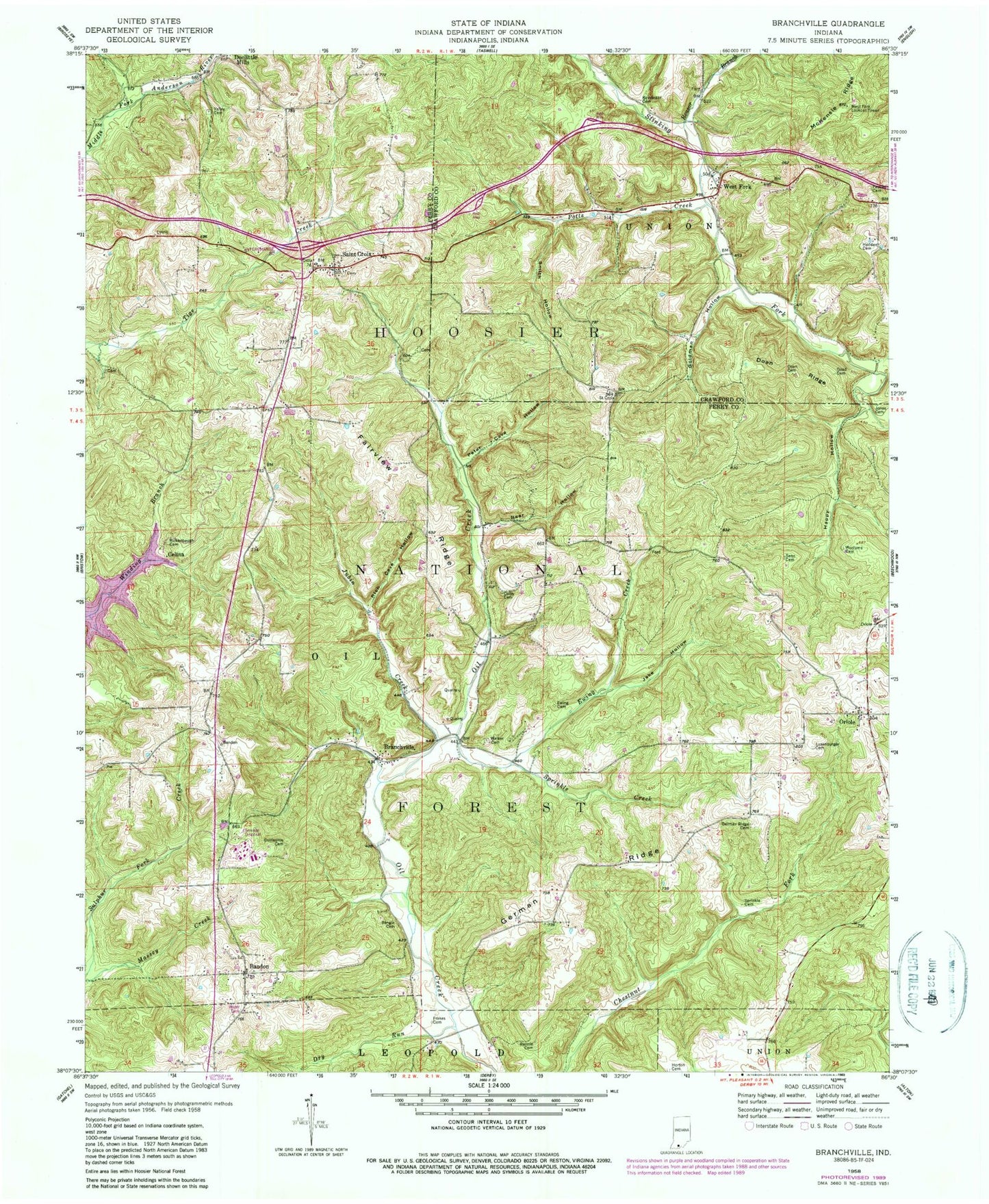
MyTopo
Classic USGS Branchville Indiana 7.5'x7.5' Topo Map
Couldn't load pickup availability
Historical USGS topographic quad map of Branchville in the state of Indiana. Map scale is 1:24000. Print size is approximately 24" x 27"
This quadrangle is in the following counties: Crawford, Perry.
The map contains contour lines, roads, rivers, towns, and lakes. Printed on high-quality waterproof paper with UV fade-resistant inks, and shipped rolled.
Contains the following named places: Bandon, Bangle Cemetery, Bear Hollow, Branchville, Branchville Correctional Facility, Branchville Correctional Facility Fire Department, Branchville Walker Cemetery, Celina, Colby Cemetery, Doan Cemetery, Doan Ridge, Dry Run, Ewing Cemetery, Ewing Creek, Fairview Ridge, Fessler Cemetery, Frakes Cemetery, German Ridge, German Ridge Cemetery, Goad Cemetery, Goldman Hollow, Guillaume Cemetery, Happy Hollow, Hedden Cemetery, Horton Cemetery, Jake Hollow, Jones Cemetery, Jubin Creek, Keysacker Cemetery, Lake Celina, Lake Celina Recreation Site, Luxemburger Cemetery, McKensie Ridge, Oriole, Peter Cave Hollow, Potts Creek, Reasor Branch, Rennie Cemetery, Rich Cave Hollow, Rickenbaugh Cemetery, Saint Croix, Senn Cemetery, Smith Hollow, Sprinkle Cemetery, Sprinkle Creek, Township of Oil, Valley Cemetery, West Fork, West Fork Cemetery, West Fork Lookout Tower, Woolums Cemetery