
MyTopo
Classic USGS Brandon Minnesota 7.5'x7.5' Topo Map
Couldn't load pickup availability
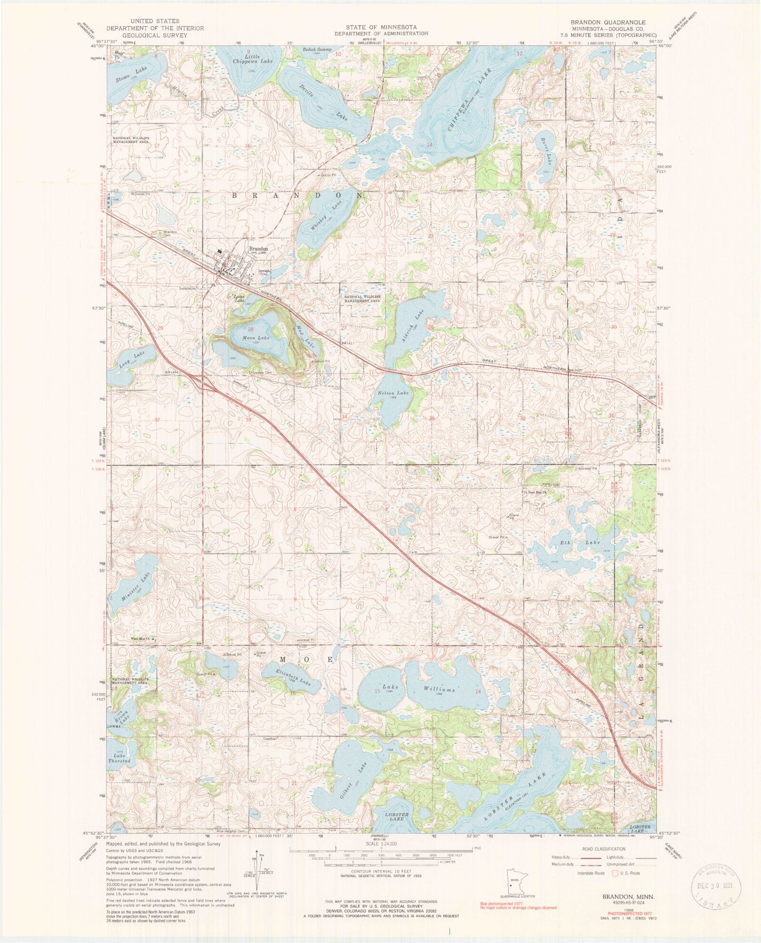
Historical USGS topographic quad map of Brandon in the state of Minnesota. Map scale may vary for some years, but is generally around 1:24,000. Print size is approximately 24" x 27"
This quadrangle is in the following counties: Douglas.
The map contains contour lines, roads, rivers, towns, and lakes. Printed on high-quality waterproof paper with UV fade-resistant inks, and shipped rolled.
Contains the following named places: Acorn Acres Resort and Campground, Aldrich Lake, Angen Field, Brandon, Brandon Auditorium, Brandon Cemetery, Brandon Fire Department, Brandon High School, Brandon Police Department, Brandon Post Office, Brown Lake, Burrs Lake, Chippewa Cemetery, Chippewa Lake, City of Brandon, Devils Lake, East Moe Church, East Moe Lutheran Churc Cemetery, Elizabeth Lake, Elk Lake, Gilbert Lake, Golden Pond, Grace Lutheran Church, Hoplin Creek, Lake Williams, Little Chippewa Lake, Lobster Lake, Loves Lake, Martin Lake, Minister Lake, Moe Heights Cemetery, Moon Lake, Nelson Lake, Oak Park Campground, Saint Ann's Church, Township of Brandon, Township of Moe, West Moe Cemetery, West Moe Church, Whiskey Lake, Wolf Creek, ZIP Codes: 56315, 56332


