MyTopo
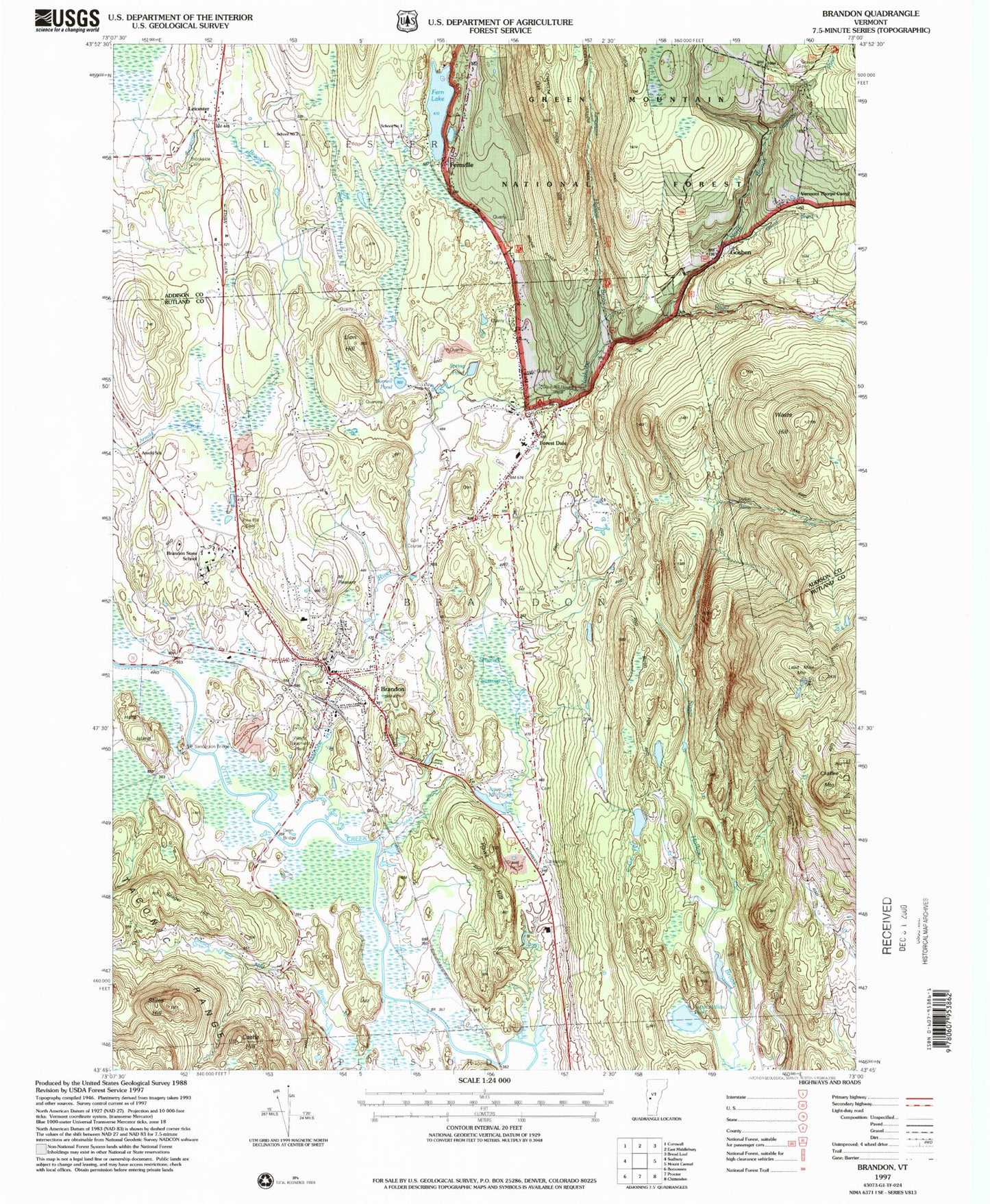
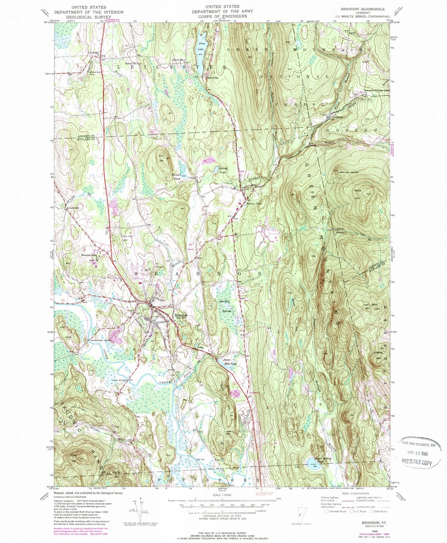
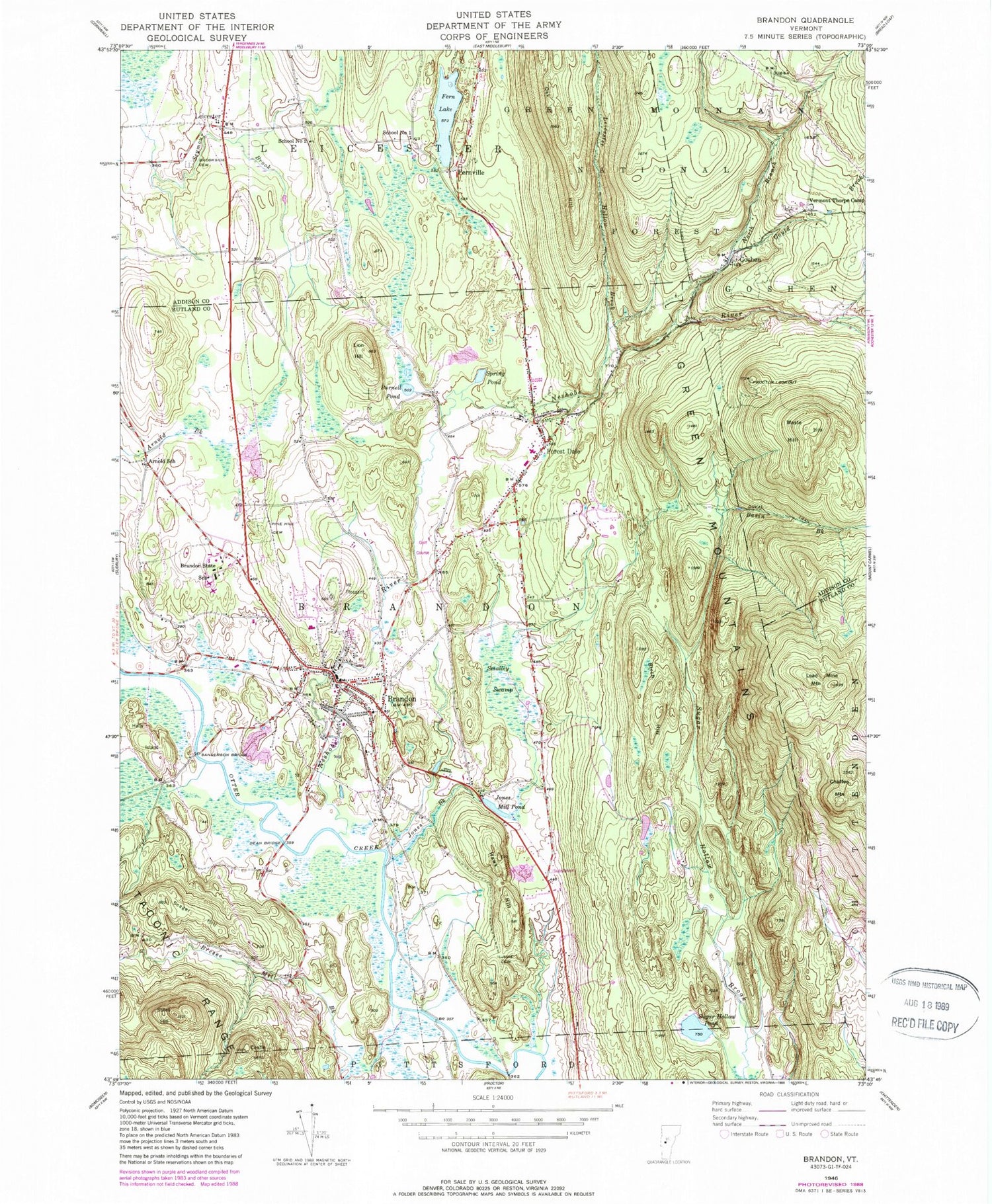
Classic USGS Brandon Vermont 7.5'x7.5' Topo Map
Couldn't load pickup availability
Historical USGS topographic quad map of Brandon in the state of Vermont. Map scale may vary for some years, but is generally around 1:24,000. Print size is approximately 24" x 27"
This quadrangle is in the following counties: Addison, Rutland.
The map contains contour lines, roads, rivers, towns, and lakes. Printed on high-quality waterproof paper with UV fade-resistant inks, and shipped rolled.
Contains the following named places: Arnold School, Basin Brook, Birch Hill, Bradbury State Park, Brandon, Brandon Area Rescue Squad, Brandon Baptist Church, Brandon Census Designated Place, Brandon Fire District 1, Brandon Free Public Library, Brandon Municipal Forest, Brandon Police Department, Brandon Post Office, Brandon State School, Brandon Town Cemetery, Brandon Town Hall, Brandon Village Historic District, Bresee Mill Brook, Brookside Cemetery, Burnell Pond, Castle Hill, Chaffee Mountain, Chandler Ridge Trail, Churchhill House Ski Area, Dean Bridge, Duval Trail, Fern Lake, Fernville, Forest Dale, Forest Dale Post Office, Forestdale Cemetery, Forestdale Iron Furnace, Gilbert - Cook - Goodrow Cemetery, Goshen, Goshen Cemetery, Goshen Municipal Forest, Gould Brook, Halls Island, Hawk Hill, Jones Brook, Jones Mill Pond, June Cemetery, Lead Mine Mountain, Leicester, Leicester Central School, Leicester Hollow Brook, Leicester Hollow Trail, Leicester Meeting House, Leicester Town Hall, Lion Hill, Maple Street Cemetery, Mount Pleasant, Neshobe Golf Course, Neshobe River, Neshobe School, North Branch Neshobe River, Oak Hill, Otter Valley Union High School, Pine Hill Cemetery, Proctor Lookout, Rutland Northeast Supervisory Union, Saint Marys Cemetery, Sanderson Bridge, School Number 1, School Number 2, Seager Hill, Smalley Swamp, Smoke Rise Family Campground, Spring Pond, Stephen A Douglas Birthplace, Stiles Hill, Sugar Hollow, Sugar Hollow Cemetery, Sugar Hollow Pond, Town of Brandon, Town of Goshen, Town of Leicester, Towtaid, Vermont Thorpe Camp, Waste Hill, ZIP Code: 05733