MyTopo
Classic USGS Brandonville West Virginia 7.5'x7.5' Topo Map
Couldn't load pickup availability
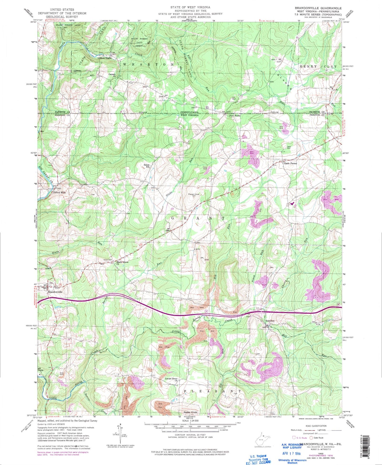
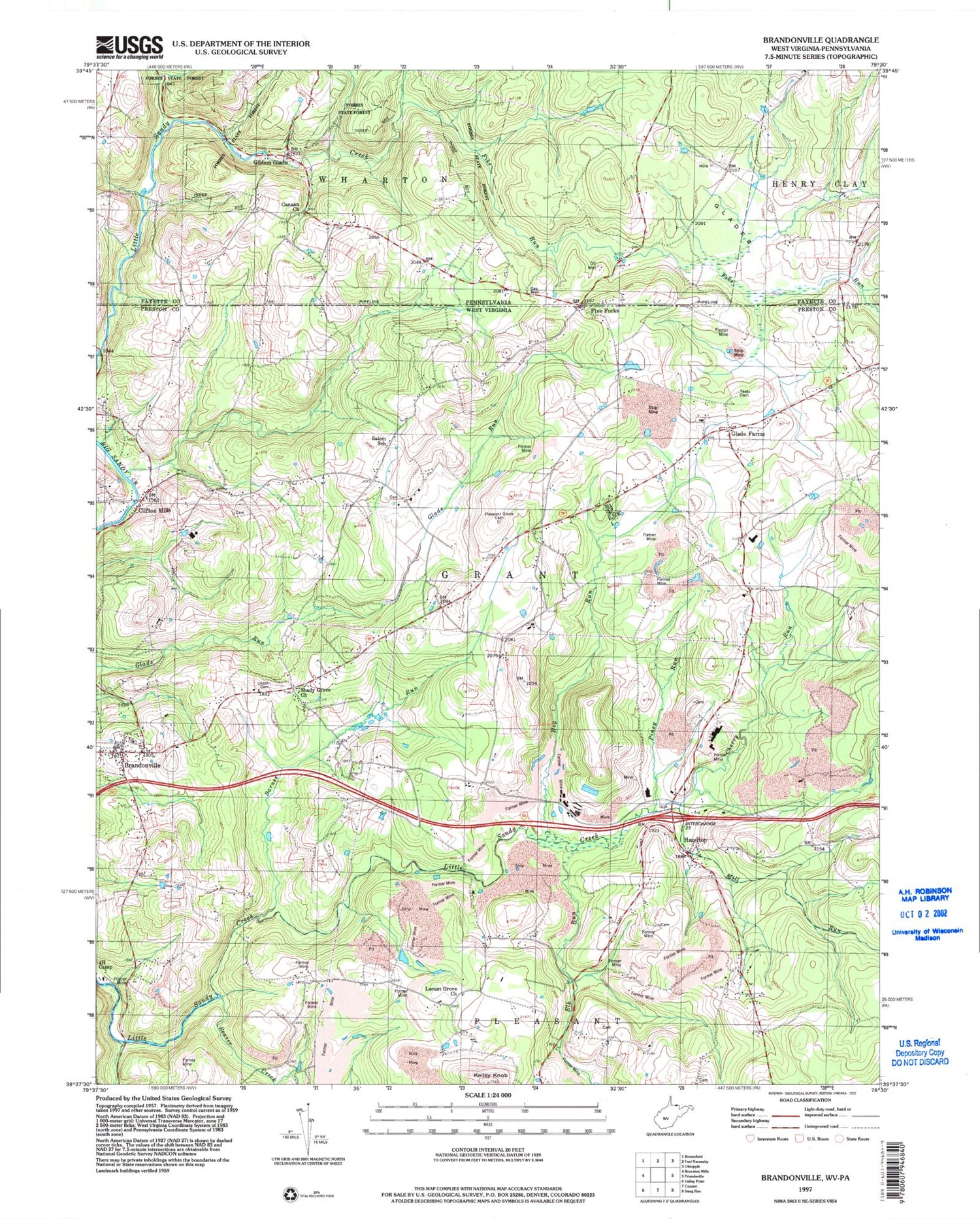
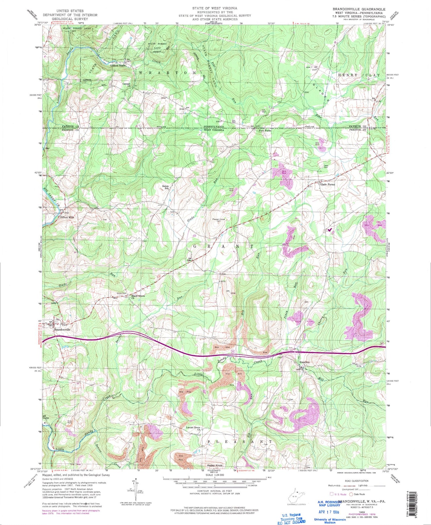
Historical USGS topographic quad map of Brandonville in the states of West Virginia, Pennsylvania. Map scale may vary for some years, but is generally around 1:24,000. Print size is approximately 24" x 27"
This quadrangle is in the following counties: Fayette, Preston.
The map contains contour lines, roads, rivers, towns, and lakes. Printed on high-quality waterproof paper with UV fade-resistant inks, and shipped rolled.
Contains the following named places: Barnes Run, Beaver Creek, Brandonville, Brandonville United Methodist Church, Bruceton Mills Wildlife Management Area, Canaan Church, Canaan School, Cherry Run, Clifton Mills, Clifton Mills Union Church, Cuppert School, Elk Run, Federal Correctional Institution Hazelton, Fike Run, Five Forks, Gibbon Glade, Gibbon Glade Post Office, Glade Farms, Glade Farms United Methodist Church, Glades, Glover School, Guthrie School, Hazelton, Hazelton Post Office, Hazelton Union Church, Hog Run, Kelley Knob, Locust Grove School House, Locust Grove United Methodist Church, McCracken School, Mill Run, Old Brick Church, Piney Run, Pleasant Grove Cemetery, Saint Johns Evangelical Lutheran Church, Salem, Salem Church of the Brethren, Salem School, Shady Grove Church, Shafer School, Spurgeon School, Teets Cemetery, Union Cemetery, Wrights, Zar, ZIP Code: 15440