MyTopo
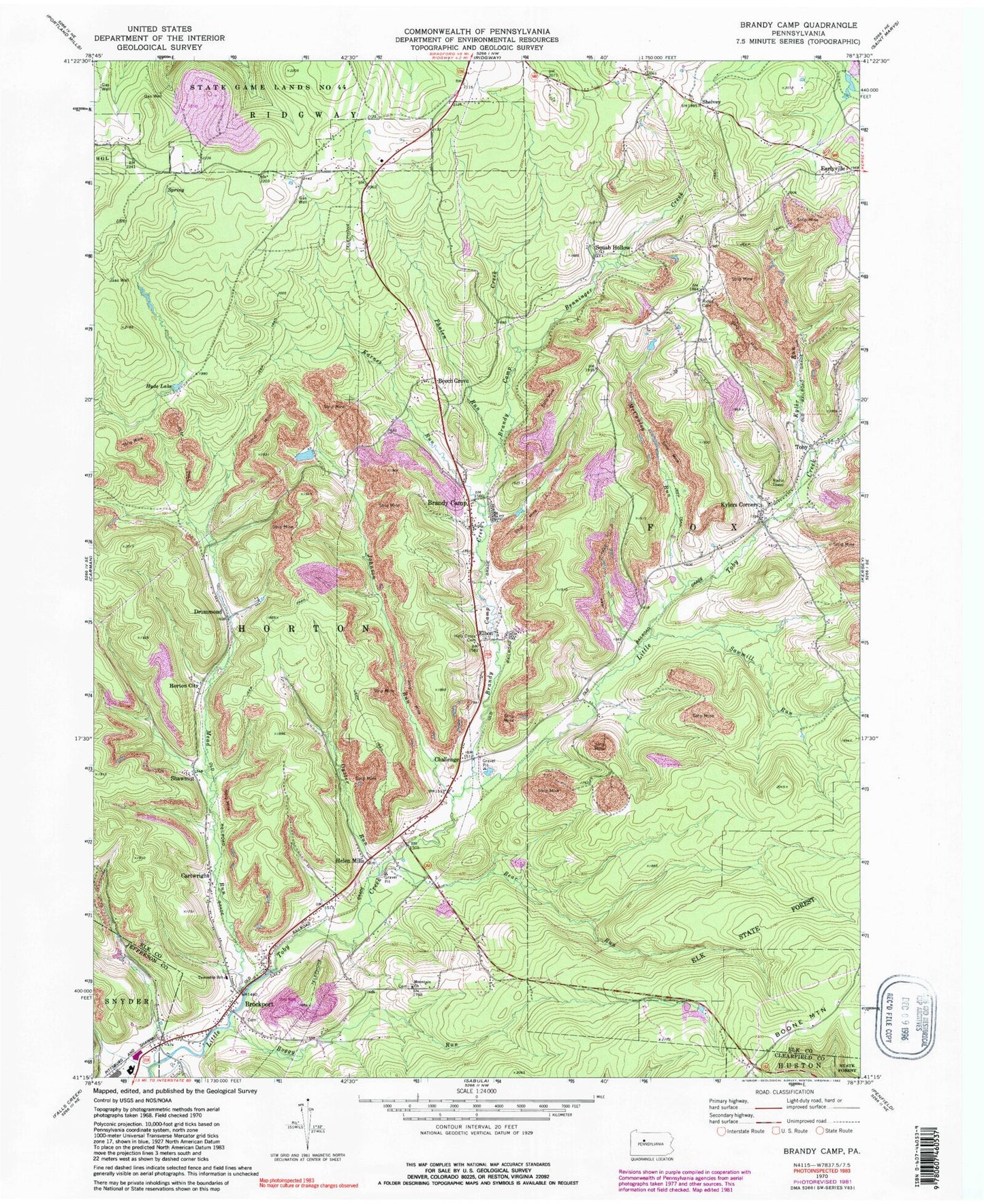
Classic USGS Brandy Camp Pennsylvania 7.5'x7.5' Topo Map
Couldn't load pickup availability
Historical USGS topographic quad map of Brandy Camp in the state of Pennsylvania. Map scale is 1:24000. Print size is approximately 24" x 27"
This quadrangle is in the following counties: Clearfield, Elk, Jefferson.
The map contains contour lines, roads, rivers, towns, and lakes. Printed on high-quality waterproof paper with UV fade-resistant inks, and shipped rolled.
Contains the following named places: Bear Run, Beech Grove, Benninger Creek, Boggy Run, Brandy Camp, Brandy Camp Cemetery, Brandy Camp Creek, Brockport, Brockport Cemetery, Brockport Post Office, Cartwright, Challenge, Drummond, Earleyville Cemetery, Elbon, Helen Mills, Holy Cross Cemetery, Horton City, Horton Township Volunteer Fire Department Company 7, Hyde Lake, Johnson Run, Karnes Run, Kyler Mine, Kyler Run, Kylers Corners, Limestone Run, McCauley Run, Mead Run, Mountain Church, Mountain Church Cemetery, Oyster Run, Phalen Run, Ridge Cemetery, Ridge School, Sawmill Run, Shawmut, Shawmut Reservoir, Shelvey, Squab Hollow, Toby, Township of Horton