MyTopo
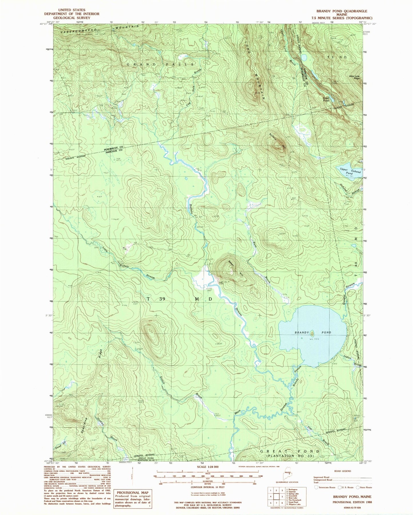
Classic USGS Brandy Pond Maine 7.5'x7.5' Topo Map
Regular price
$16.95
Regular price
Sale price
$16.95
Unit price
per
Couldn't load pickup availability
Historical USGS topographic quad map of Brandy Pond in the state of Maine. Map scale may vary for some years, but is generally around 1:24,000. Print size is approximately 24" x 27"
This quadrangle is in the following counties: Hancock, Penobscot.
The map contains contour lines, roads, rivers, towns, and lakes. Printed on high-quality waterproof paper with UV fade-resistant inks, and shipped rolled.
Contains the following named places: Baker Hill, Brandy Pond, Brandy Stream, Buffalo Hill, Buffalo Stream, Elm Brook, Guagus Stream, Indian Brook, Little Buffalo Stream, Lord Mountain, Pug Hole Brook, Runt Brook, Scotch Brook, Snail Pond, Spaulding Ridge, T39 MD BPP, Thirty-Nine Tannery, Upper Oxhead Pond